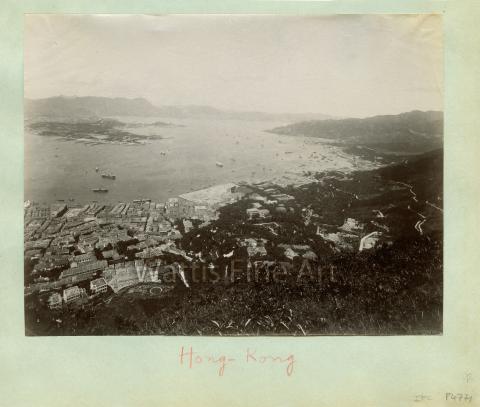
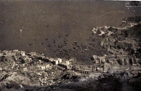
| c.1892 |
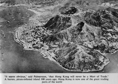
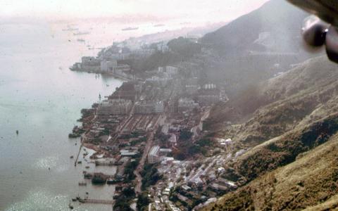
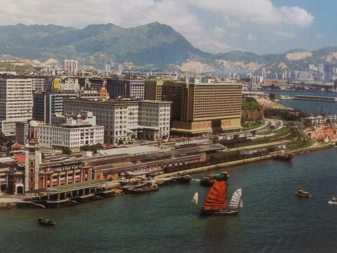
Bird's eye view of Hong Kong c.1892
|
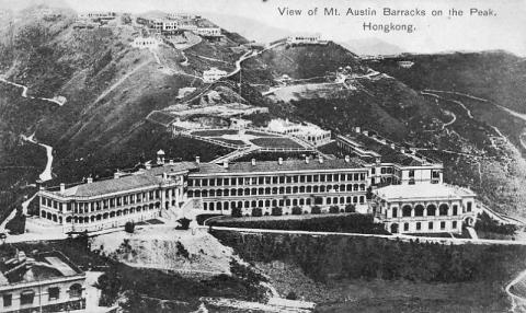
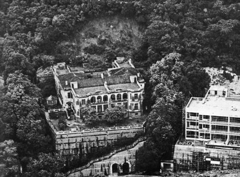
| 1897 |
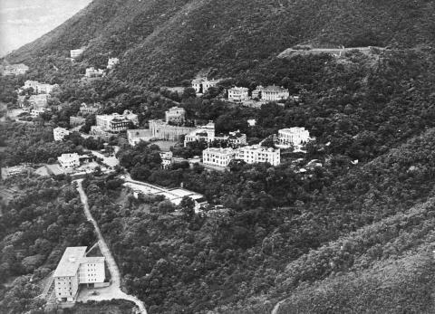
1890s Mount Austin Hotel
|
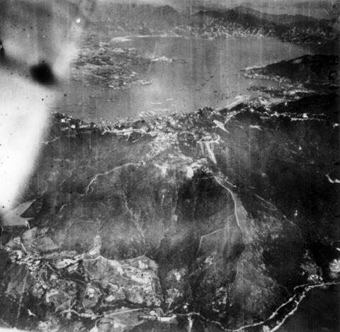
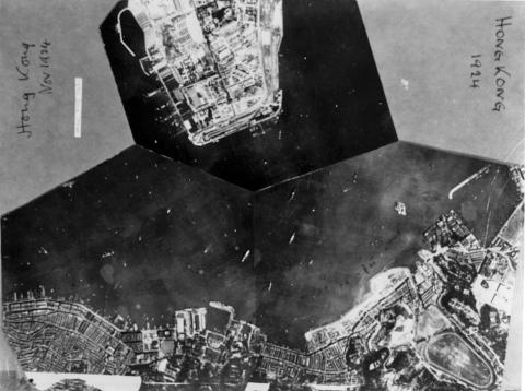
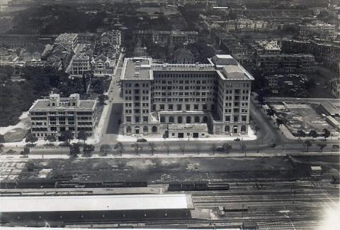
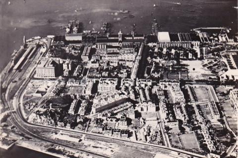
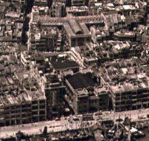
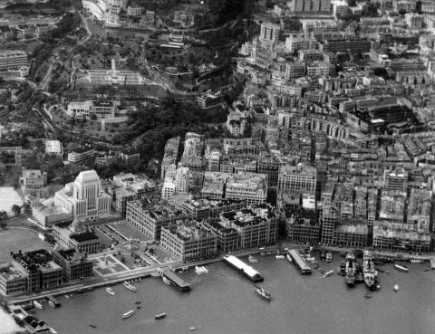
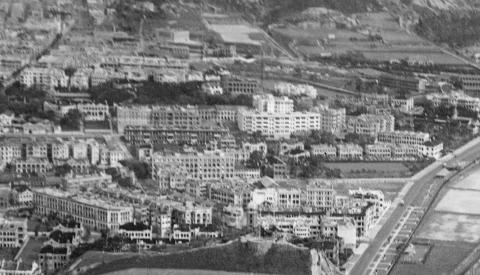
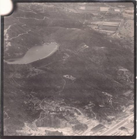
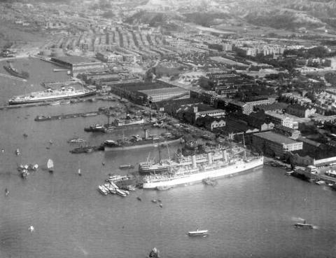
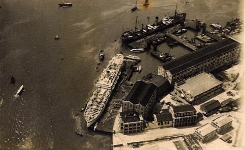
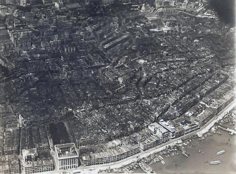
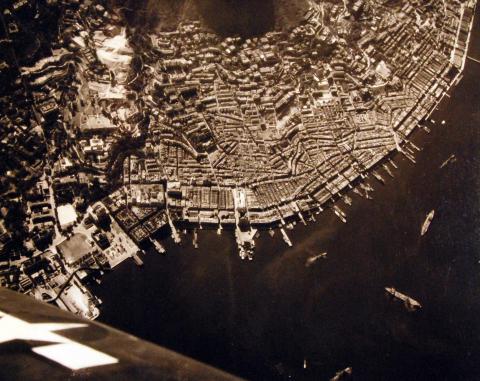
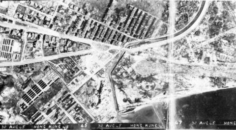
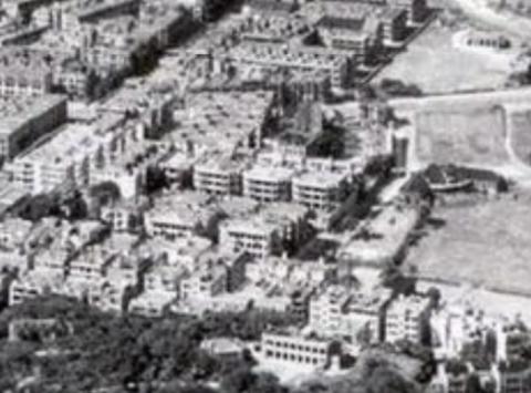
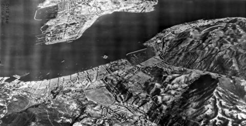
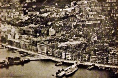
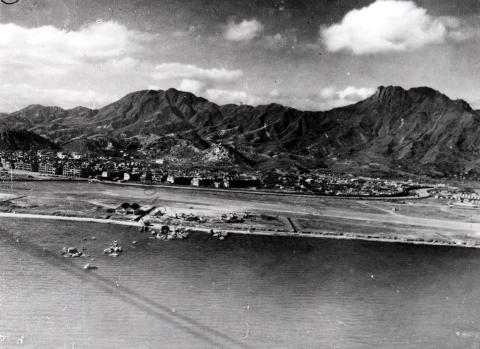
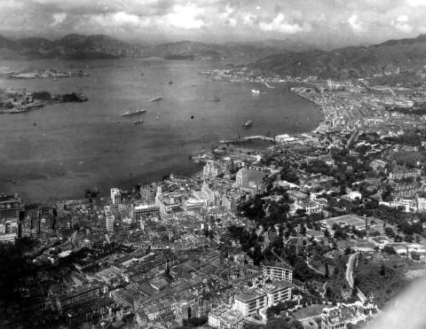
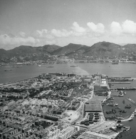
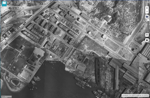
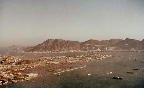
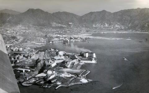
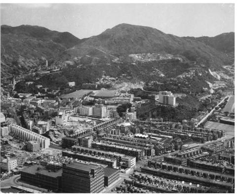
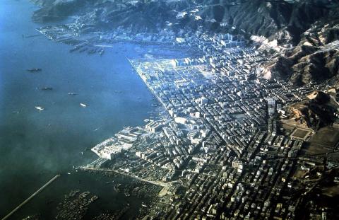
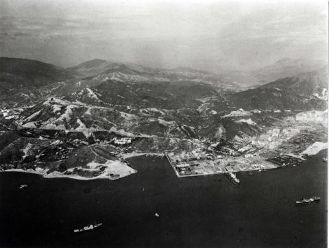
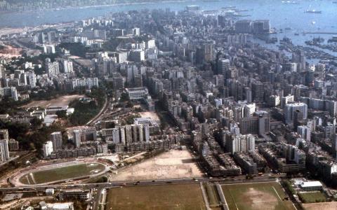
| 1924 |
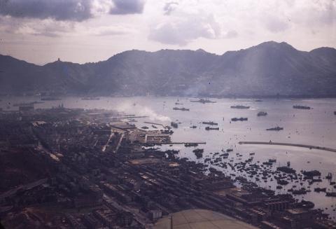
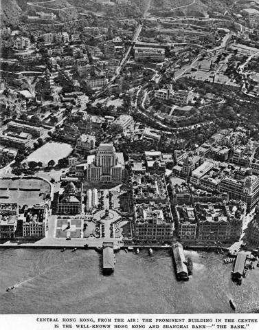
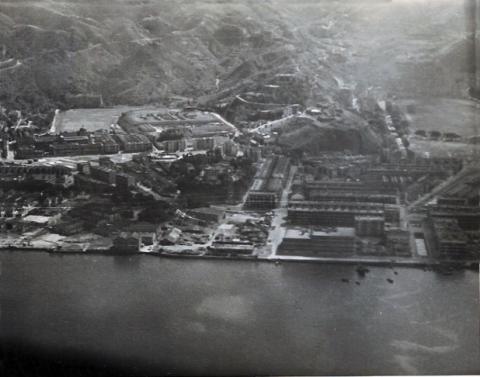
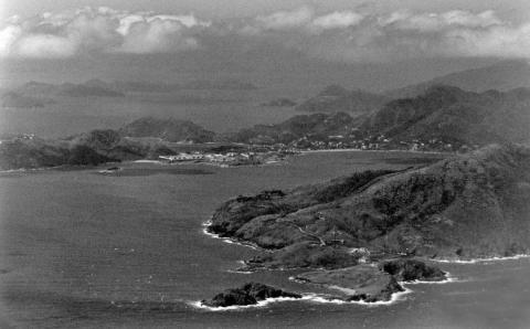
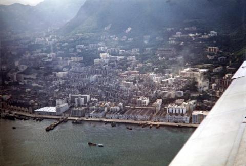
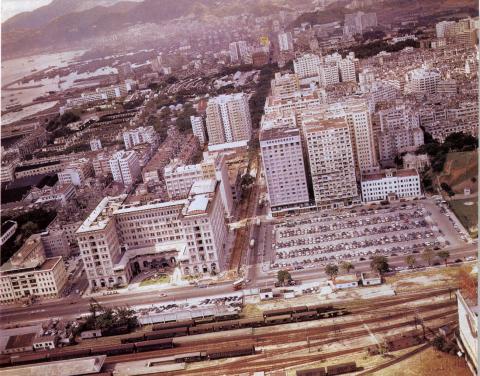
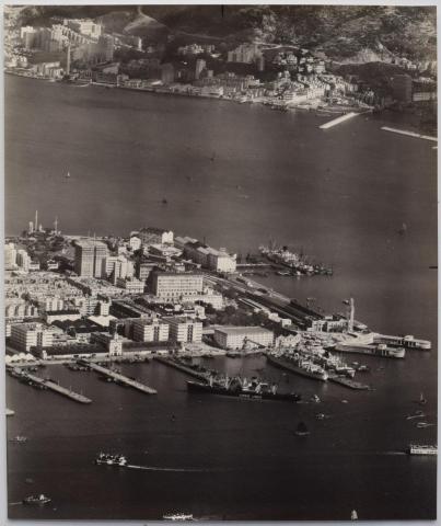
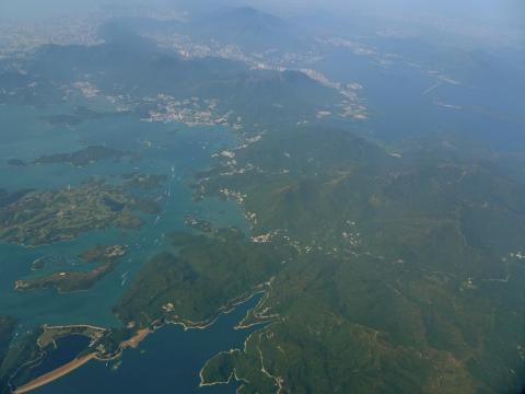
Hong Kong from above 1924
|
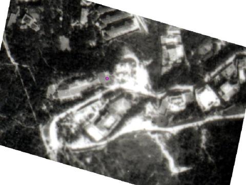
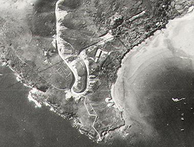
| 1924 |
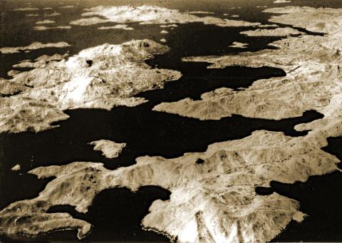
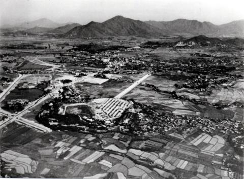
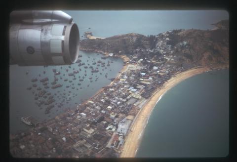
94 years old HIGH-Resolution areal picture of Cheung Chau from 25 November 1924
|
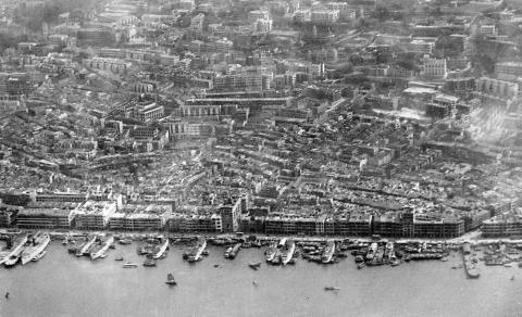
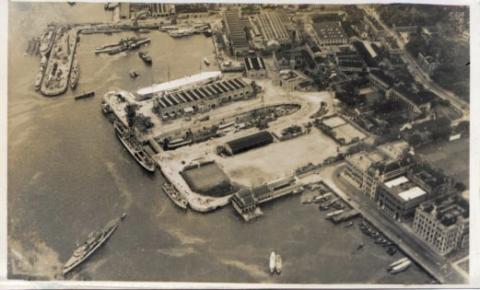
| 1924 |
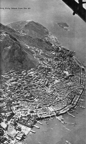
Hong Kong from the air 1924
|
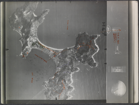
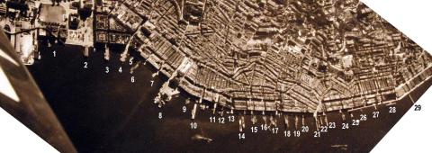
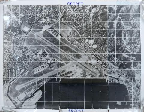
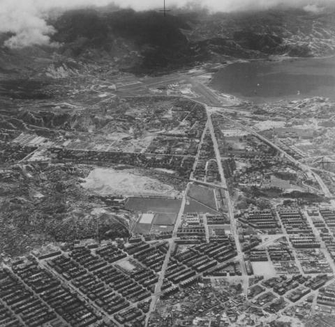
| 1924 |
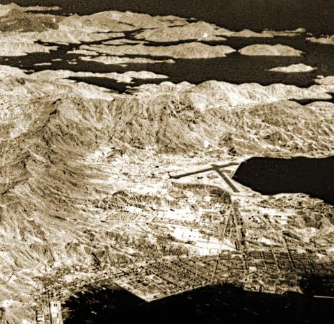
Aerial photo ref: H25.18
|
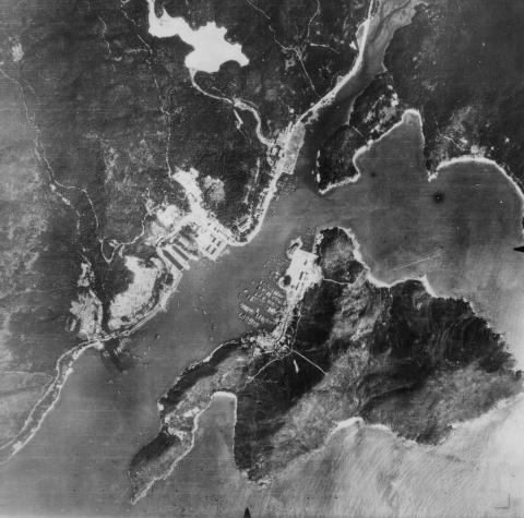
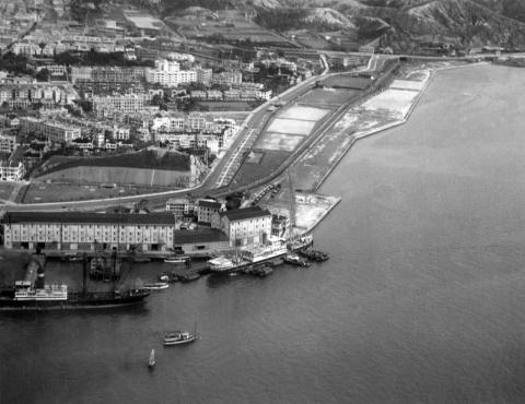
| 1924 |
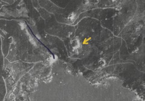
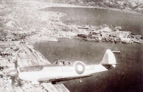
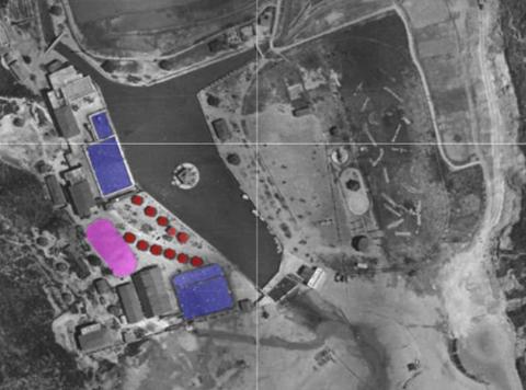
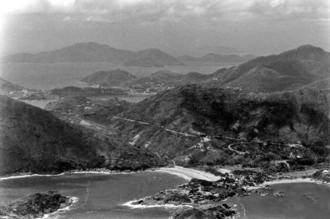
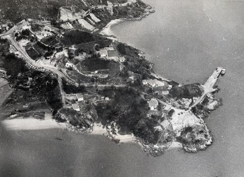
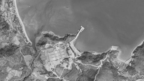
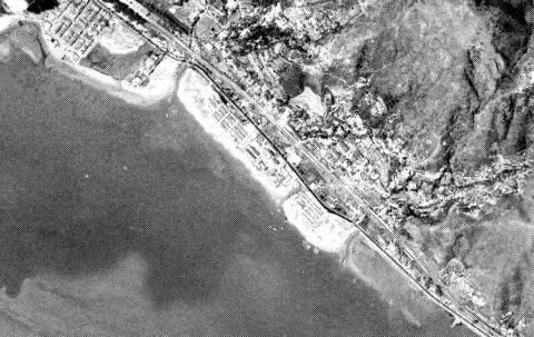
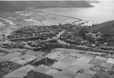
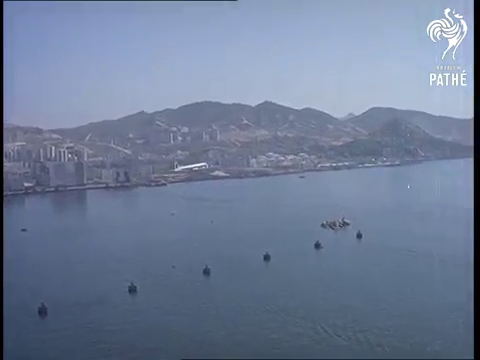
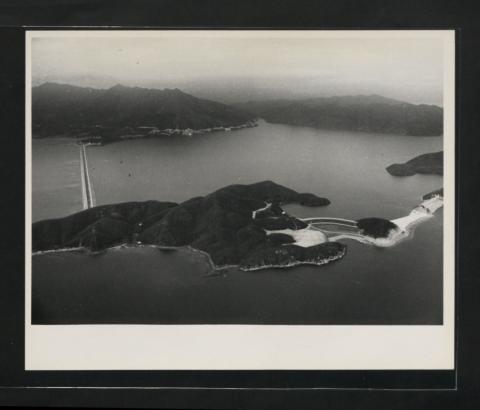
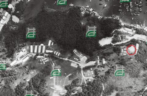
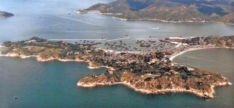
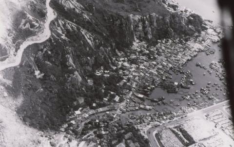
Aberdeen aerial view 1924
|
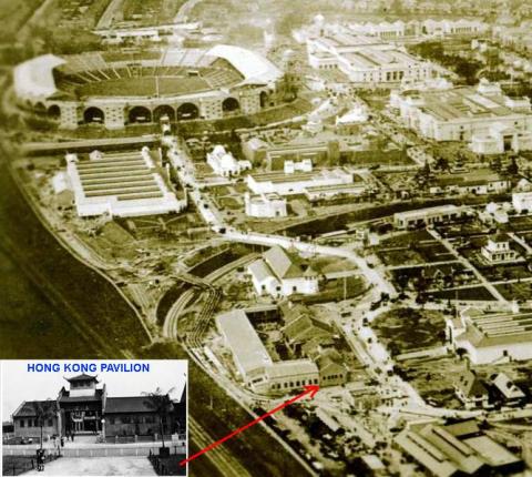
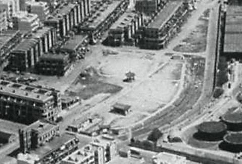
| 1924 |
Aerial Photo - British Empire Exhibition - Hong Kong Pavilion
|
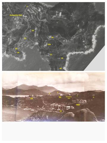
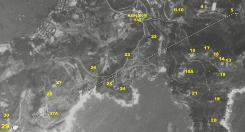
| 1924 |
1924 European House 18a Cheung Chau
|
| 1924 |
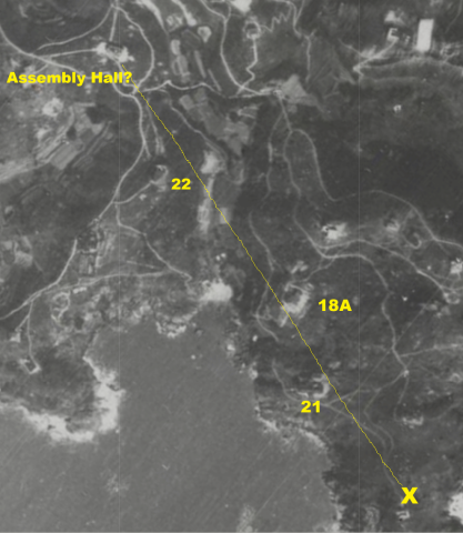
1924 crop HKMaps Cheung Chau Assembly Hall?
|
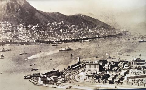
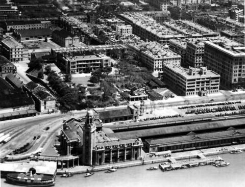
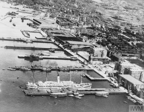
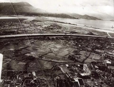
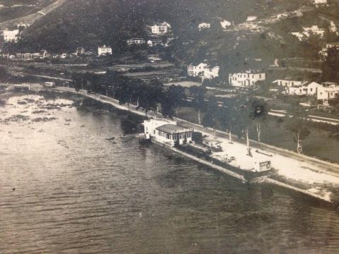
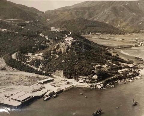
| c.1925 |
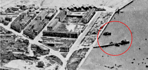
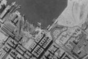
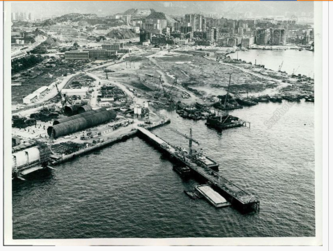
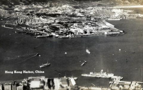
Kai Tak bund pier circa 1925
|
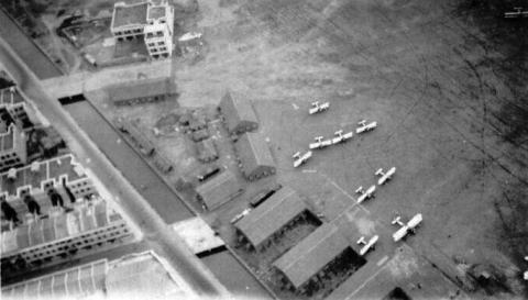
| 1927 |
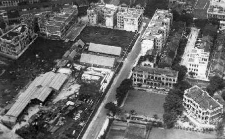
1927 Cameron Road - Temporary Quarters for RAF Airmen
|
| 1927 |
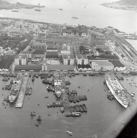
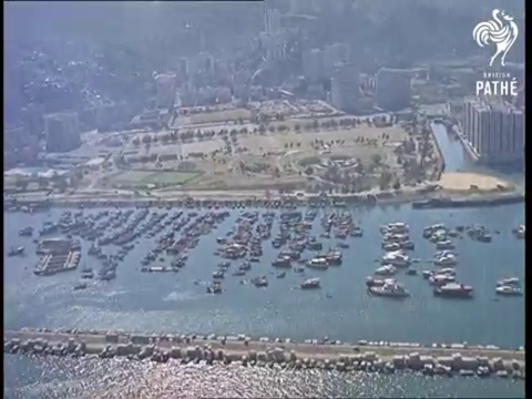
c.1927 Aerial view of TST
|
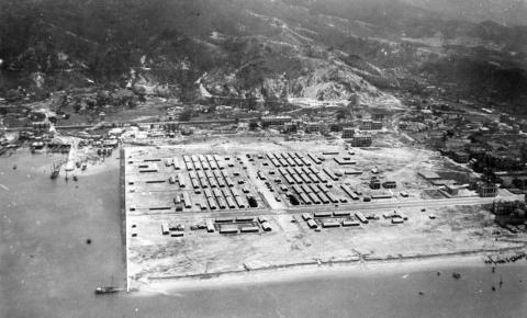
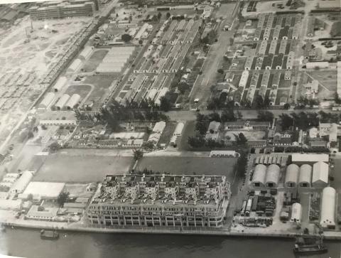
| 1927 |
1927 Sham Shui Po Barracks/Camp
|
| 1927 |
Hankow Road Houses 1927
|
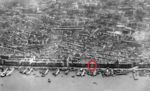
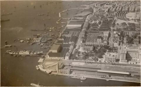
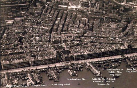
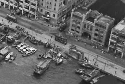
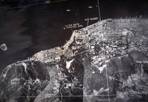
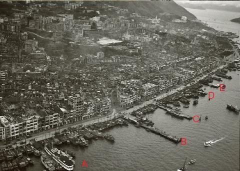
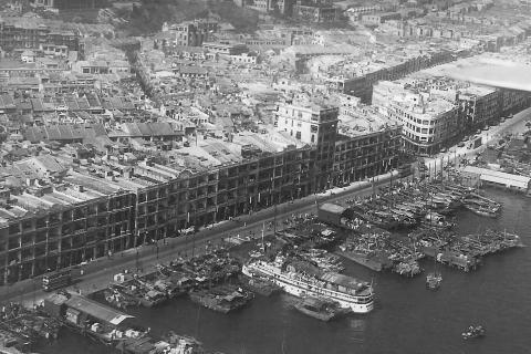
| 1927 |
1927 Sheung Wan Waterfront
|
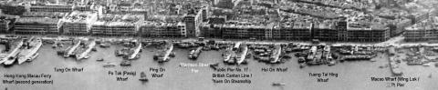
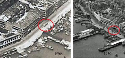
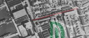
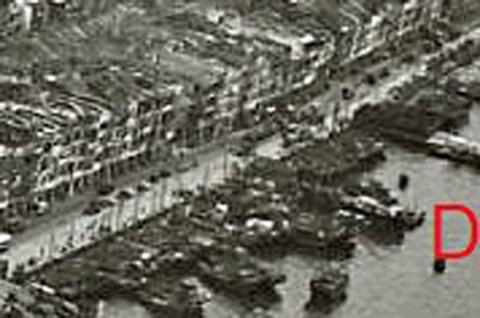
| 1927 |
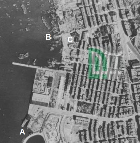
Sheung Wan piers (annotated) 1927
|
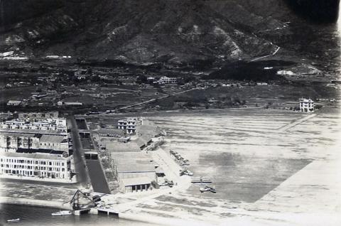
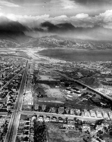
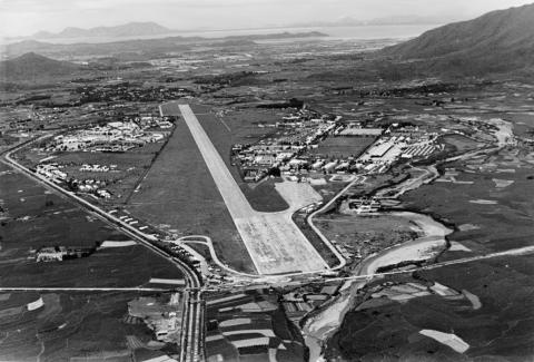
| 1927 |
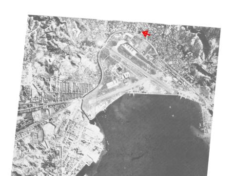
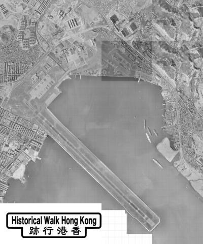
1927 Aerial View of Kai Tak Airfield
|
| 1927 |
1927 Sheung Wan Piers edited to show CMSN Company
|
| c.1927 |
Harbour view postcard - late 1920s
|
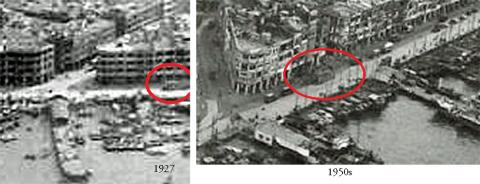
| c.1927 |
Urinal on the Praya at the end of Wing Lok Street 1927+1950s
|
| c.1927 |
aerial view of tst
|
| 1928 |
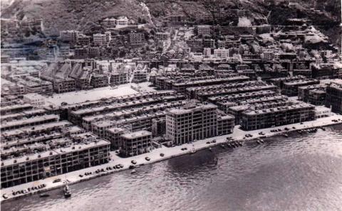
Kowloon air view TST 1927-28
|
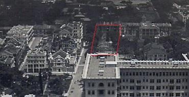
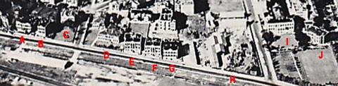
| 1928 |
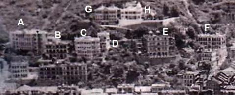
Chatham Road Houses 1927/28 annotated
|
| 1928 |
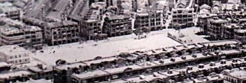
Kowloon air view TST 1927-28 (detail)
|
| 1920s |
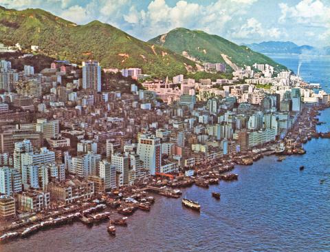
1920s Causeway Bay
|
| 1920s |
Whampoa Dock 1920
|
| 1920s |
View from House #20
|
| 1930 |
Hankow Road Houses

|
| 1931 |
1931 Aerial view of Happy Valley & Bowrington
|
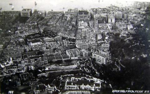
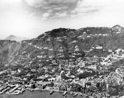
| 1931 |
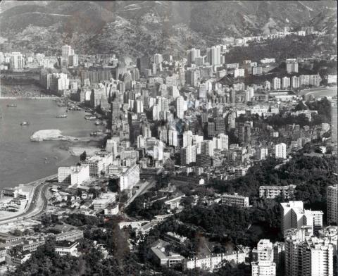
Central from Peak c.1931
|
| 1931 |
1931 Aerial view of TST
|
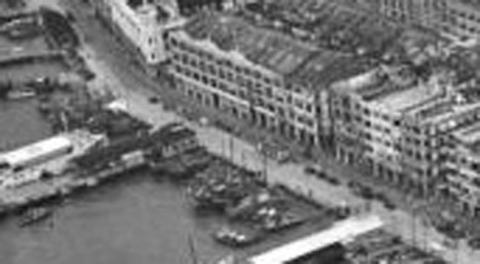
| 1931 |
Sheung Wan Piers 1931 annotated
|
| c.1931 |
Sheung Wan buildings 1931
|
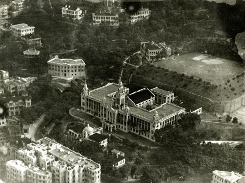
| 1933 |
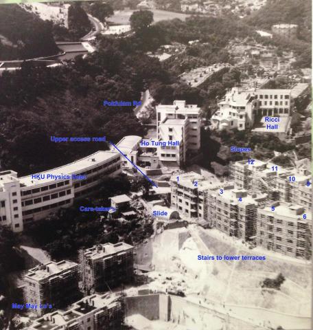
HKU from the air, taken by Kenneth, Jan 1933
|
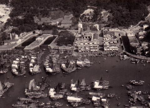
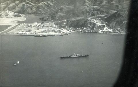
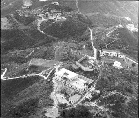
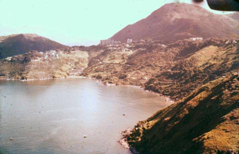
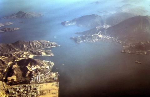
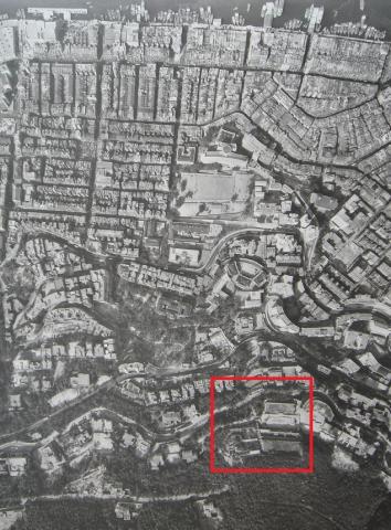
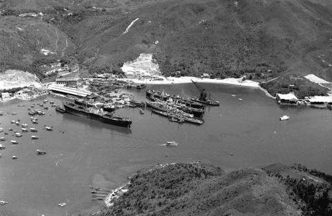
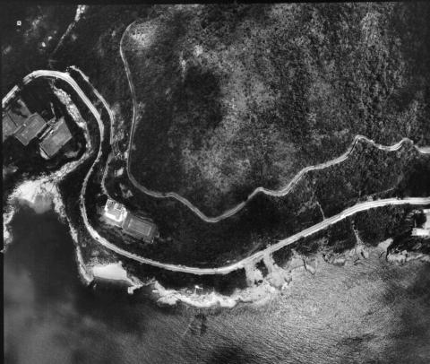
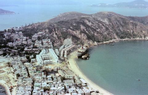
| 1934 |
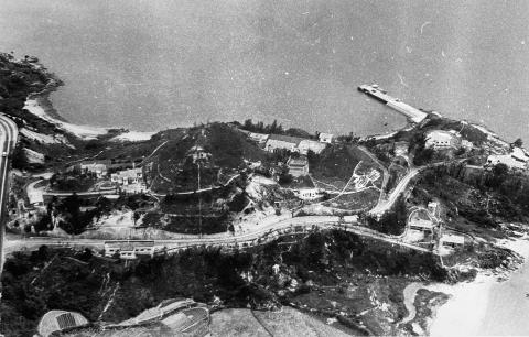
1934 Over Aberdeen
|
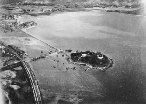
| 1935 |
Island House Tai Po-1930s
|
| 1935 |
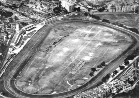
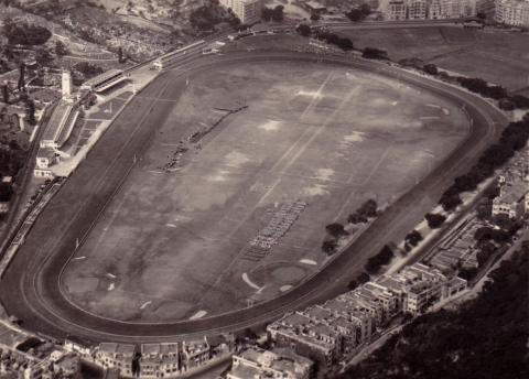
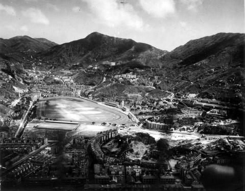
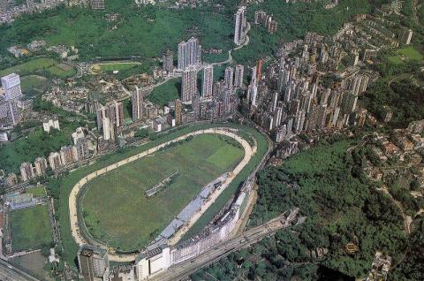
Happy Valley race course-Jubilee Parade-aerial-1935
|
| 1935 |
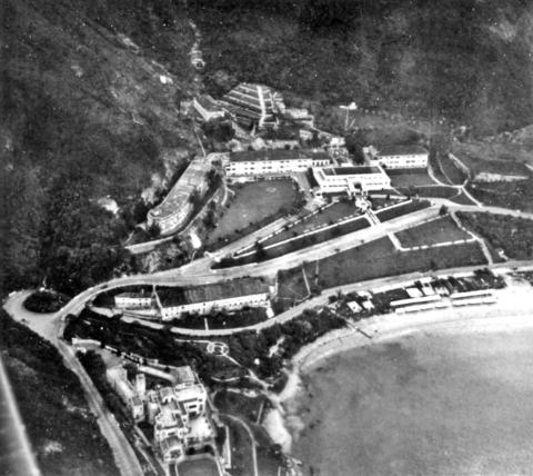
Repulse Bay Hotel plus EUCLIFFE mansion-aerial-1935
|
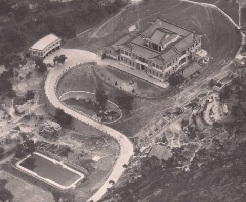
| 1935 |
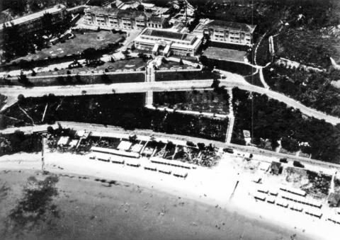
Repulse Bay Hotel- aerial-1935
|
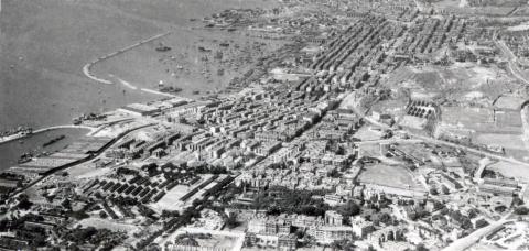
| 1935 |
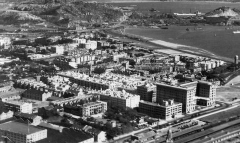
1930s TST and Hung Hom
|
| 1935 |
Chatham Road reclamation
|
| 1935 |
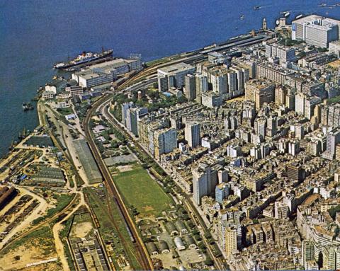
Central District 1935
|
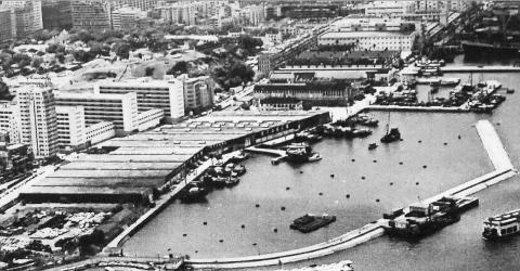
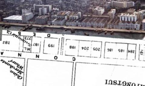
| 1935 |
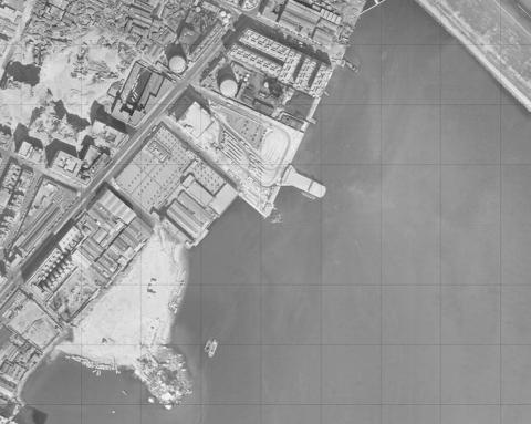
Kowloon Wharves 1935
|
| 1935 |
Shaukiwan 1935
|
| 1935 |
Chatham Road reclamation-Tsim Sha Tsui central area 1935
|
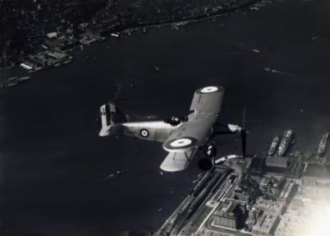
| 1935 |
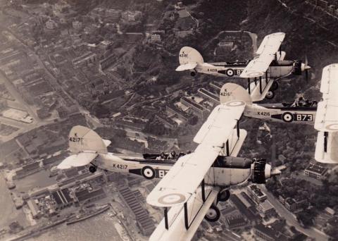
1935 Aircraft RAF 803 Squadron, over Kowloon, Hong Kong
|
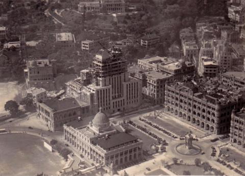
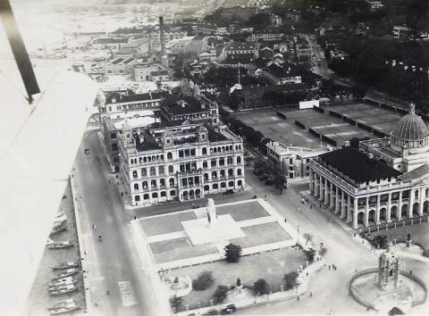
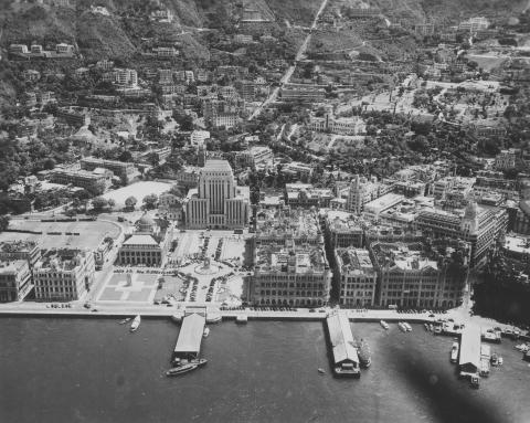
| 1935 |
1935 Over Statue Square
|
| 1935 |
1935 Over Central Victoria Harbour
|
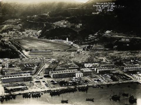
| 1935 |
1935 Over Happy Valley Racecourse
|
| 1935 |
Planes in Flight over Admiralty
|
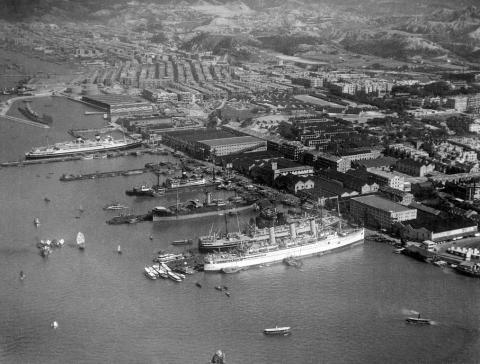
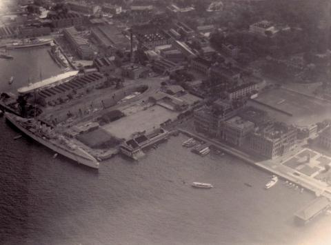
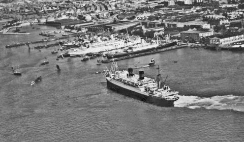
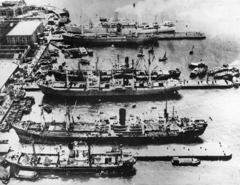
| 1935 |
Kowloon wharves-passenger vessel approaching its berthing pier
|
| 1936 |
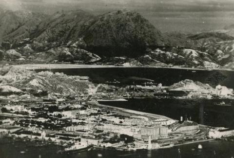
1930s Aerial View of Ma Tau Kok and To Kwa Wan
|
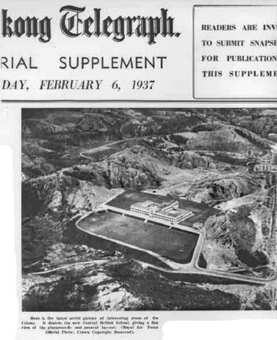
| 1937 |
Central British School a.k.a. KGV school in 06-02-1937
|
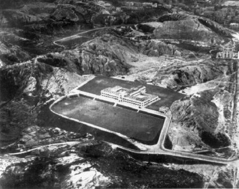
| 1937 |
1937 Central British School / King George V School
|
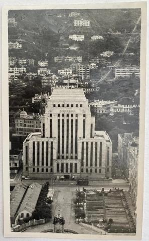
| 1938 |
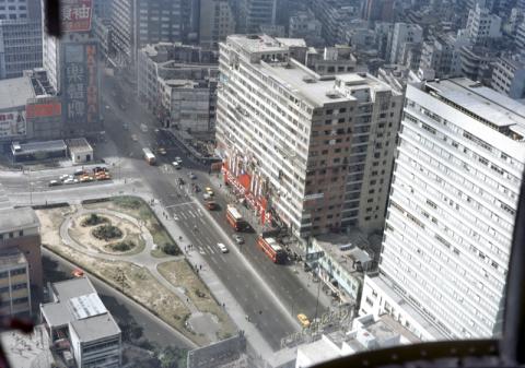
central 1938
|
| 1939 |
16 Feb 1939 TSAT TSZ MUI North Point HK.jpg
|
| 1939 |
Seven Sisters 16 Feb 1939.jpg
|
| 1939 |
Seven Sisters 16 Feb 1939.jpg
|
| 1939 |
Tai Hang Road
|
| 1930s |
1930s Tsim Sha Tsui KCR station, YMCA and Peninsula Hotel
|
| 1930s |
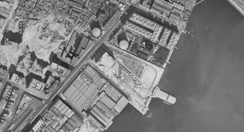
1930s Kowloon Wharves
|
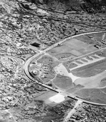
| 1930s |
1930s Kai Tak Airfield
|
| 1930s |
1930s Aerial view over Statue Square
|
| 1930s |
Peninsula Hotel 1930.JPG
|
| 1930s |
1930s Holts Wharf at TST
|
| 1930s |
Large Mansion above North Point.jpg
|
| 1930s |
1930s Ship dock air view
|
| 1930s |
Hankow Road Houses 1930
|
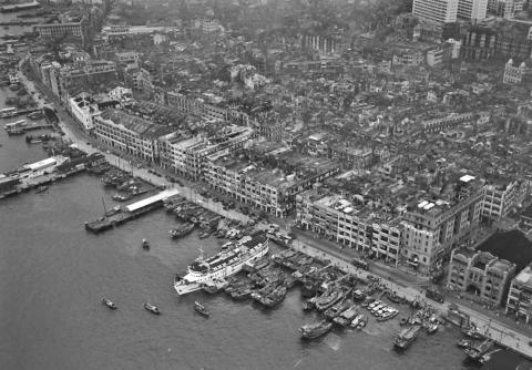
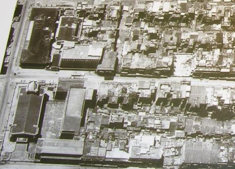
| 1930s |
Aerial photo of Central and Sheung Wan 1930s
|
| 1930s |
Urinal on Connaught Road east of Man Wa Lane Junction
|
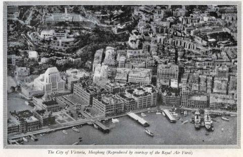
| 1930s |
City of Victoria from the China Shipping Manual for1937-1938
|
| 1930s |
1930s pic suggested viewpoint on 1924.1 crop HKMaps
|
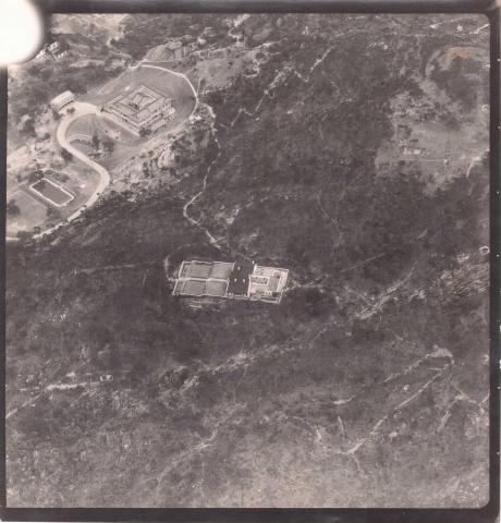
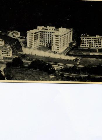
| 1940 |
Queen Mary Hospital
|
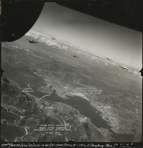
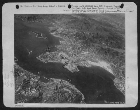
| 1944 |
Air Raid 1944-10-16 (2)
|
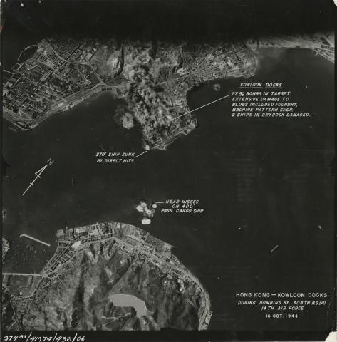
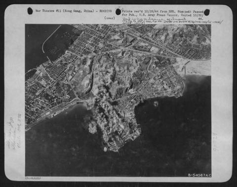
| 1944 |
Air Raid 1944-10-16 (3)
|
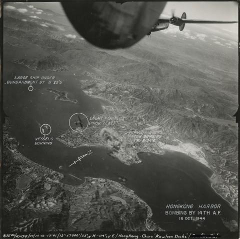
| 1944 |
53-112(4)
|
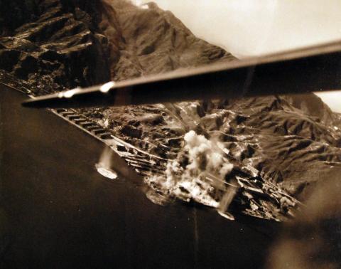
| 1944 |
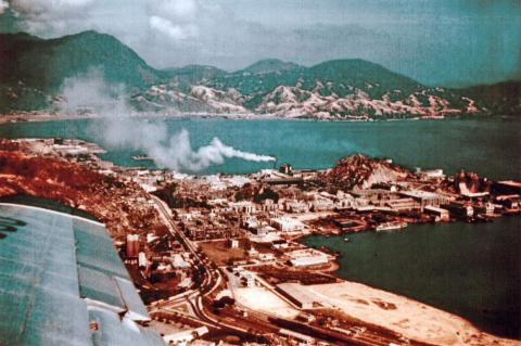
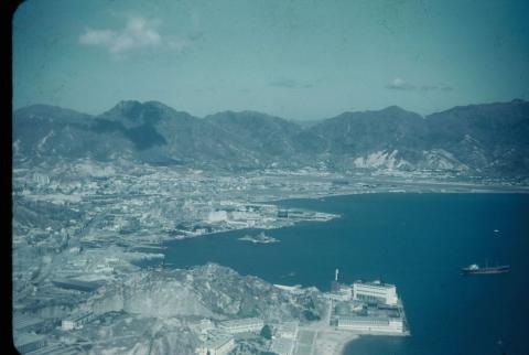
Aerial view of HK Harbour US Airforce Bombing
|
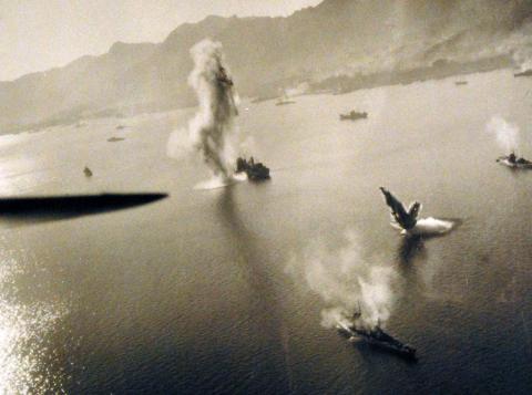
| 1944 |
Aerial Photo of US Airforce Hung Hom Bombing
|
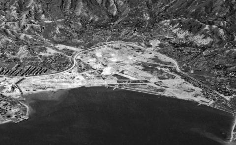
| 1944 |
Kai Tak airfield under Japanese control
|
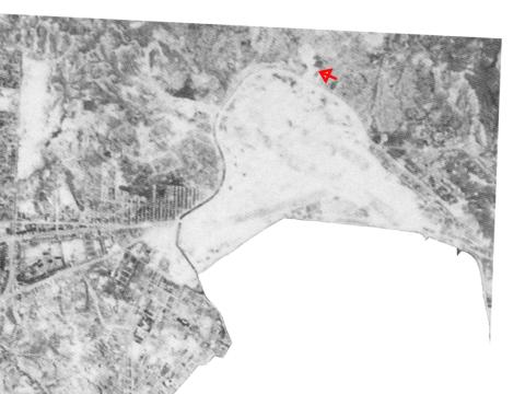
| 1944 |
Kai Tak airport area
|
| 1945 |
Air Raid 1945-01-16 (1)
|
| 1945 |
Air Raid 1945-01-16 (2)
|
| 1945 |
Air Raid 1945-01-16 (3)
|
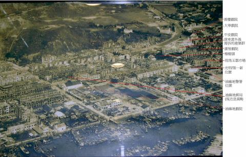
| 1945 |
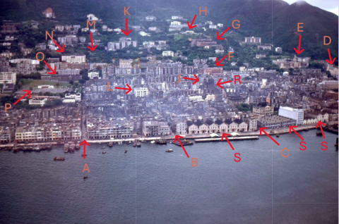
1945 Central, Sheung Wan to Sai Ying Pun Piers (annotated)
|
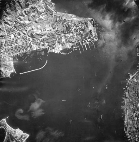
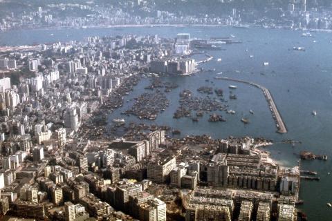
| 1945 |
1945 Kai Tak Airport - Aerial View
|
| 1945 |
kowloon dockyard 1945
|
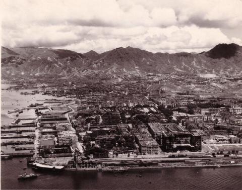
| 1945 |
1945 Kowloon
|
| 1945 |
c.1945 Kowloon
|
| 1945 |
c.1945 Kowloon (detail)
|
| 1945 |
1945 Above TST
|
| 1945 |
aerial photo 1945 part
|
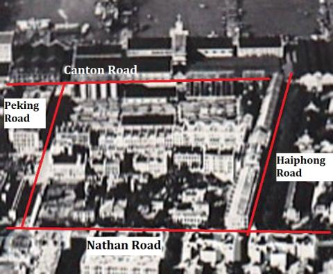
| 1945 |
Aerial Photograph of Haiphong Road 1945
|
| 1945 |
Jordan aerial view 1945-11-11
|
| 1945 |
Aerial View of Kowloon Peninsula 1945
|
| 1945 |
Hong Kong from the air, 1945
|
| 1945 |
1945 Wanchai
|
| 1945 |
Hong Kong harbour 1944 or 45
|
| 1945 |
Kowloon and Victoria Harbour (WW II)
|
| 1945 |
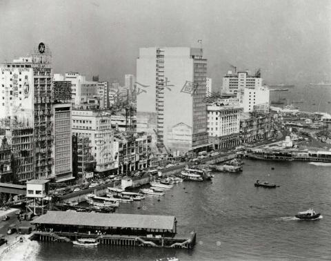
1945 Central waterfront
|
| c.1945 |
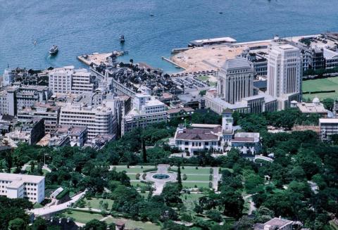
Statue Square & HSBC
|
| 1946 |
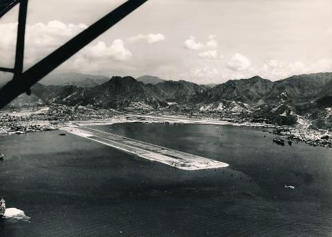
Kai Tak Aerial view of Runways
|
| 1946 |
Kai Tak Airfield Aerial Photo
|
| 1946 |
1946 Central & Mid-Levels
|
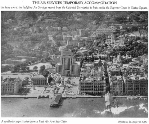
| 1946 |
Temporary buildings in Statue Square-June 1946
|
| 1946 |
1946 Over Hunghom
|
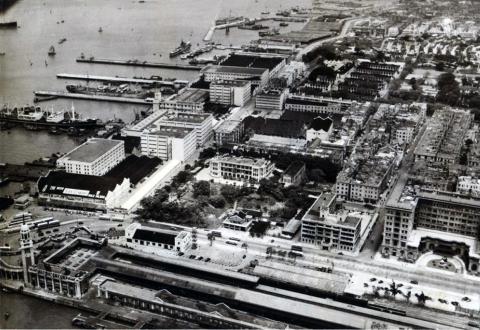
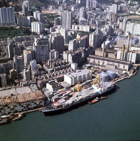
| 1947 |
Hong Kong-Kowloon-East TST & Chatham Road
|
| 1947 |
Chatham and Cameron Roads 1947
|
| 1947 |
Aerial view of Happy Valley
|
| 1947 |
File2301.jpg
|
| 1947 |
File2302.jpg
|
| 1947 |
Happy Valley 1947
|
| 1947 |
尖沙嘴消防局 Tsim Sha Tsui Fire Station 1947
|
| 1947 |
1947.1-HK-Maps-Lai-Chi-Kok-Aerial-views.jpg
|
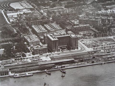
| 1948 |
Central District & slopes beyond-1949
|
| 1948 |
Hong Kong Island-1948
|
| 1948 |
Kowloon Peninsula 1948
|
| 1948 |
1948 Kowloon Peninsula
|
| 1948 |
Site of King George V Memorial Park (Kowloon) 1948
|
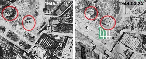
| 1949 |
Hung Hom Police Station 1945_49
|
| 1949 |
The Peak 1949
|
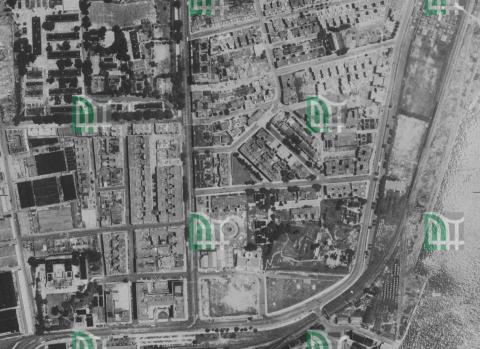
| 1949 |
North Point aerial photograph 1949
|
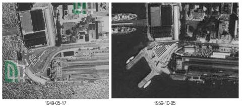
| 1949 |
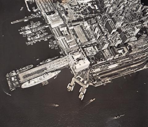
Access to Star Ferry 1949/1959
|
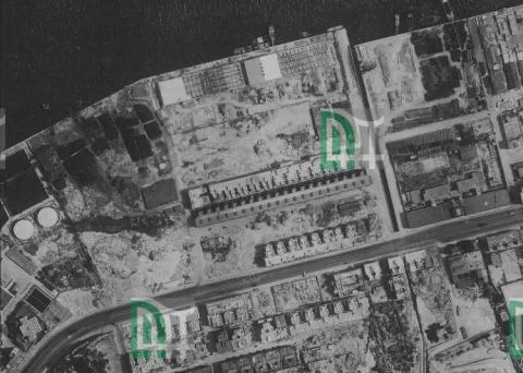
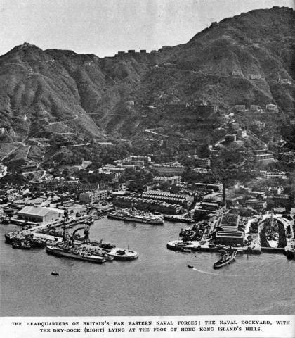
| 1949 |
Naval Dockyard-1949
|
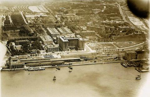
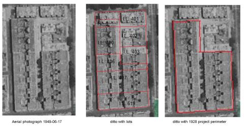
| 1949 |
TST aerial view 1949-06-17
|
| 1949 |
aerial view 1949-06-17 details
|
| 1949 |
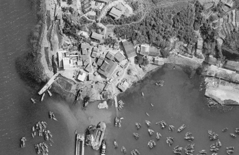
Sai Kung aerial photograph with old police station 1949
|
| 1949 |
Wartime Cooking Area E
|
| 1949 |
Wartime Cooking Area H
|
| 1949 |
Kowloon Hung Hom from the air 1949
|
| 1949 |
Late 1940s Wanchai waterfront air
|
| 1949 |
Kennedy Road Houses 1949 annotated
|
| 1949 |
Southorn Playground 1949
|
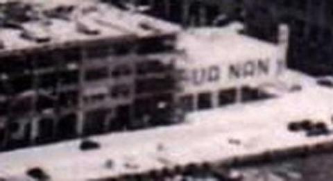
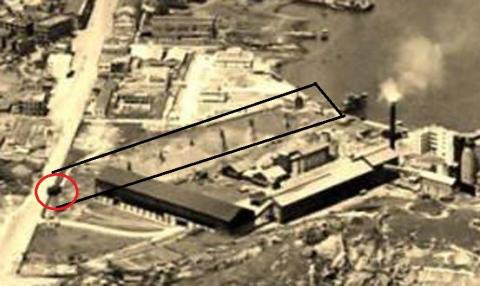
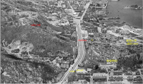
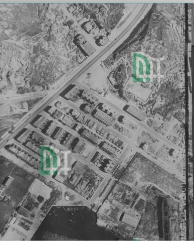
| 1949 |
Hua Nan Motors 1949
|
| 1949 |
1949 aerial view of Green Island Cement Company
|
| 1949 |
1949 hunghom air view showing a temple.png
|
| 1949 |
1949 hunghom air view 2.png
|
| 1949 |
1949 hunghom air view
|
| 1949 |
Kowloon wharves-print annotated as taken by Mrs Pat Halls
|
| 1949 |
Central & Mid Levels-print annotated as taken by Mrs Pat Halls
|
| 1940s |
1940s Garden Road
|
| 1940s |
1940s Aerial view of Causeway Bay
|
| 1940s |
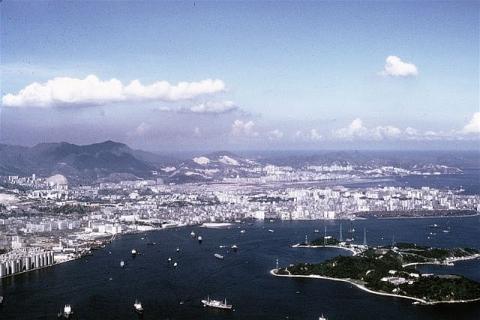
Hong Kong island from the air
|
| 1940s |
Hong Kong-Kai Tak airport and its environment infra-red image circa late 1940s
|
| 1940s |
Kai Tak airport and its mountainous environment infra-red image circa late 1940s
|
| 1950 |
western market
|
| 1950 |
North Point-aerial view-1950.jpg
|
| 1950 |
Sheung Wan waterfront-aerial view-1950
|
| 1950 |
1950 Sheung Wan Wharves
|
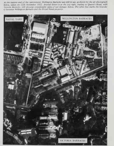
| 1952 |
Wellington and Victoria Barracks 1952
|
| 1952 |
1950s Causeway Bay
|
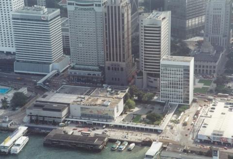
| 1952 |
Aerial view Kowloon/TST
|
| 1952 |
Wanchai_Morrison_Hill_1952
|
| 1953 |
Sheko-1953
|
| 1953 |
Cape D' Aguilar and Stanley-1953
|
| 1953 |
1950s Kai Tak (long shot)
|
| 1953 |
Sai Ying Poon Aerial Photo in the early Fifties
|
| 1954 |
1950s Kowloon Tong Aerial View
|
| 1954 |
Kai Tak airport area
|
| 1954 |
1954 Central view
|
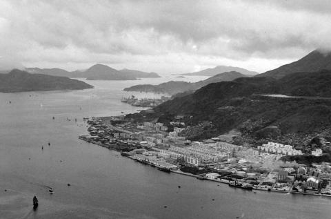
| 1955 |
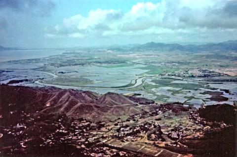
Tsuen Wan in 1955
|
| 1955 |
Kowloon peninsula from the air-1955
|
| 1955 |
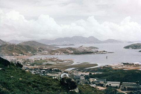
Kai Tak
|
| 1955 |
1950s Taikoo Dockyard
|
| 1955 |
1955 Hung Hom, Kowloon Bay Aerial View
|
| 1955 |
Kowloon Dockyards
|
| 1955 |
Shek Tong Tsui Godowns (1950s) and map (1905)
|
| 1956 |
Belcher's Gardens.jpg
|
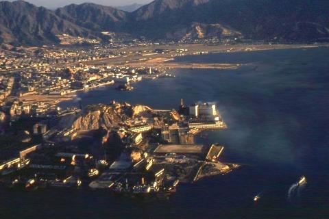
| 1956 |
1956 TST Airview

|
| 1956 |
1956 Kwun Tong view
|
| 1956 |
1956 Approaching Kaitak
|
| 1956 |
1956 Progress reclamation KT
|
| 1956 |
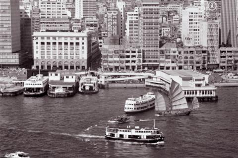
1956 Star Ferry, Central
|
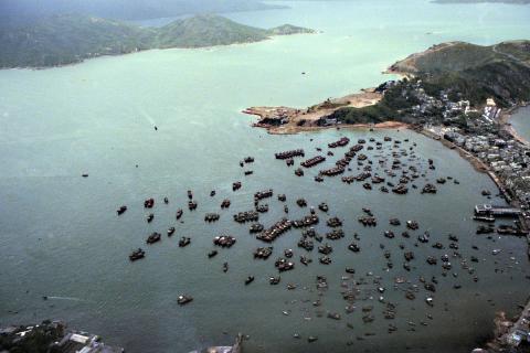
| c.1956 |
Yau Tong Bay c.1956
|
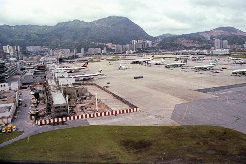
| 1958 |
Aerial view of Kai Tak
|
| 1958 |
R.A.F. Batty's 1958
|
| 1958 |
1958 Sai Yung Pun Waterfront
|
| 1958 |
Over Central.
|
| 1958 |
Aerial of Sai Ying Pun 1950s
|
| 1958 |
1958 Almost completed runway
|
| 1959 |
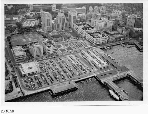
Central District-aerial-23 10 1959
|
| 1959 |
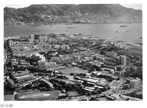
Kowloon penisula-aerial-23 10 1959
|
| 1959 |
Wanchai waterfront-Happy Valley-Causeway Bay-aerial-23 10 1959

|
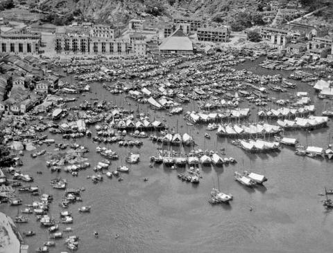
| 1959 |
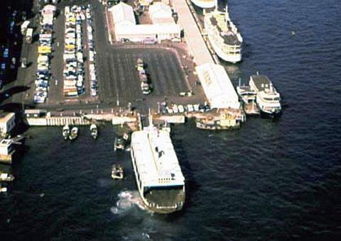
Floating Restaurants 1959
|
| 1950s |
1950s Tsim Sha Tsui and Star Ferry
|
| 1950s |
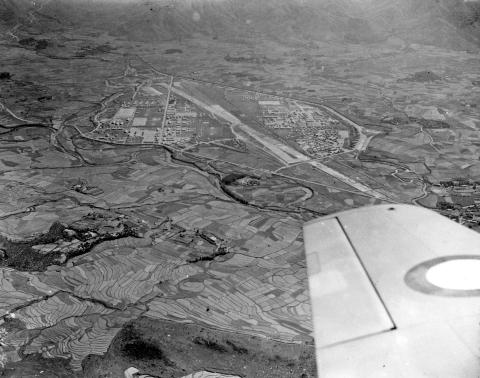
RAF Sek Kong Airfield, early 1950s
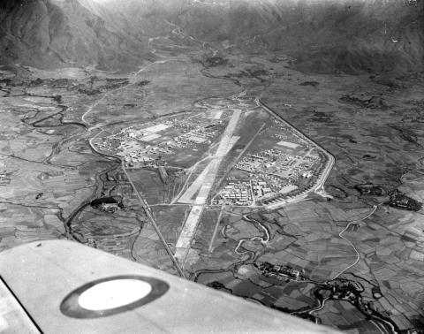
|
| 1950s |
RAF Sek Kong Airfield, early 1950s
|
| 1950s |
pic of shatin roadhouse
|
| 1950s |
1950s Aerial view of Causeway Bay and Leighton Hill
|
| 1950s |
Mong Kok, Sham Shui Po and Kai Tak - Aerial early 1950s
|
| 1950s |
1950 HK aerial view 3
|
| 1950s |
Kennedy Town Gasholder_1950
|
| 1950s |
1950 HK aerial view2
|
| 1950s |
1950 HK aerial view1
|
| 1950s |
Aerial View of City looking east
|
| 1950s |
LYE MUN
|
| 1950s |
Aerial view of Sheung Wan and Sai Ying Pun 1950s
|
| 1950s |
Waterfront near Sutherland Street pier 1950s
|
| 1950s |
Jubilee building and surrounding area
|
| 1960 |
Kotewall Road-1961
|
| c.1960 |
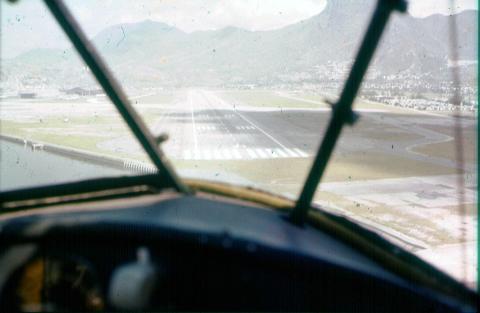
Landing at Kai Tak.j
|
| c.1960 |
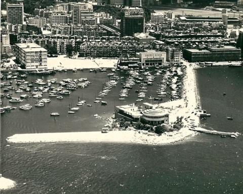
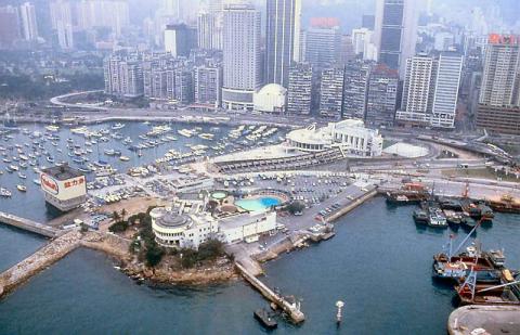
Over Aberdeen.
|
| c.1960 |
Over West Point.
|
| c.1960 |
Telegraph Bay and surroundings
|
| c.1960 |
Fu Kong Shan, Mui Wo around 1960
|
| c.1960 |
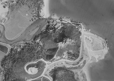
Tai Lam Prison - nestled beneath Tai Lam Chung Reservoir
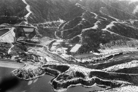
|
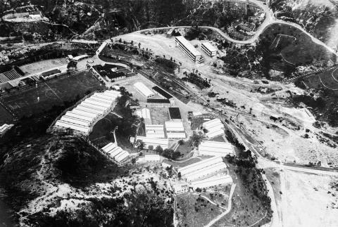
| c.1960 |
Tai Lam Prison
|
| c.1960 |
Siu Lam Peninsula
|
| c.1960 |
Siu Lam Peninsula
|
| 1961 |
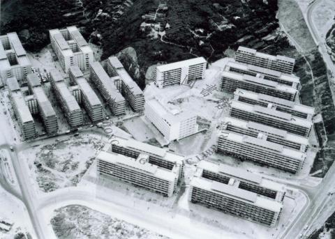
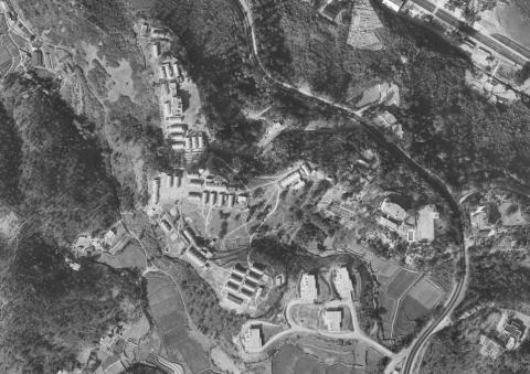
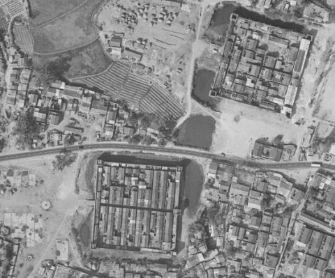
1961 1:10000 Chai Wan Resettlement Estate
|
| 1961 |
1960s City Hall Construction
|
| 1961 |
1961 Kowloon Sham Shui Po and Cheung Sha Wan air view
|
| 1961 |
1961 RAF Sek Kong
|
| 1961 |
1961 Lee Yue Mun aerial view
|
| 1962 |
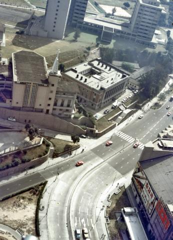
Conduit Road-1962
|
| 1962 |
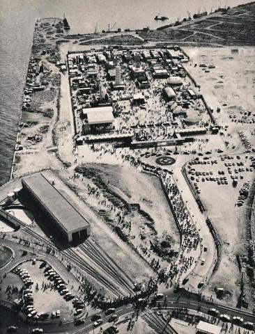
Garden of Remembrance - Opening Ceremony 30 August 1962
|
| 1962 |
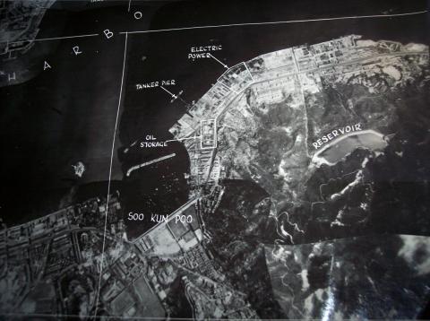
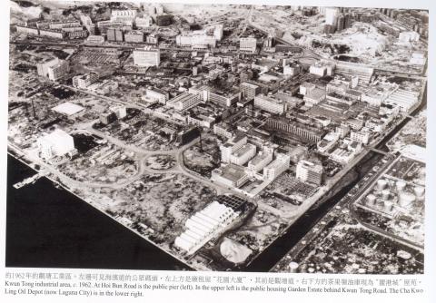
kwun tong industrial area ca. 1962
|
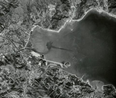
| 1962 |
Tidal basin 1962
|
| 1962 |
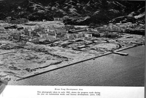
Kwun Tong 1962
|
| 1962 |
Kowloon-West 1962
|
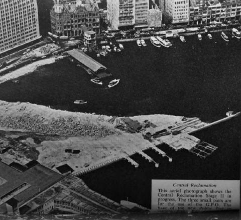
| 1962 |
Central reclamation 1962-3
|
| 1962 |
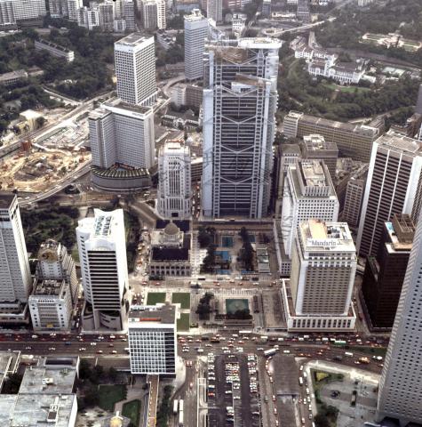
Central district Star ferry City hall & military lands now Admiralty district circa 1962
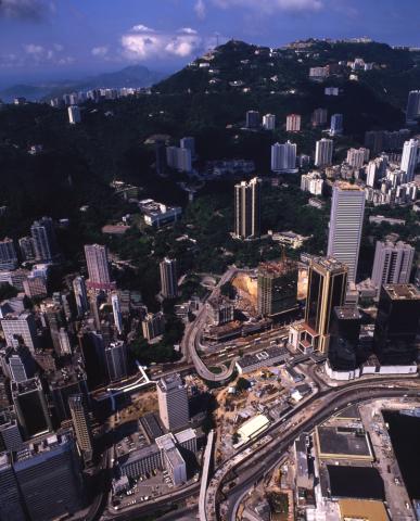
|
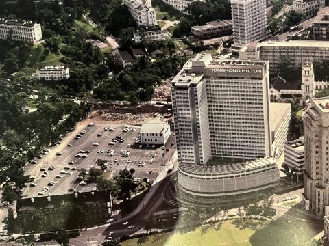
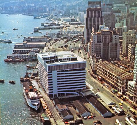
| 1962 |
Hilton Hotel under construction
|
| c.1962 |
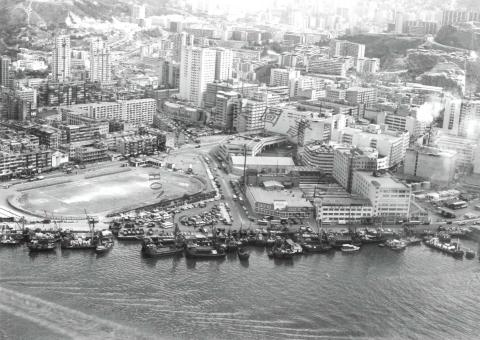
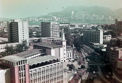
TST in the mid 1960s
|
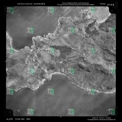
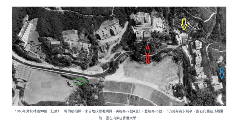
| 1963 |
Gillies Ave pier aerial view January 1963
|
| 1963 |
1963 aerial view of Green Island Cement Company
|
| 1963 |
Yau Tong Bay Aerial View 1963
|
| 1963 |
Hong Kong Correspondents Club 00.jpg
|
| 1963 |
Detail of Hollywood Road in Feb 1963 Showing Central Theatre
|
| 1963 |
Sai Ying Pun waterfront 1963
|
| 1963 |
Morrison Hill Aerial
|
| 1963 |
Lamma 1963 Aerial Mo Tat village
|
| 1963 |
Aerial view of Tsuen Wan
|
| 1963 |
1963 Central Aerial View
|
| 1963 |
Tai Po aerial circa 1963
|
| 1963 |
Mobil Oil Tank + Li Chai Kok Hospital .jpg
|
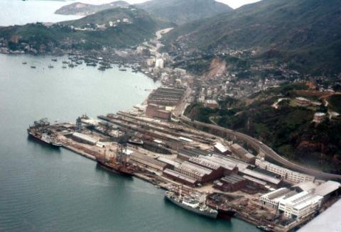
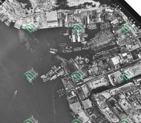
| 1963 |
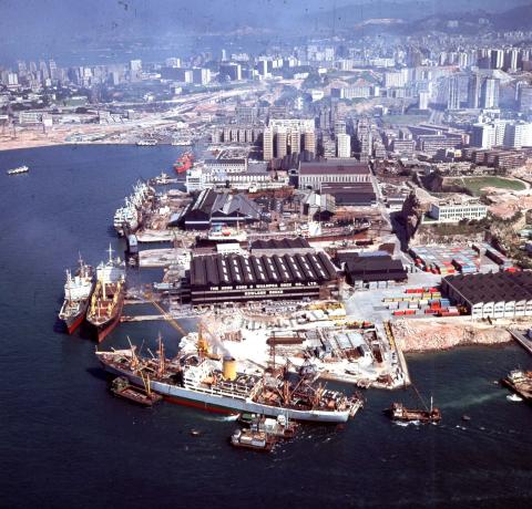
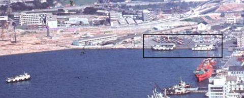
The Hong Kong and Whampoa Dock Co Ltd = 香港黃埔船塢有限公司1963
|
| 1963 |
Hung Hom Piers 1963
|
| 1963 |
1963 An aerial view of Wong Tai Sin Resettlement Estate = 黃大仙新區空中一景
|
| 1963 |
1963 An aerial view of Chai Wan Resettlement Estate = 柴灣新區空中一景
|
| 1963 |
1963 Aerial view of Kowloon - Yau Ma Tei = 九龍航空景觀 - 油麻地
|
| 1963 |
The reclamation project in Central 1963
|
| 1963 |
1963.2-HK-Maps-Lai-Chi-Kok-Aerial-views.jpg
|
| 1963 |
KaiTak Plan 1963
|
| 1963 |
To Kwa Wan Aerial Photograph 1963
|
| 1963 |
kowloon city pier 1963
|
| 1963 |
1963 Yi Pak and Tai Pak, Lantau
|
| 1963 |
1963 Cattle Depot and Pier, Lantau
|
| 1963 |
1963 - Ahwee land leased to Kowloon Dairy
|
| 1963 |
CLP Military Installation, Taipo
|
| 1963 |
Tung Tau Tsuen, Yuen Long - 1963 aerial image
|
| 1963 |
stonecutters is east 1963
|
| 1963 |
1963 aerial view of RAF Ping Shan
|
| 1963 |
1963.2 European Houses #9 & #10 cheung chau, HKMaps
|
| 1963 |
1963.2 HKMaps crop Kwun Yam Wan
|
| c.1963 |
discovery bay ta hing farm 1963
|
| c.1963 |
Aerial Photograph Mui Wo 1963
|
| c.1963 |
Rumsey Street Temporary Vehicular Ferry Pier
|
| 1964 |
Cherry Hill Lodge-Homantin Hill Road
|
| 1964 |
Shatin Roadhouse-location aerial view 1964
|
| 1964 |
Hung Hom Ferry Piers aerial view 1964
|
| 1964 |
Central 1964
|
| 1964 |
Possible Rose Garden Hotel
|
| 1964 |
1964 Kowloon Tong
|
| 1964 |
Old_Hong_Kong - Town Gas north & south gas plant in 1964 [煤氣馬頭角南廠及北廠]
|
| 1964 |
Jordan Road Piers
|
| c.1964 |
Ocean Terminal under construction circa 1964-65

|
| 1965 |
Tai O-Lantau Island-1
|
| 1965 |
Tai O-Lantau Island-2
|
| 1965 |
Jordan Road Ferry and Typhoon Shelter 1965
|
| 1965 |
1965 Central waterfront
|
| 1965 |
Hong Kong Central and Sheung Wan = 香港中、中環[圖中可見恒生根行大廈、消防局和港外線碼頭] 1960s
|
| 1965 |
cricket club
|
| c.1965 |
c.1965 Approaching Kaitak
|
| 1966 |
Alhambra and Kln CPO.jpg
|
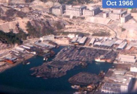
| 1966 |
Junk Bay ship breakers 4.jpg
|
| 1966 |
Junk Bay ship breakers 5.jpg
|
| 1966 |
Yau Tong aerial photo 1966
|
| 1967 |
Hung Hom aerial view 1967-05-13
|
| 1967 |
Junk Bay Aerial Photograph 1967
|
| 1967 |
Eastern New Territories? but where?-now identified as Sai Wan Beach
|
| 1967 |
Do South & Gacoigne Rd.jpg
|
| 1967 |
Gascoigne Rd.jpg
|
| 1967 |
1967 Hunghom new land
|
| 1968 |
09-1968 Hong Kong_0023.jpg
|
| 1968 |
1968 Aerial view of Kennedy Town
|
| 1968 |
1968 Looking northwest to Wah Fu Estate
|
| 1968 |
Ferry Piers Central/Sheung Wan 1968
|
| 1968 |
Channel Rock 1968
|
| 1968 |
Victoria Park 1968
|
| 1968 |
永樂戲院 photo.png

|
| 1969 |
33_09 a HKG island Panam flight SGN-HKG Mar 69 CC NDB Approach.jpg
|
| 1969 |
Tsim Sha Tsui East circa 1969
|
| 1969 |
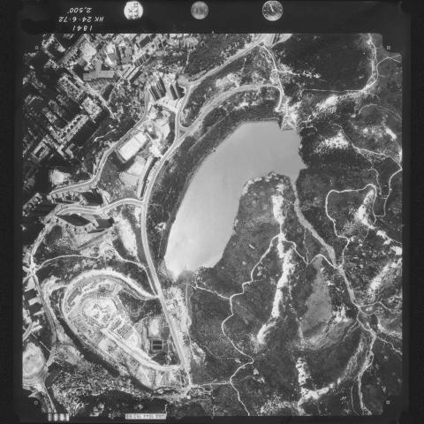
Plover Cove Reservoir 1969
|
| 1969 |
Hung Hom aerial view 1969
|
| 1969 |
1969 hunghom air view.png
|
| 1969 |
1969 aerial view of Green Island Cement Company
|
| 1969 |
Overhead Ropeway 1963/69
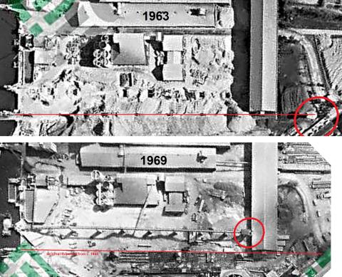
|
| 1969 |
Gloucester Road Reclamation 1969
|
| c.1969 |
Sheung Wan 1969
|
| 1960s |
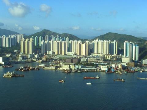
Aerial photos:Hong Kong from above
|
| 1960s |
Royal Hong Kong Yacht Club
|
| 1960s |
1960s: The next Wanchai reclamation begins
|
| 1960s |
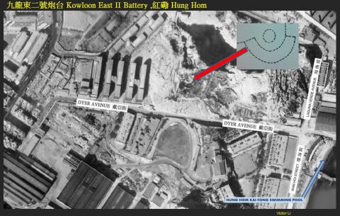
九龍東二號炮台 Kowloon East II Battery ,紅磡 Hung Hom
|
| 1960s |
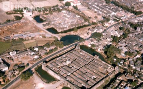
Aerial View of Kam Tin 1960s (HKU Images)
|
| 1960s |
Aerial View of TST c1960
|
| 1960s |
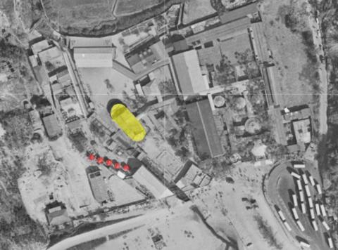
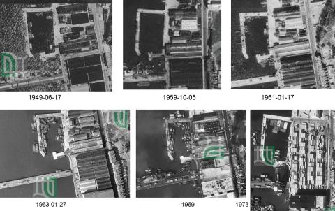
Timeline (Kowloon) Government Dockyard 1949-1973
|
| 1960s |
Old_Hong_Kong - The restaurant [一定好荼樓] and 天后廟 temple
|
| 1960s |
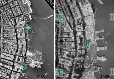
central piers aerial view 1963+1969
|
| 1960s |
aerial view of central 1960s
|
| 1960s |
Pokfulam wing pit ting location
|
| 1970 |
Sheung Wan Rumsey Street car park- Marine dept control room on roof Macau ferry alongside
|
| 1971 |
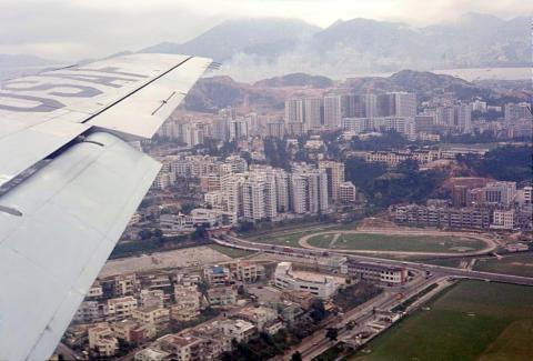
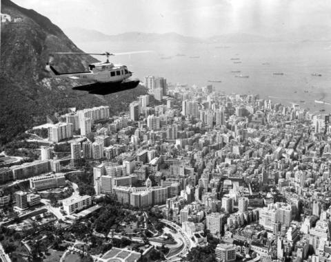
1970s Hong Kong Air Helicopter over Hong Kong
|
| 1971 |
1971 Over Central Kowloon - Landing Kai Tak 4
|
| 1971 |
1971 Over Central Kowloon - Landing Kai Tak 5
|
| 1971 |
1971 Over Central Kowloon - Landing Kai Tak 3
|
| 1971 |
1971 Over Central Kowloon - Landing Kai Tak 2
|
| 1971 |
1971 Over Central Kowloon - Landing Kai Tak 1
|
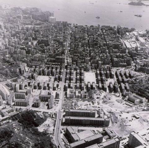
| c.1971 |
hunghum air view before 1972 aug tunnel before train station 1975
|
| 1972 |
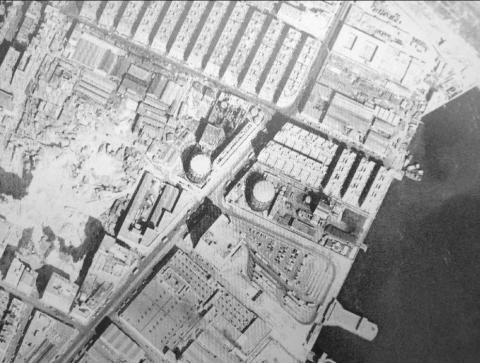
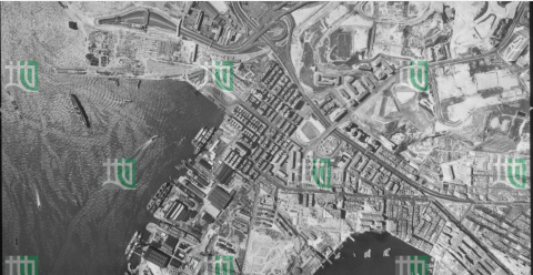
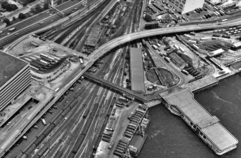
Tsim Sha Tsui-vertical aerial view
|
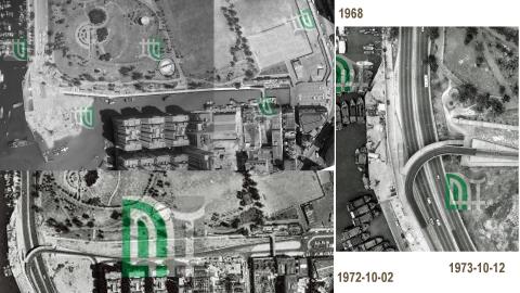
| 1972 |
1972-10-03 hunghom air view b.png
|
| 1972 |
1972-10-03 hynghom air view.png
|
| 1972 |
Tuen Mun from the air 1972
|
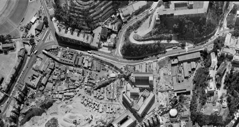
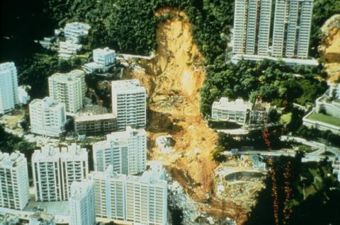
| 1972 |
1972 Po Shan Road landslide / Kotewall Road disaster
|
| 1972 |
Breamar Hill 1972 - 1.jpeg
|
| 1972 |
Tsuen_Wan_cemetery
|
| 1972 |
1972 air view hunghom.png
|
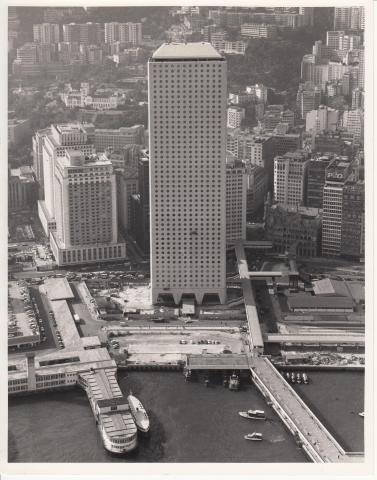
| 1972 |
Connaught Centre / Jardine House
|
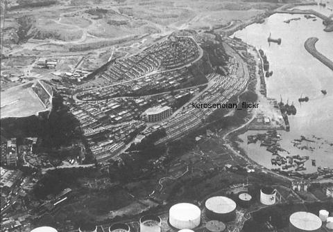
| 1972 |
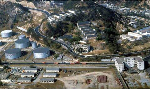
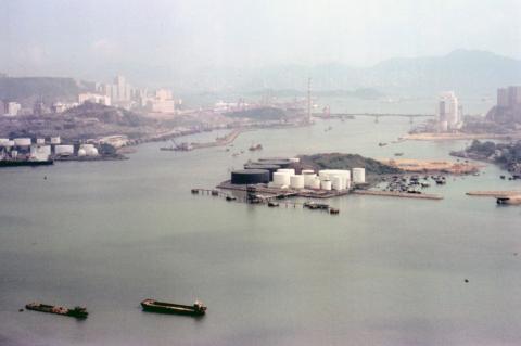
Aerial view of Gulf/Concord Kerosene Store
|
| 1972 |
Shatin aerial view 1972
|
| 1972 |
1972 Central Waterfront
|
| 1973 |
1973-02-20 hunghom air view.png
|
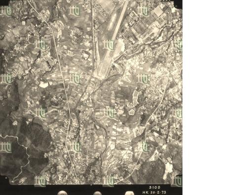
| 1973 |
Shek Kong aerial photo 3100 @5000 ft 1973-02-20
|
| 1973 |
Sai Kung Camp 1973
|
| 1973 |
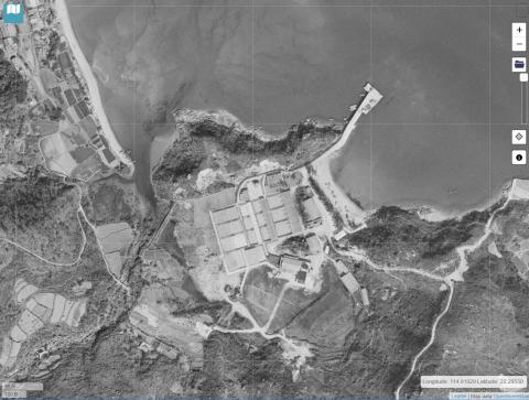
High Island Reservior construction
|
| 1973 |
Kowloon-New World Centre-construction-aerial-1973
|
| 1973 |
Hung Hom aerial view 1973-06-23
|
| 1973 |
Aerial View of Sham Shui Po and Shek Kip Mei 1973-08-02.jpg
|
| 1973 |
Ice Works Causeway Bay - Conveyor Belt
|
| 1973 |
1973-10-23 hunghom air view.png
|
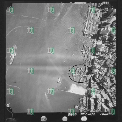
| 1973 |
Wing Lok Pier 1973-11-01
|
| 1973 |
1973 Aerial View of Tai Tam
|
| 1973 |
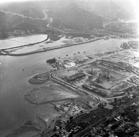
1973 North Point
|
| 1973 |
Junk Bay = 將軍澳 1973
|
| 1973 |
tai wan shan 1973.png
|
| 1973 |
1973 Wanchai view from the air
|
| 1974 |
1970s Stonecutters Island
|
| 1974 |
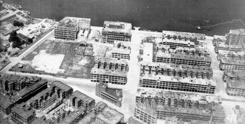
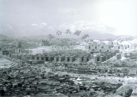
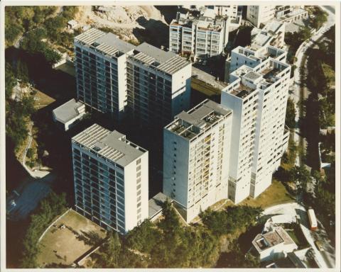
Hong Kong, Wah Fu Estate, Government Low Cost House
|
| 1974 |
Approaching Kowloon 1974
|
| 1974 |
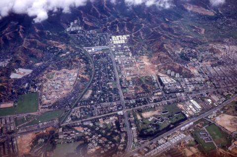
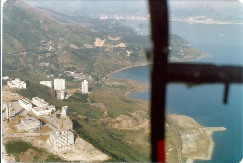
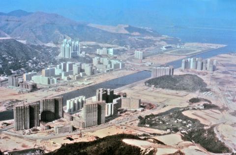
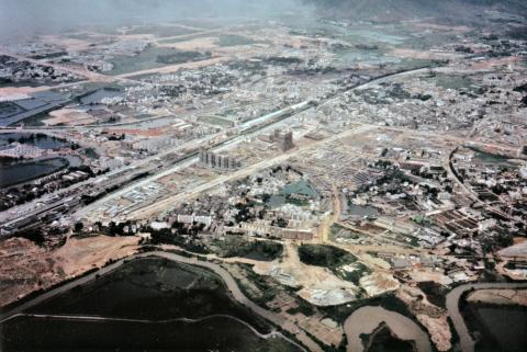
Aerial views of Shatin Reclamation = 沙田填海空中景觀1974
|
| c.1974 |
Central and Sheung Wan
|
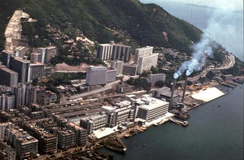
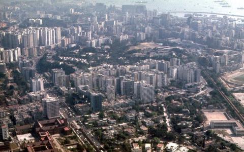
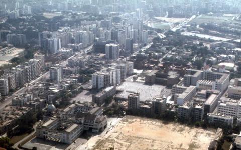
| 1975 |
Hung Hom
|
| 1975 |
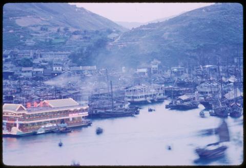
Tai Pak floating restaurant, Castle Peak-1975
|
| 1975 |
Lok On Pai desalting plant-Sui Lam
|
| 1975 |
Rambler Channel
|
| 1975 |
Hung Hom aerial view 1975-12-01
|
| 1975 |
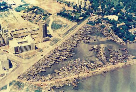
Tsim Sha Tsui from the east 1975
|
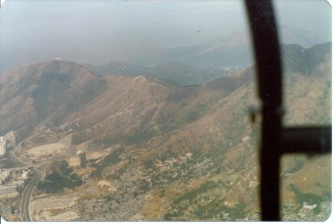
| 1975 |
Hung Hom from the air
|
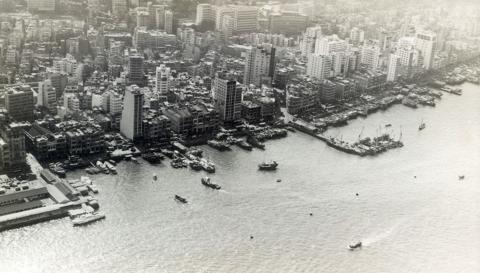
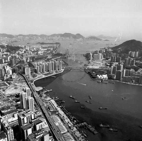
| 1975 |
Kowloon from the air
|
| 1975 |
SCMP_Taikoo_1970's
|
| 1975 |
Tsim_Sha_Tsui_Aerial_view_1975
|
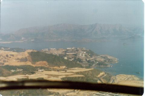
| 1975 |
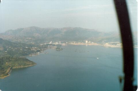
Aerial views of Shatin = 沙田空中景觀 1975
|
| 1976 |
Ho Sheung Heung Aerial Photo 1976
|
| 1976 |
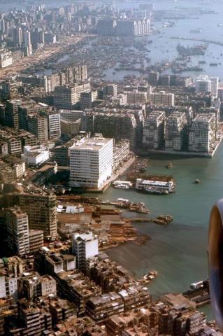
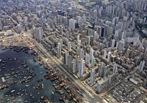
Tsim Sha Tsui waterfront 1976
|
| 1976 |
An aerial view of Lai Chi Kok Bay.
|
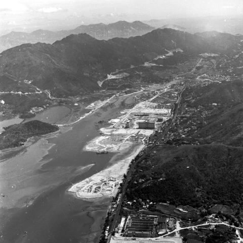
| 1976 |
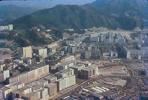
Tsim_Sha_Tsui,_Hong_Kong mid-1970s
|
| 1976 |
An aerial view of North Point waterfront 1976
|
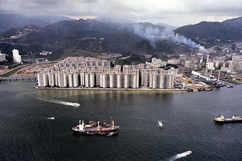
| 1977 |
Flying Doctor Trip. Kai Tak. 24:12:1977 (2).jpeg
|
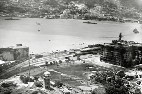
| 1977 |
Flying Doctor Trip. Kowloon City. 24:11:1977 (3).jpg
|
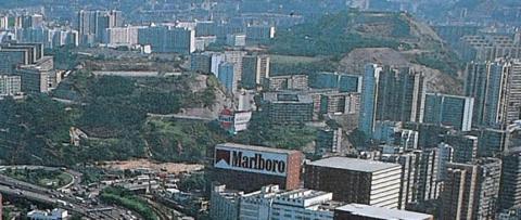
| 1977 |
Flying Doctor Trip. Unicorn Ridge. 24:12:1977 (4).jpg
|
| 1977 |
Flying Doctor Trip. Chinese University. 24:12:1977 (5).jpg
|
| 1977 |
Flying Doctor Trip. University&Tolo Hbr. 24:12:1977 (6).jpg
|
| 1977 |
Flying Doctor Trip. Tolo Hbr & Ta Po. 24:12:1977 (7).jpg
|
| 1977 |
Flying Doctor Trip. Lai Chi Wo. 24:12:1977 (12).jpg
|
| 1977 |
Flying Doctor Trip. 24:12:1977 (15).jpg
|
| 1977 |
Flying Doctor Trip. 24:12:1977 (16).jpg
|
| 1977 |
Katherine Building
|
| 1977 |
kowloon city from the air 15jun77
|
| 1978 |
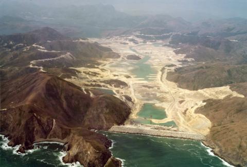
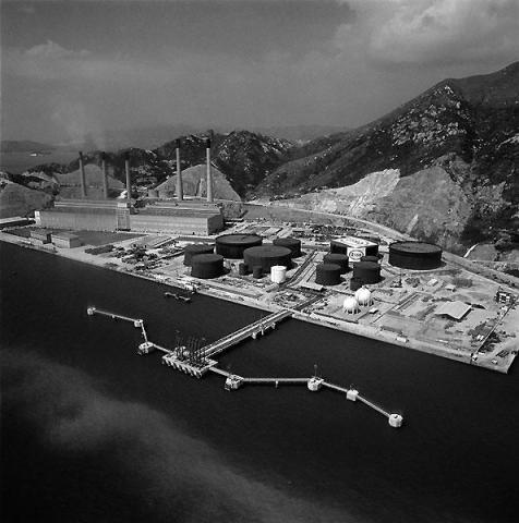
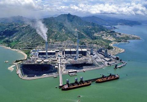
Tap Shek Kok-site of the future Castle Peak power station
|
| 1978 |
Hung Hom aerial view 1978-12-07
|
| 1978 |
naval dockyard
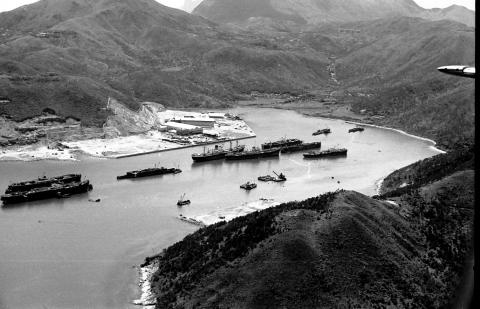
|
| 1979 |
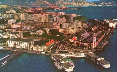
Tsim Sha Tsui East-May 1979
|
| 1979 |
Tsim Sha Tsui East-May 1979
|
| 1979 |
Tsim Sha Tsui East-May 1979
|
| 1979 |
Tsim Sha Tsui May 1979
|
| 1979 |
Tsim Sha Tsui-May 1979
|
| 1979 |
Tsim Sha Tsui-May 1979
|
| 1979 |
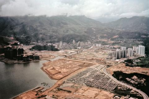
Shatin-New Town-1
|
| 1979 |
Shatin-New Town-2
|
| 1979 |
Shatin-New Town-4
|
| 1979 |
Fanling-New Town
|
| 1979 |
Taipo-New Town
|
| 1979 |
Turntable-Tsim Sha Tsui East
|
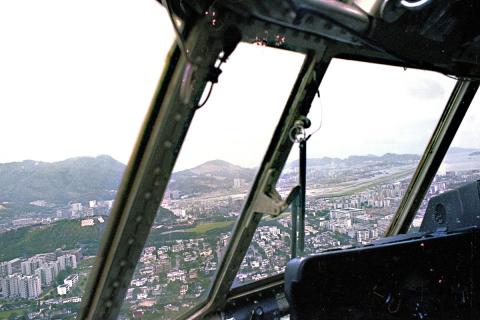
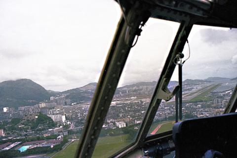
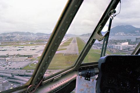
| 1979 |
Approaching Kai Tak 1979 (1)
|
| 1979 |
Approaching Kai Tak 1979 (2)
|
| 1979 |
Approaching Kai Tak 1979 (4)
|
| 1979 |
Approaching Kai Tak 1979 (5)
|
| 1979 |
Approaching Kai Tak 1979 (6)
|
| 1979 |
Departure from Kai Tak (1)
|
| 1979 |
Departure from Kai Tak (3)
|
| 1979 |
Departure from Kai Tak (4)
|
| 1979 |
Shatin-New Town-3
|
| 1979 |
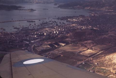
1979 - flying into Kai Tak Airport
|
| 1979 |
1979 - flying into Kai Tak Airport
|
| 1970s |
Aerial view of Tai Tam, circa 1970
|
| 1970s |
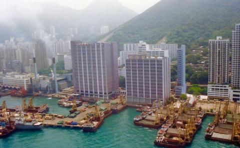
Hong Kong United Dockyards
|
| 1970s |
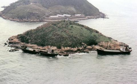
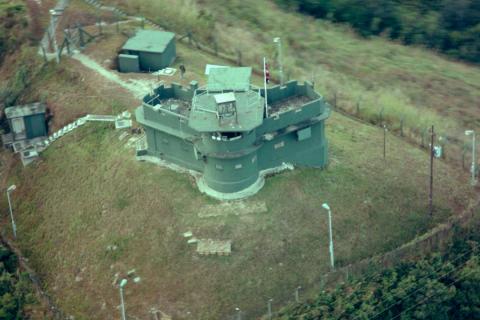
Mystery Rock, Aerial view
|
| 1970s |
1970s Taikoo Dockyard
|
| 1970s |
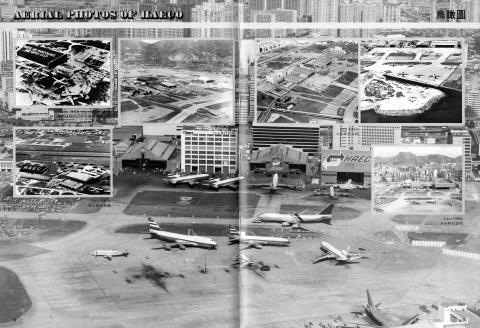
Kaitak-Airport-Former-HAECO-premises-Aerial
|
| 1970s |
000006 (3).JPG
|
| 1970s |
1970 Over North Kowloon
|
| 1970s |
1970 Lai Chi Kok from the air

|
| 1970s |
TST Aerial View
|
| 1970s |
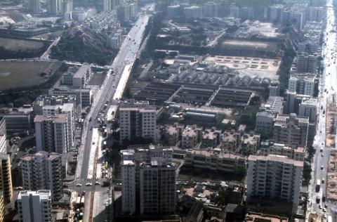
Tsing Yi Power Station (1970's)
|
| 1970s |
Cavendish Heights-Hong Kong Electric Company staff quarters - edited.jpg
|
| 1970s |
Mei Foo aerial view 1970.jpg
|
| 1970s |
1970s RHKAAF Islander over Hong Kong
|
| 1970s |
The hong kong polytechnic 4
|
| 1970s |
1975 shatin air view
|
| 1970s |
Wanchai reclamation-1970s
|
| 1970s |
Western district waterfront-1970s
|
| 1970s |
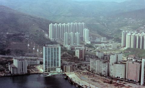
Cavendish Heights, Jardine’s Lookout, circa mid-1970s
|
| 1980 |
Canton Road/Kowloon Park Drive aerial view 1980
|
| 1981 |
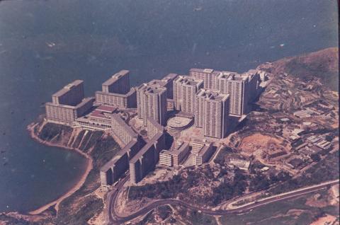
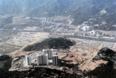
1981 Wah Fu, Hong Kong's largest public estate
|
| 1982 |
Hammerhead Crane (Demolition) Timeline
|
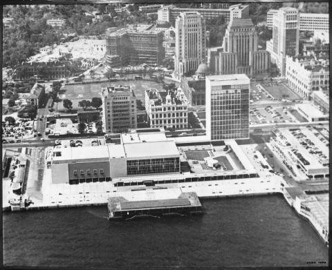
| 1982 |
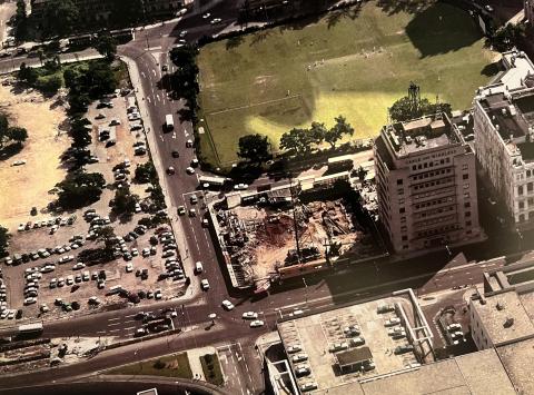
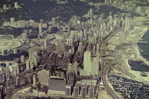
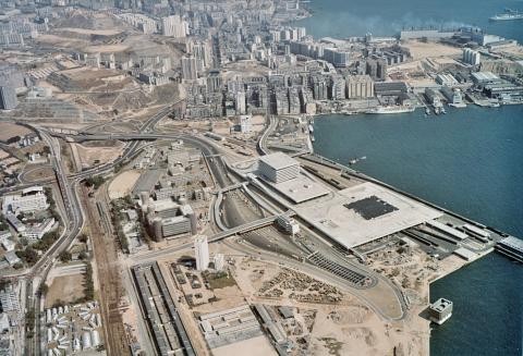
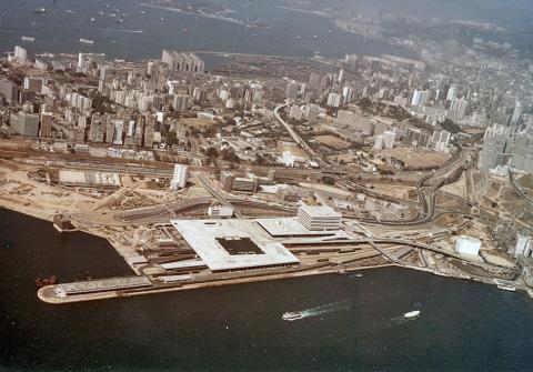
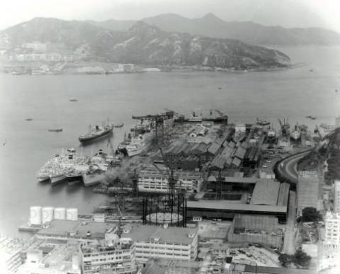
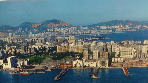
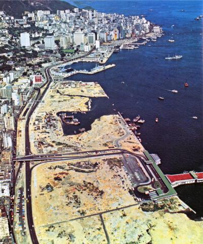
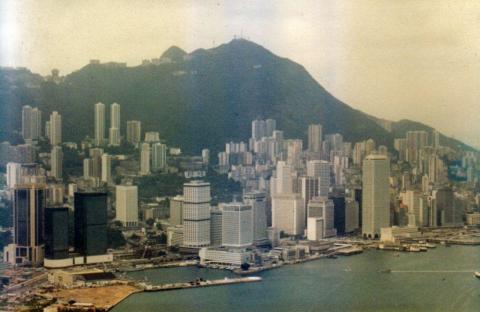
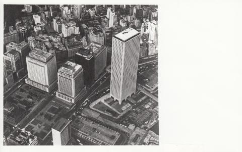
1982 Aerial View of Central
|
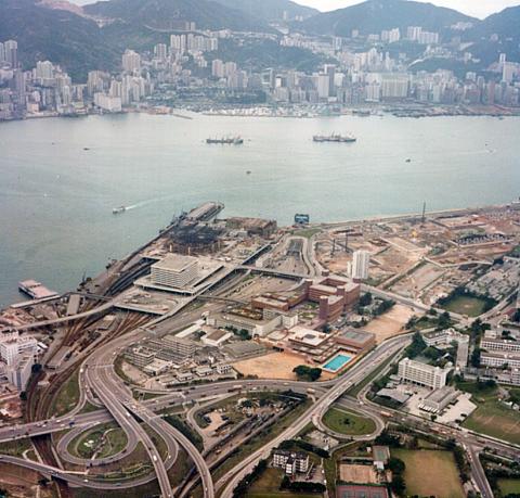
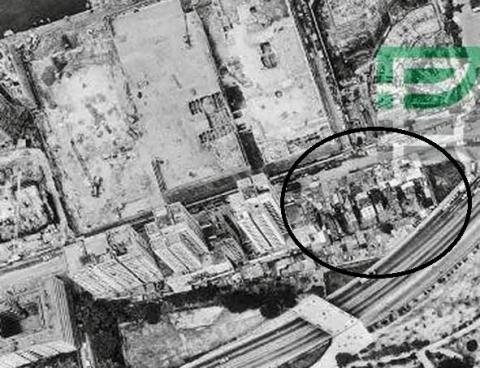
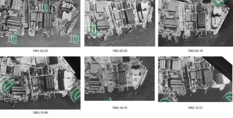
| 1982 |
1982 air view hung hom
|
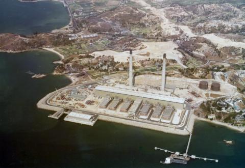
| c.1982 |
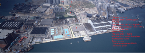
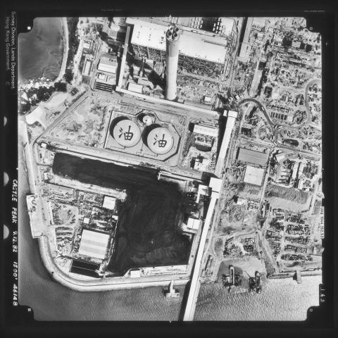
Castle Peak CLP Plant under construction.
|
| 1983 |
Tsuen Wan West
|
| 1983 |
Green Island typhoon victims
|
| 1983 |
Cheung Chau Island typhoon victim
|
| 1983 |
Early_Taikooshing_c1983
|
| 1983 |
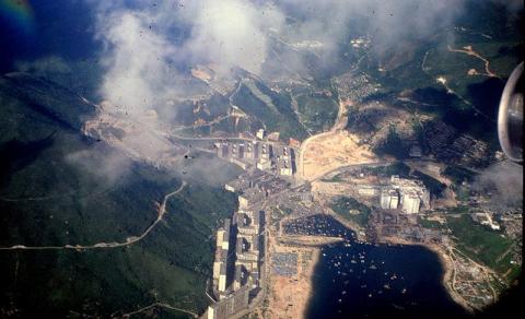
Tai Tam Villas
|
| 1985 |
Yau Tong Bay Aerial View 1985
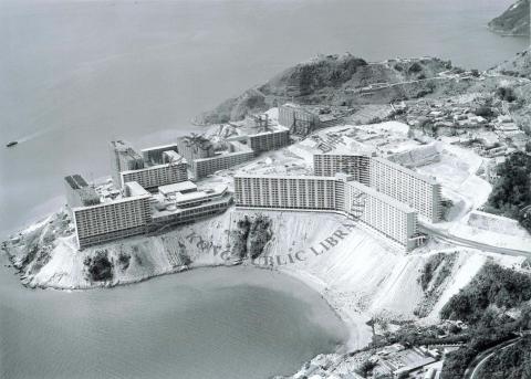
|
| 1985 |
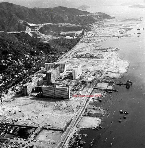
Repulse Bay-Breakfast by the pool, Sir?
|
| 1985 |
Hung Hom aerial view 1985-10-03
|
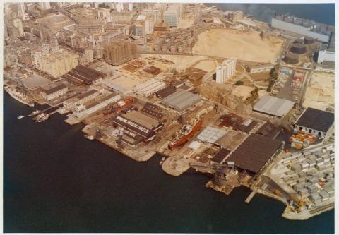
| 1985 |
1980s Kai Tak Airport and HAECO
|
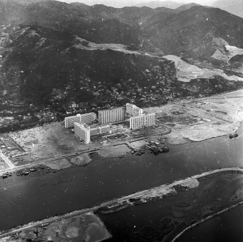
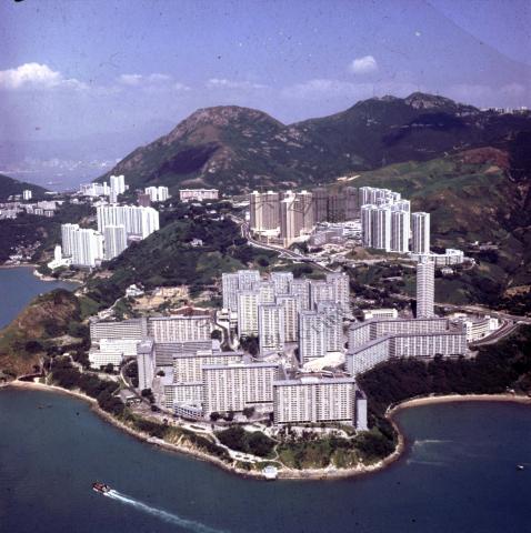
| 1985 |
Aerial view of Aberdeen mid 1980s
|
| 1986 |
1986 - helicopter view of Yacht Club
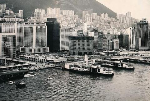
|
| 1986 |
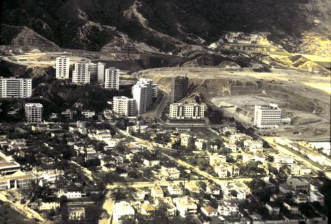
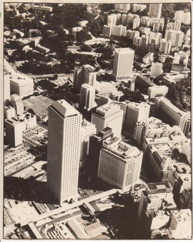
A bird's eye view of high rise development around Statue Square = 從高處俯瞰皇后像廣場一帶的發展1986
|
| 1986 |
HUD_Expatriate_Staff_Quarters_in_Whampoa
|
| 1986 |
Quarry Bay Gas Holder 1980's
|
| 1986 |
1985 Hung Hom aerial view
|
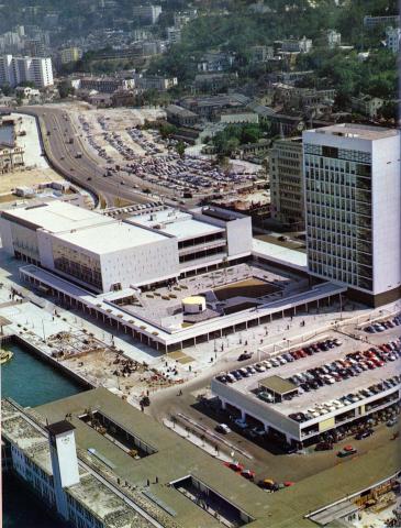
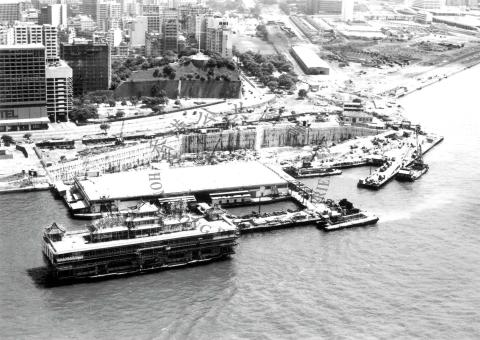
| 1987 |
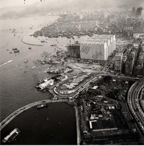
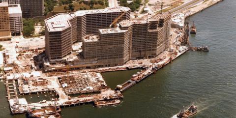
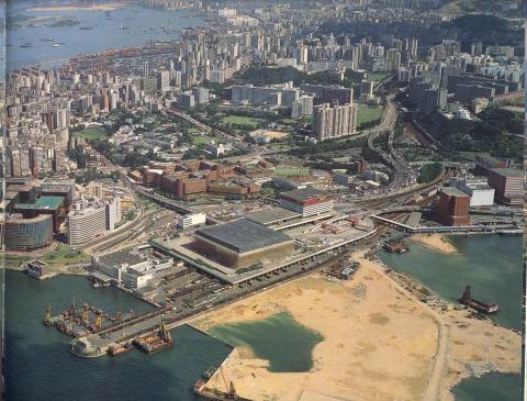
Aerial view of pacific place under Construction
|
| 1988 |
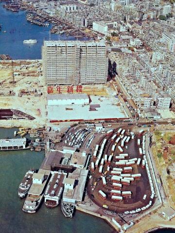
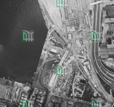
Hung Hom peninsula & Piers
|
| 1988 |
1988 hunghom air view.png
|
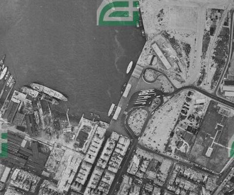
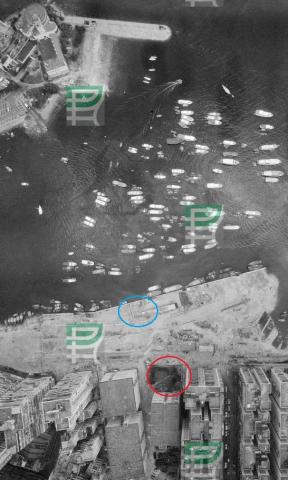
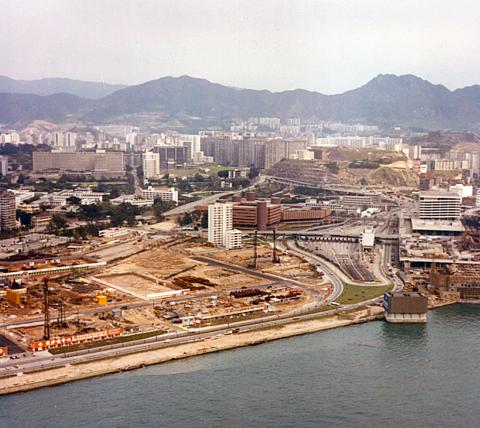
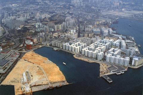
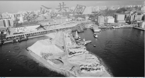
| 1989 |
Hung Hom aerial view 1989-02-03
|
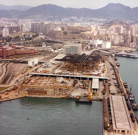
| 1989 |
Hung Hom Reclamation July 1989
|
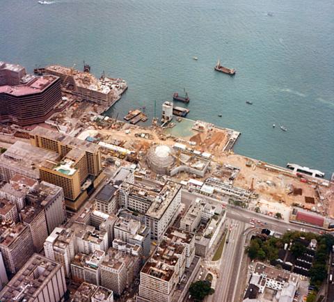
| 1989 |
Hung Hom aerial view 1989-08-16
|
| 1989 |
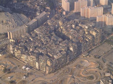
Kowloon Walled City - aerial view
|
| 1989 |
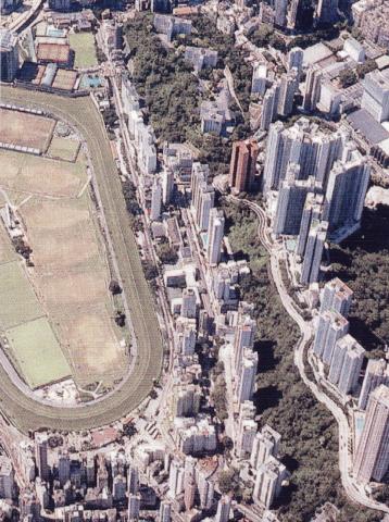
1980s Happy Valley Aerial View
|
| 1980s |
Border wetlands- river is the HK- China boundary
|
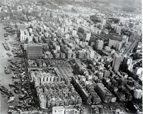
| 1980s |
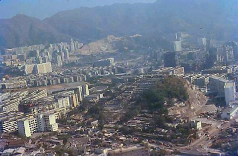
Yau Ma Tei and Mongkok aerial
|
| 1980s |
Castle Peak power station site
|
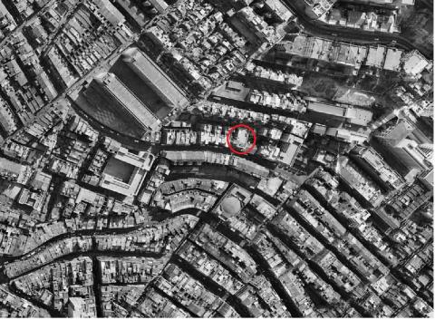
| c.1990 |
1990 - aerial view of the Chek Chue Tin Hau Temple & surrounds
|
| 1991 |
Kennedy Town from the air
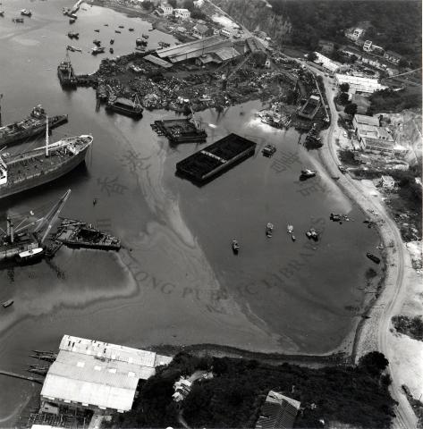
|
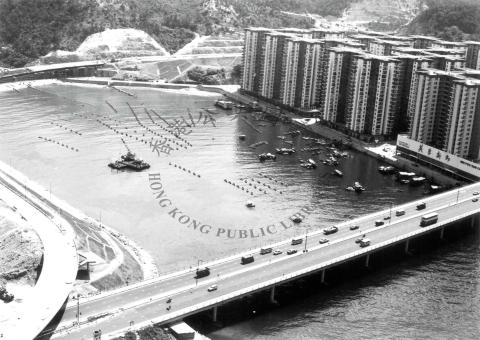
| 1992 |
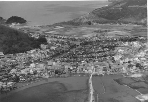
Yau Tong Bay Aerial View 1992
|
| 1992 |
macintosh small92 heli posts j a0693
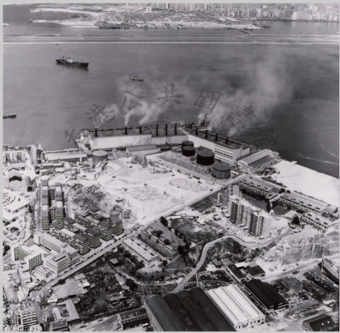
|
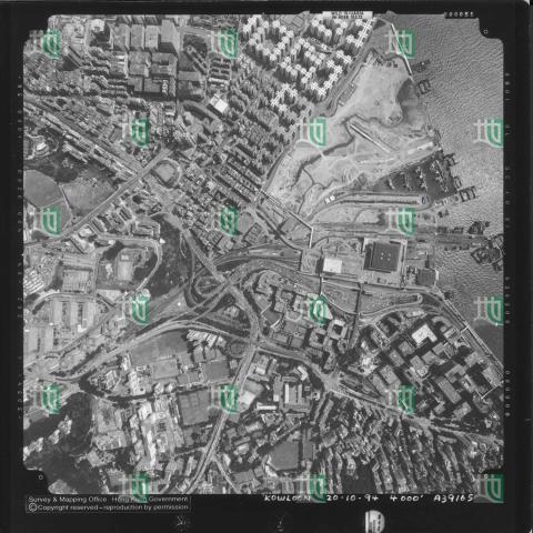
| 1994 |
Hung Hom aerial view 1994
|
| 1998 |
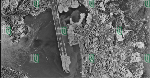
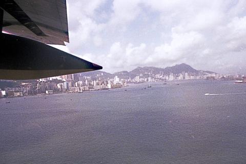
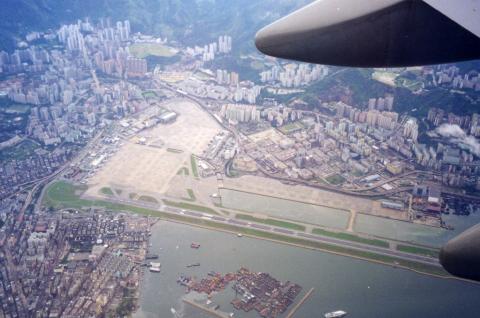
Hong-Kong Kai-Tak airport
|
| 1998 |
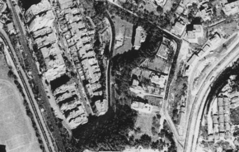
Broadwood Road late nineties.jpg
|
| 1990s |
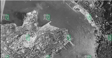
Aerial View of Tsuen Wan and Tsing Yi = 荃灣和青衣空中景觀 1990
|
| 1990s |
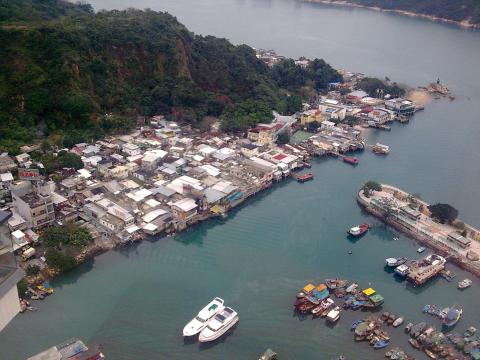
Cheung Chau island looking west
|
| 1990s |
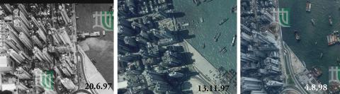
Green Island Cement Pier Demolition 1997/98
|
| 2000 |
Ju52-passing-Tuen-Mun-Butterfly Estates
|
| 2000 |
Junction of Severn & Plantation Roads 2000
|
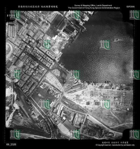
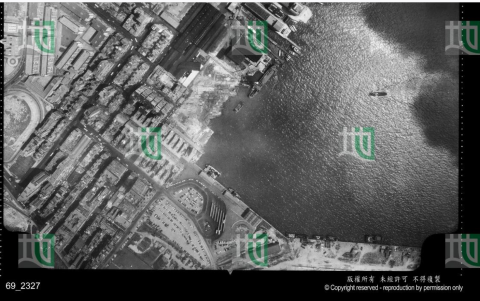
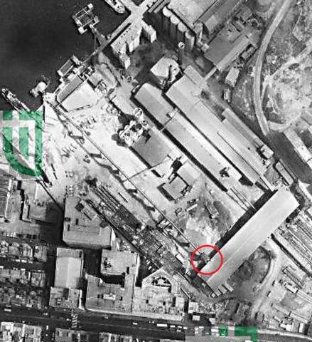
| 2006 |
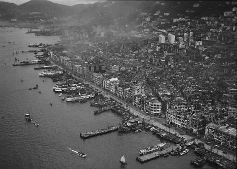
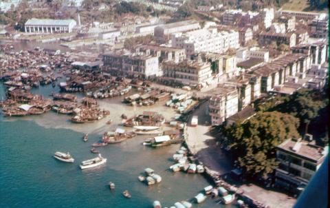
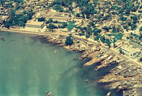
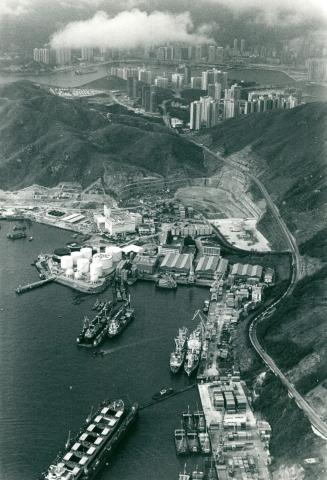
Yau Tong view from the harbour
|
| 2006 |
Junction of Severn & Plantation Roads 2006
|
| 2007 |
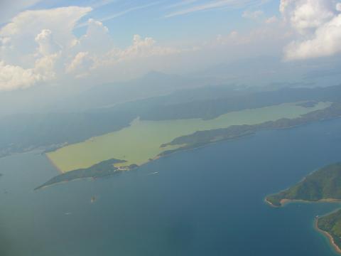
Plover Cove Reservoir from a plane
|
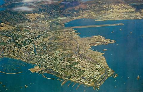
| 2008 |
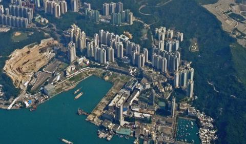
Kai Tak airport area
|
| c.2008 |
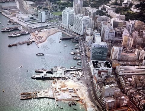
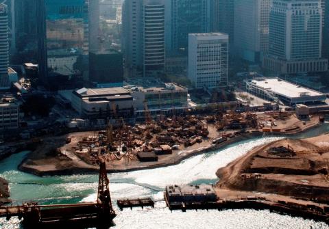
Reclamation in front of City Hall
|
| 2010 |
2010 Lei Yue Mun Ferry Pier (Sam Ka Tsuen)
|
| 2011 |
Just after take-off
|
| 2014 |
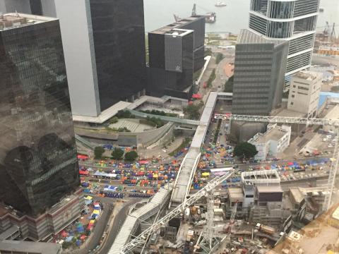
Harcourt Road
|
| 2014 |
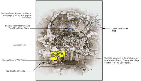
Ping Shan 9th December 2014 JPEG.jpg
|
| 2017 |
Signal Hill 2017
|
| 2017 |
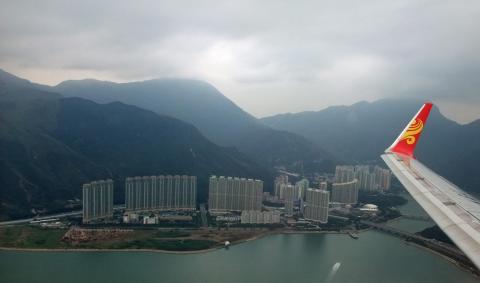
2017 - Leaving Hong Kong (Tuen Mun)
|
| 2017 |
Rambler Channel aerial view 2017
|
| 2017 |
Sai Kung Aerial View
|
| 2017 |
Kwun Tong Bay aerial view 2017
|
| 2018 |
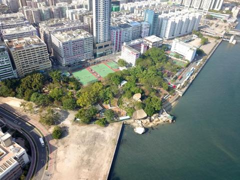
Hoi_Sham_Park_2018
|
| ???? |
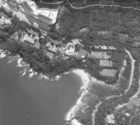
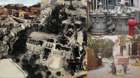
Remains of Royal Naval Hospital,
|
| ???? |
Third St No 103, Hong Kong
|
| ???? |
YauMaTei-Aerial 油麻地.jpg
|
| ???? |
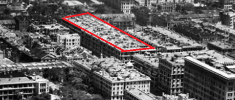
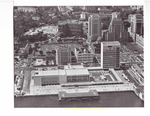
Aerial view of Central
|
| ???? |
Aerial view of Central
|
| ???? |
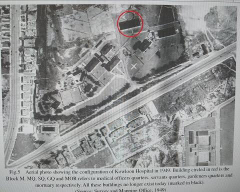
Kowloon Hospital aerial photo 1949
|
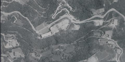
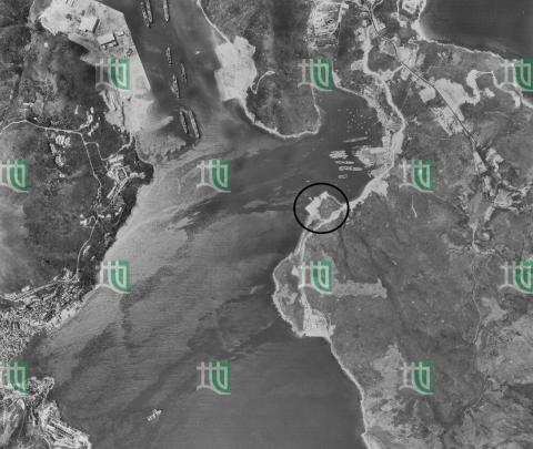
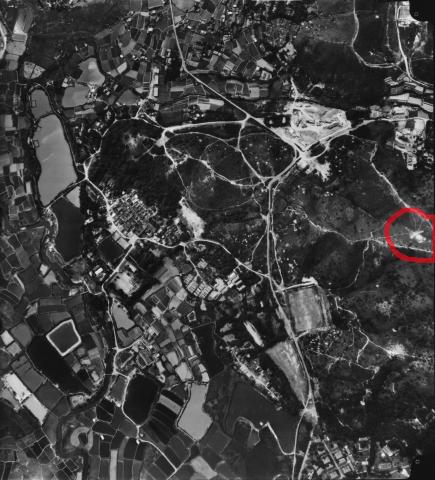
| ???? |
Sai Kung_1963_63d8sw11d00.png
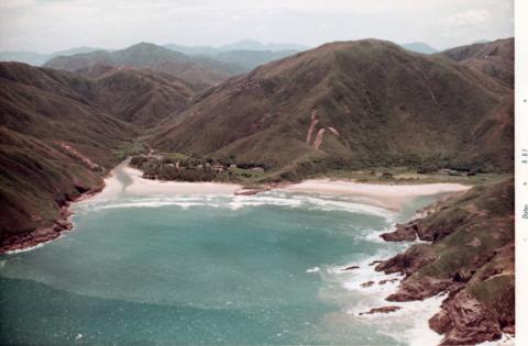
|
| ???? |
Kam Tin Walled Villages
|
| ???? |
Tsing Yi
|
| ???? |
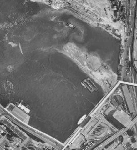
Sam Ka Tsuen 1973
|
| ???? |
view of kowloon 1946
|
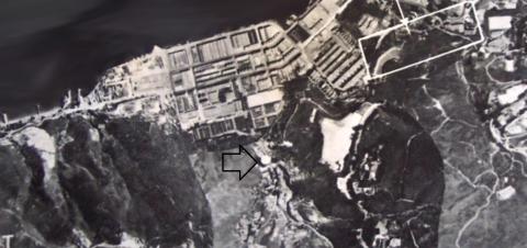
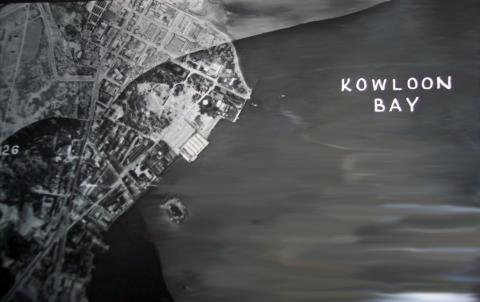
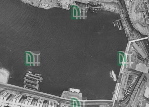
| ???? |
kowloon bay aerial view
|
| ???? |
aerial view of central 1950s

|
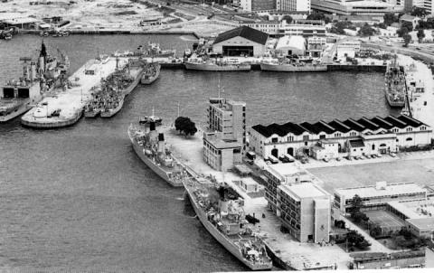
| ???? |
admiralty tamar
|
| ???? |
tamar
|
| ???? |
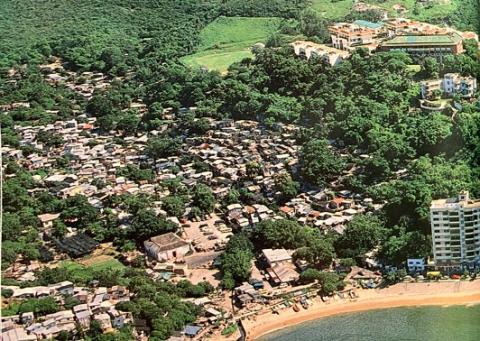
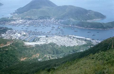
aerial photograph of aberdeen
|
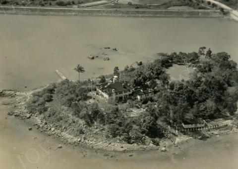
| ???? |
Island House on Yuen Chau Tsai in Taipo
|
| ???? |
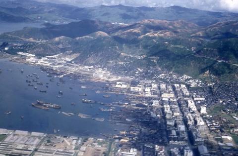
Cheung Sha Wan
|
| ???? |
aerial view of the western part
|
| ???? |
Queen's Pier
|