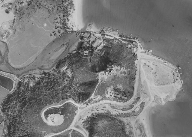
Here you can see the Police Station at the top of the hill, Occupational Road runs down to the waterfront where the land reclamation looks to be almost complete, much later this would become Mui Wo ferry pier, bus station, car park and associated residential housing blocks that we see today. At the top of the photo is the precarious wooden bridge leading to the Silver Mine Beach, to the left the flood lands / marsh which would also be reclaimed forming the current river silver which feeds into the main water in the bay of Mui Wo.
Date picture taken
1963 (year is approximate)
Shows place(s)
Comments
Mui Wo, Lantau Island, 1972
This photograph dated c 1972 shows the precarious wooden draw bridge leading to Silver Mine beach, this would also be in the similar location to the current bridge leading to the Silver Mine Hotel and beach. To the left you can see the flood plain / marshland which would all become reclamation land forming the River Silver.