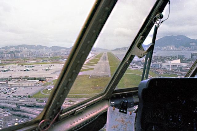
Klaus Sun, 08/21/2016 - 18:05 prevnextoldernewer Date picture taken 1 Jul 1979 Tags 1970s kai tak Kai Tak Airport aerial photographs Author(s) Tony Hawes Gallery 1970s Hong Kong Shows place(s) Kai Tak Airfield / Airport [????-????] Kai Tak Reclaimed Runway Main Airport Fire Station (1st Location) [1960- ] Kai Tak Reclaimed Runway Main Airport Fire Station (2nd Location) [c.1975-c.1993] Log in or register to post comments Comments What is this chart? Which company made this chart (to the left side of the captain)? I don't even think that's Jeppesen. Or is that some sort of the Company Route Manual? Log in or register to post comments
What is this chart? Which company made this chart (to the left side of the captain)? I don't even think that's Jeppesen. Or is that some sort of the Company Route Manual? Log in or register to post comments
Comments
What is this chart?
Which company made this chart (to the left side of the captain)?
I don't even think that's Jeppesen. Or is that some sort of the Company Route Manual?