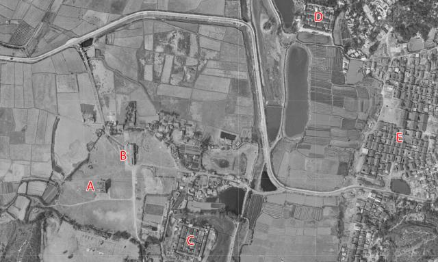
This is a good aerial view of the Ping Shan area in 1963.
A & B are buildings on the site of RAF Ping Shan.
C is the walled village, Kiu Tau Wai, and D is another walled village, Sheung Cheung Wai.
The two lines of three large buildings above the E are (upper) the Tang Ancestral Hall, and (lower) the Yu Kiu Ancestral Hall.
Source: the 1963 aerial survey, shown as the 1963.2 layer at hkmaps.hk
Date picture taken
1963