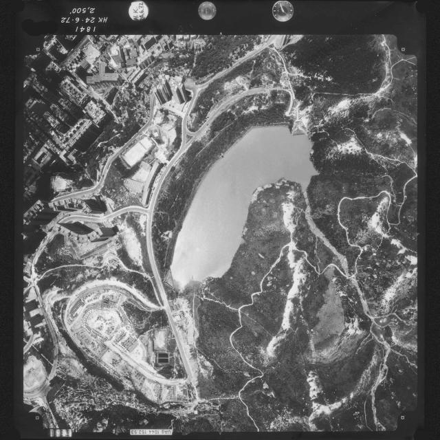
I purchased the Aerial photograph from the HK Gov't Map office to understand the area which I work in, Braemar Hill. On the Photo, it's stated that it was taken in 1972, prior to the draining and development of Braemar Hill Mansions. It's interesting to note in the south west corner, which is bounded by Hau Yuen Path and Wai Tsui Crescent , it appears to be containers - why they would be located here seems odd. In the furthest southwest corner is the old squatter village Nga Choi Hang, which emptied out about 1994, and remained empty after the mysterious fire of 1995.
Date picture taken
1972
Gallery
Comments
Containers
Could it be a car park? It looks like a mix of cars, buses and lorries.
Regards, David
Not sure, but why a car park
Not sure, but why a car park at the end of a dead end. Also, they look very uniform in their positioning.
Re: Not sure, but why a car park
Hi there,
Maybe the carpark was temporarily before development starts. Probably the developer determined the timing was not right. You could see similar but in much smaller scale carpark sites popping up in the city from time to time even today.
T