Aerial photos are literally the big picture. They don't have the detail of a street-level photo, but they make up for that in other ways:
History
A photo of a bombed-out, deserted Wanchai
taken near to the time of the Japanese surrender. It captures this bleak time in Hong Kong - when else have the streets been this empty?
Received by email: Here is a photo of bomb-scarred western end of Wanchai taken in 1945. The two major buildings on the waterfront (i.e. Gloucester Rd) are the former China Fleet Club on the cormer with Arsenal St and the Sailors' Home and Missions to Seamen on the corner with Fenwick St. The Chinese Methodist Church at the junction of Hennessy and Johnston Rd is in the centre of the photo. What a bleak view of Wanchai, no sign of people or transportation. Was the photo taken during a bombing raid, sending everyone to find cover? Many of the photos we see are of the 1950s, showing a bustling Hong Kong. It's hard to imagine how quickly things would change from the time this photo was taken.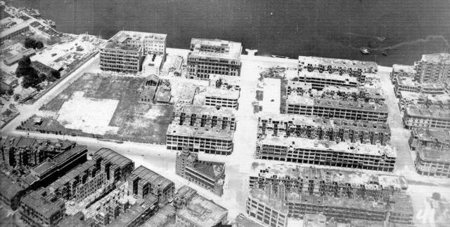
Mystery
Need to know what stood where? Check an aerial photo!
eg was this 1950s photo of the Star Ferry or City Hall car parks?
This is the car park that JJ Cowperthwaite refused to pay for out of Government funds, saying "If the private sector wants a car park, it can build one". I'm pretty sure that car park was still there, unchanged, in the 1980's, by which time the cost of a days parking was considerably more than the cost of travelling into and out of Central by any other means. I thought this picture showed the multi-storey car park behind City Hall. Reason being this photo of the building only shows a ramp leading down from the upper levels. The car park in front of the old star ferry building (which will be pulled down from what I understand) is a longer building and has another ramp that leads up at the opposite end. Just some housekeeping of facts. Can admin please update/clarify the following two car parks? As noted by moddsey in post just above: Star ferry car park opened 8th December 1957 City Hall multi-storey car park opened 1961 ...but link still says city hall multi-storey car park opened 1959 Thanks in advance! I'll stick with 1959 for now, as Fred's photo shows the car park in use, and he left Hong Kong permanently in 1959. Klaus also found a mention the car park was in use in 1959 (https://gwulo.com/comment/56815#comment-56815), but that note also suggests the car park was closed at some point that year while piling work was underway. So maybe it had an unofficial opening in 1959, closed during the piling works, then had its formal opening in 1961?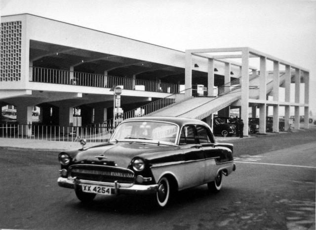
Comments
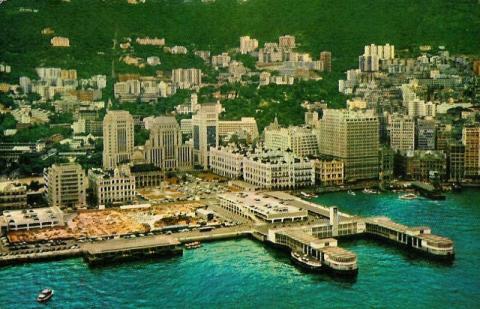
Here's the answer, posted yesterday.
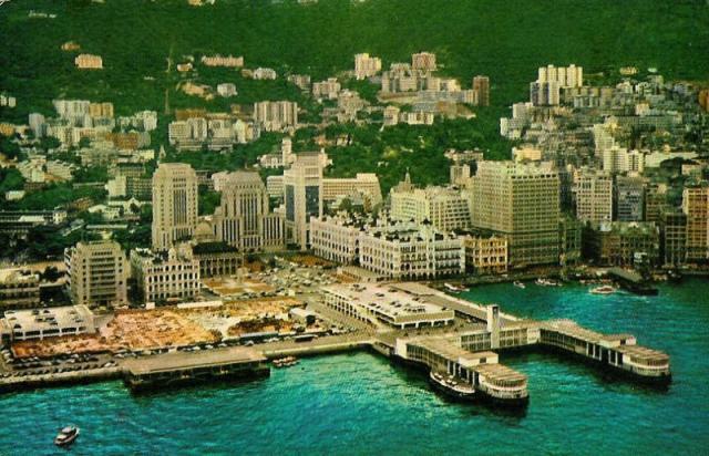
(It was the City Hall Car Park, shown on the left. The Star Ferry Car Park had two ramps, City Hall one.)
And can you guess what this is:
Cropped image from Aerial Photo ref: 1949-6085-81A-128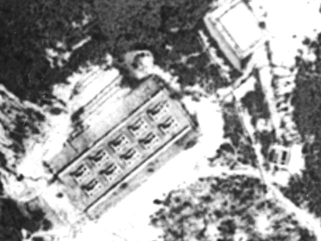
It was taken above the hills behind Quarry Bay in 1949. I knew there were several wartime stoves built around there, but until I saw this photo I didn't know exactly where they stood or how they were laid out.
Maps
Aerial photos are a natural companion to old maps. With maps you're at the mercy of the person deciding what to include. eg it's unlikely the post-war mapping dept would consider the broken-down stoves shown above worth mentioning. With photos, you get the unfiltered view of everything in front of the camera.
They also add the third dimension to 2-D maps, eg this photo of TST in the early 1960s. The buildings off to the right are still low-rise, but you can see a growth spurt among buildings along Nathan Road. Recently completed buildings like Chungking Mansions and Mirador Mansions tower over their older neighbors. This would be the standard height for TST buildings until the 1990s.
Where to find aerial photos of Hong Kong?
- You can view the gallery of photos tagged "aerial photo" here on Gwulo
- The Survey and Mapping office (SMO) has a library of aerial photos dating from 1924 to the present day. They will sell you reprints.
- The SMO also published a book ""Hong Kong in Old Times - A Collection of Aerial Photos Taken in 1964". Unfortunately when I contacted the SMO last month to buy a copy, they replied: "[it] has been sold out for quite a while. It's unfortunate that our senior management has decided not to reprint it."
- And of course for modern photos, we're spoiled for choice with free satellite images available from Google, Microsoft, and Yahoo.
Readers, any other good sources to recommend?
Regards, David