Current condition
Ruin
Date completed
(Year is approximate.)
Date closed / demolished
(Year is approximate.)
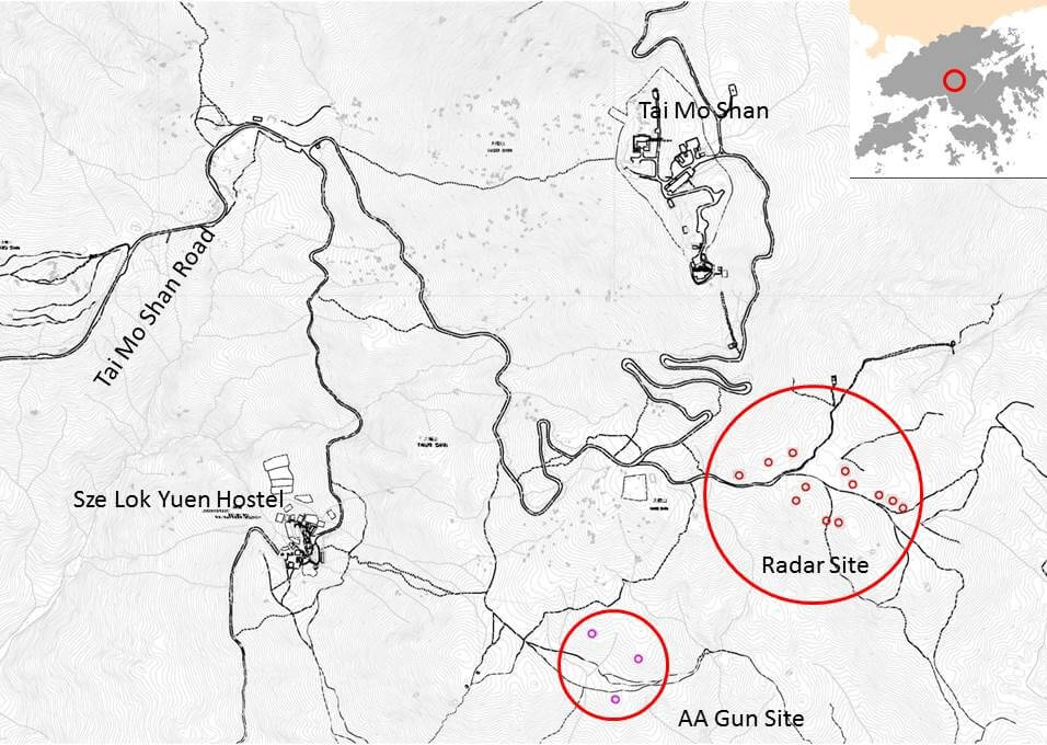
Location is approximate and more or less fit the markers stated in this map. A photo of it, taken atop the eastern site on the northern slopes could be viewed here. The site is actually visible in Google Earth.
Photos that show this Place
2016
Comments
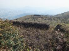
Tai Mo Shan Japanese Anti-Aircraft Gun Site No. 3
Here is the view of the gun site with the radar station in the background. This one has a much higher retaining wall on the left side of the picture, which could limit the firing angle of the AA gun and make it only effective against targets flying over the mountain top.
[scald=28041:sdl_editor_representation {"link":"http:/atom/28041"}]
Tai Mo Shan
Those photo’s bring back some memories. There were more ruins on the top. I still have some of the bricks from those buildings. We were stationed at Kai Tak but took our alsatians up each afternoon, for our 12 hour shift. Once the day shift went down the mountain we would follow them down and then lock the access barrier, until the following morning. At night we could see all the village light’s twinkling up to the border. From the border into China complete darkness. From what I read it would appear that it would be hard to pick out the border now with all the industrial developments.
Re: Tai Mo Shan
Hi there,
I believe Shenzhen is muc brighter than at night these days. On the contrary the boundary on HK side had not been much developed. I suspect the dark zone is now mostly on our side, except for a few sections along where train and road traffic are crossing the line.
T