1856

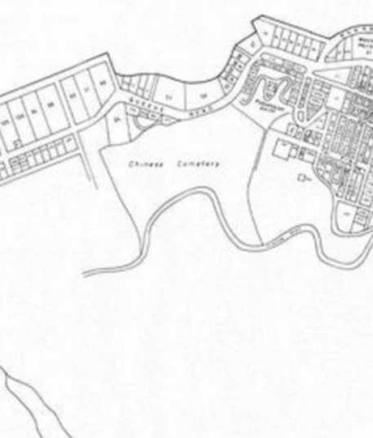
The graves were moved, and the land put into use for hospitals.
(approximate area of original Chinese Cemetery below)
[gmap polygon=22.28619069755883,114.14650654784054 + 22.28549577752968,114.14736485472531 + 22.28482070905085,114.1467854975781 + 22.283947086180753,114.14642071715207 + 22.284125782211916,114.14616322508664 + 22.284542738729787,114.1460130213818 + 22.284880274047758,114.1460130213818 + 22.285118533781574,114.14571261397214 + 22.285058968886176,114.14526200285763 + 22.28503911391541,114.14485430708737 + 22.28482070905085,114.14442515364499 + 22.284463318536535,114.1442105769238 + 22.28436404323154,114.14388871184201 + 22.284463318536535,114.1436526774487 + 22.28627011677078,114.14373850813718 + 22.28619069755883,114.14650654784054 |zoom=16 |center=22.285899824431,114.14430141448975 |width=480px |height=350px |control=Small |type=Map]
Comments
I've seen the old maps at the flyover next to Western Market of the area and the current Po Yan Street and it was marked Cemetary Road and where the present day New Street exist, was literally a boundary between the cemetary and the buildings on Gap Road (Hollywood Road). If I get a chance to go back to the map, I will take some pictures.

Comments
Possession Point is shown
Possession Point is shown adjoining the upper right part of the Cemetery
Added tag 'map'
Added tag 'map'