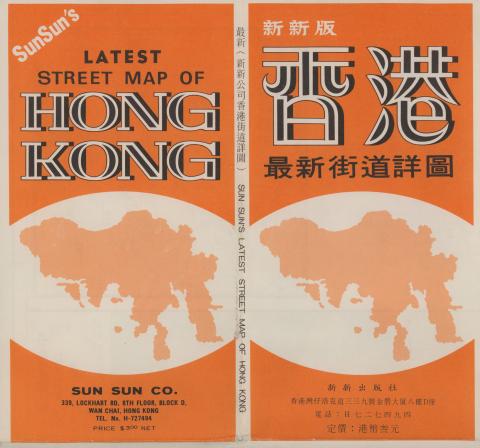
Everything tagged: map

Photos tagged: map

1842
1843
1843

Pages tagged: map

HK Government Mapping Service 2.0 tutorial

Submitted by Herostratus on Fri, 08/31/2018 - 03:07

The Lands department has recently upgraded its online Mapping Service system, significantly increasing the availability of products and services. Previously useful access to many of these products required a trip to the Mapping and Survey office in North Point or elsewhere. .  I have summarised a few of the most useful parts of the new service to people researching Hong Kong History below.


The HK Mapping service website can be reached here 


Protecting Hong Kong Names

Submitted by acklbbc on Sat, 07/25/2015 - 09:49

Hi all,

For years(actually from childhood) I can't help but notice that there is a lot of confusion on the geographic divisions of neighbourhoods in Hong Kong. The more research I did, the more I have found there has been a vast amount of manipulation from the Establishment (real estate developers, the government, the MTRC, etc.) on our perception of this space that we live in. It is chaotic and full of contradictions at the moment, and actions should taken to protect our heritage.

1924 Map of Central & Western

Submitted by David on Fri, 08/27/2010 - 10:52

May 2016 update: This 1924 paper map is now available as an overlay on the main map. Please see:

http://gwulo.com/map-of-places#14/22.2832/114.1440/Map_by_ESRI-1924_HK-…


Here's a detailed, zoomable, scrollable, clickable map of Hong Kong from 1924, showing Central to Kennedy Town:

<?php

/*print views_embed_view('places_by_lat_lon', 'page_2', "22.28165,114.14299_0.00967,0.01839");*/

?>