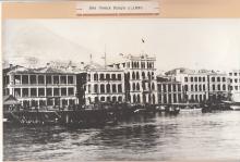
Everything tagged: Ferry pier

Photos tagged: Ferry pier

c.1890
1902
1904

Pages tagged: Ferry pier

Tung On / Tai Hing / Tai Yip Wharf [c.1924-c.1957]

Submitted by Klaus on Sun, 10/29/2023 - 00:04

Pier on Connaught Road opposite Hillier Street. Likely named after TUNG ON STEAMSHIP COMPANY, LIMITED

The HK Company Directory refers for this company:

Date of Incorporation: 07-OCT-1926  - Date of Dissolution: 23-DEC-1949

The pier is visible on an aerial photograph from 1924, and latest on the 1955 map The name changed to Tai Hing Wharf, and in 1951 to Tai Yip Wharf (see comments below).

Sham Shui Po Ferry Pier (1st generation) [c.1917-1931]

Submitted by Klaus on Thu, 06/01/2023 - 22:11

The first Sham Shui Po Ferry Pier was located at Nam Cheong Street

The area was reclaimed during the mid-1910s, so the pier could have been built in 1917 (guessed only). It was made of wood. It could be the one shown on the 1920 map on Gwulo.

Sham refers: In January 1919, the Kau Lung Sze Yeuk Kai Fong Ferry Company Limited, the first licenced ferry company, started to operate three ferry routes, ..... West Point (Eastern Street) and Sham Shui Po (Nam Cheong Street).

Hung Hom Ferry Piers – A Timeline

Submitted by Klaus on Fri, 11/26/2021 - 02:25

Currently, a lot of comments are posted on Gwulo regarding the ferry piers in Hung Hom. Many of these are by simtang who was able to reveal the timeline of the different piers. I thought it would be valuable to collect all comments and create a summary of the development. This might not be fully correct, so any comments are welcome.


Temporary Hung Hom Ferry Pier [1988-1991]

Submitted by Klaus on Fri, 11/26/2021 - 00:37

Hung Hom Bay was reclaimed in two steps, the first ended in July 1989, the second one finally in December 1994. During the first phase, the 1979 Hung Hom Pier had to be demolished (done at the end of 1988), a new pier was planned and finally finished by November 1990. 

For the intermediate period, a temporary pier was built. This pier was situated on a small piece of reclaimed land near Hung Hom Bay Centre off todays Hung Hom South Road, a pontoon was moored to the shelter/waiting rooms for boarding.

Silvermine Bay Jetty [1951-1963]

Submitted by Klaus on Fri, 04/30/2021 - 22:48

The name can be found on the 1957 map on hkmaps.hk.

Public Works Report for 1951 refers:

In the spring a 400-foot Government pier was constructed at Silver Mine Bay on Lantao Island, this improvement being primarily responsible for the noticeable increase in holiday traffic on this run. It is expected that the comparative ease of travel between Hong Kong and the eastern end of Lantao Island will induce more people to settle in this beautiful part of the Colony. 

Ping On Wharf [c.1924-c.1958]

Submitted by Klaus on Fri, 02/26/2021 - 21:32

Pier located at Connaught Road opposite the block between Morrison and Cleverly Streets. It was built later compared to its neighbors, it appears first on the 1924 aerial photograph on hkmaps.hk. This pier is at the place where the Hong Kong Macau Ferry Wharf (third generation) [c.1959-c.1985] was built on reclaimed land, so it was demolished approximately in 1958.