Currently, a lot of comments are posted on Gwulo regarding the ferry piers in Hung Hom. Many of these are by simtang who was able to reveal the timeline of the different piers. I thought it would be valuable to collect all comments and create a summary of the development. This might not be fully correct, so any comments are welcome.
Sometimes aerial photographs, especially when piers are of interest, help a lot in detecting developments. This will be done in this post. The vertical aerial photos are all from the Hong Kong Map Service.
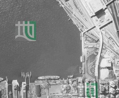
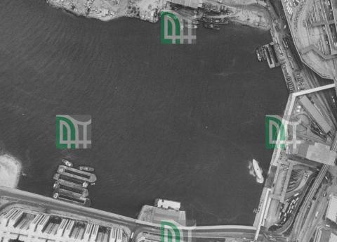
Let’ start about 120 years ago. The first pier (Hung Hom Ferry Pier (1st generation?) [c.1903-c.1963]) was situated at the end of Gillies Avenue. Here’s an aerial photo from January 1963, the pier is “at 7 o’clock”
Reclamation had started already, the new seawall can be seen on the left side. The first pier was likely decommissioned in late 1963/early 1964.
The hong kong annual report for 1963 refers:
The Hongkong and Yaumati Ferry Company Ltd operates a fleet of 62 diesel-engined ferries. During the year four cross-harbour services were added bringing to 11 the total number.
These new services are the Wan Chai/Hung Hom, North Point/Hung Hom, North Point/Kowloon City and North Point/ Kwun Tong services. A Jubilee Street/Hung Hom service was operated by the company before the war but it was not until September 1963 when a seawall was built that the company resumed operations from Hung Hom. The North Point/Hung Hom passenger service commenced on 1st September.
So two new piers opened in the second half of 1963:
Former Hung Hom Ferry Pier (1979) for Hung Hom / North Point service
Former Hung Hom Ferry Pier (1979) for Hung Hom / Wanchai service
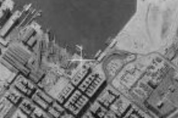
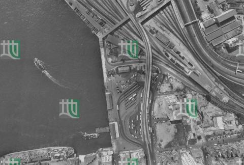
The next aerial photo is from 1964 (only low resolution) where the two piers can be seen:
Let's move to the Hong Kong annual report for 1965:
The Star Ferry Company Limited is authorized by ordinance to run passenger ferry services across the harbour between Victoria City on Hong Kong Island and Tsim Sha Tsui on the southern tip of the Kowloon peninsula, and also between Victoria and Hung Hom on the eastern side of the peninsula. This latter service was introduced in June 1965.
This is the Former Hung Hom Ferry Pier for Hung Hom / Central service
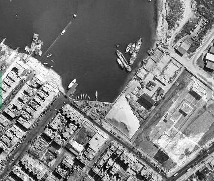
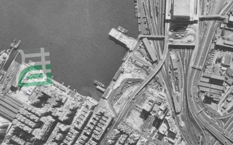
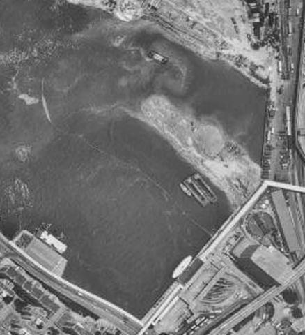
All three piers can be seen on the aerial photo from 1967:
Fortunately, double-ended Star ferry boats are easy to distinguish from boats of other companies. So a Star Ferry and a YMT ferry are at their designated piers.
Simtang reported that the Hung Hom/Victoria(Central ) service ended in 1967. The pier building was demolished later (likely in 1972), on the 1973 aerial photo it’s gone, a road at this place was built later in this year.
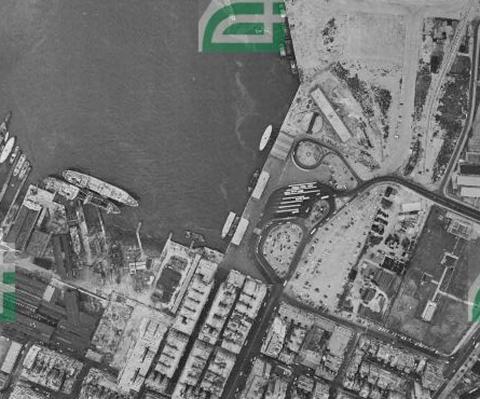
On 30 November1975, the service was resumed (HK Report for 1975). It looks as if a Star Ferry is at the Hung Hom/Wanchai pier, see aerial photo from 1 December 1975:
Simtang refers: the pier was for the Wanchai line (1963-1976), and then for the Central line (1976-1988).
In 1975/76, the North Point Pier was rebuilt and equipped with a jetty to accommodate two ferries at a time.
Simtang refers: the pier was for north point line (1963-1976), and then for north point and Wanchai lines after some reconstruction (1976-1979).
and
Initially the line [Star Ferry] would share the Hunghom pier which serviced Wanchai. YMT Ferry company would expand the Hunghom-North Point pier to accommodate both the Hunghom-North Point line and Hunghom-Wanchai line. In January 1976, the expansion had finished and the Hunghom-Central line would have exclusive use of the Wanchai pier.
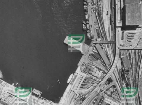
At the end of 1978, a new pier was built near the (demolished) Hung Hom/Central one, see the aerial photo from 7 December 1978.
This is the Hung Hom ferry pier to Wanchai & North Point. Therefore the old pier (North Point and Wanchai lines) was decommissioned and demolished later.
Star Ferry further used the pier which originally served the Hung Hom/Wanchai ferry line, see the aerial photo from 1985.
The 1979 Wanchai & North Point pier was demolished at the end of 1988, the services were transferred to the Temporary Hung Hom Ferry Pier opposite Hunghom Bay Center. The pier was situated on a small piece of reclaimed land off todays Hung Hom South Road, a pontoon was moored to the shelter/waiting rooms for boarding. This is the situation visible on the aerial photo from 3 February 1989:
It looks as if Star Ferry still used their old pier at this time. There is a later aerial photo from the 16 August 1989 where it looks as if Star Ferry is still using their old pier. Probably they utilized this pier until the very last moment before the reclamation project reached their place and moved then to the temporary pier.
Addendum 2021-11-26: on an aerial photo from 3 December 1990 (only low resolution), it looks as if there is a Star ferry at their old pier. Therefore it's possible that Star Ferry never used the temporary pier; only three months to go until the new (current) pier opened in March 1991.
The temporary pier was in use until the new pier at the Hung Hom Promenade opened which is Hung Hom Ferry Pier (Now)
Work finished in November 1990, services at the new pier started in March 1991.
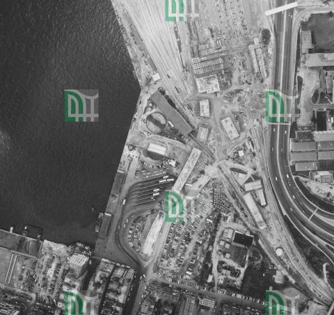
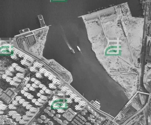
Below is an aerial photo from November 1990. Current Hung Hom Pier is completed, but not yet in use. Temporary ferry pier still active - one ferry leaving, another approaching.
The current pier has two berths:
east berth operated by New World First Ferry to North Point
west berth operated by Star Ferry to Central (service ended 2011- 03-31)
This is likely the last generation of Hung Hom piers, don’t think new ferry piers will be necessary in the future due to the MTR network.
