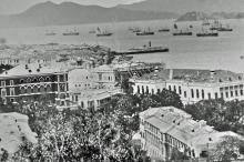
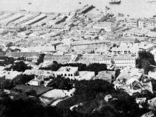
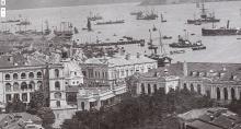
Pier at DesVoeux Road opposite Gilmann Street and M.L. 54. It was used for river steamers to Canton.
Appears on a map from 1888 (on hkmaps.hk). There are two piers with the same label; this one and the Hong Kong Macau Ferry Wharf (first generation) [c.1870-c.1897]. Both piers were operated by the Hongkong, Canton & Macau Steamboat Company (Davies).
The ownership of this pier possibly changed over time. There is a government notification from 1893 where people/companies are listed to whom a compensation should be paid for the loss of piers because of reclamation. The money for the pier opposite ML 22 (Hong Kong Macau Ferry Wharf (first generation)) goes to "Canton and Macao steam-boat Co.", and for the pier opposite ML 54 to "China Steam Navigation Co". These companies are unknown to me, therefore I asked Stephen Kentwell for advice.
He was surprised to find errors in government notifications. The owner of the first pier (ML 22) was obvious HongKong Canton & Macao Steamboat Co. (HCMSC ), but the second one isn't clear at a first glance. What would fit is China Merchants Steam Navigation Co., but this company wasn't too active in the steamboat service. What fits better is China Navigation Company (CNC). He explained further that CNC and HCMSC were partners in the service to Canton (see here). As there was a joint service between HCMSB and CNC, ships of either company would use either wharf. Most of the passengers would not have been aware of any distinction between CNC and HCMSB ships.
The pier was about 50 m long, the date of erection is unknown (it was wildly guessed to 1875). It was built sometime after the end of the first reclamation (1860), possibly a smaller pier pier was used which appears on the 1859 map on hkmaps.hk. Because of the next step of reclamation, the pier was closed in the mid to end of the 1890s. The 1903 map on hkmaps.hk indicates that the pier was extended after/during reclamation to become the second generation pier, what happened to the enclosed part is unclear. Likely removed, otherwise the stability of the ground (now used for buildings or streets) would not be high enough.
Couldn't find any information about a second generation pier. A pier was built near the old one at the new praya, but I don't know when and by whom. This pier appears on an 1924 aerial map, it is named on e.g. the 1945 map as Osaka Shosen Kaisha (O.S.K.) Wharf. This company is active in Hong Kong since 1899, so they could have used that pier from the beginning.


