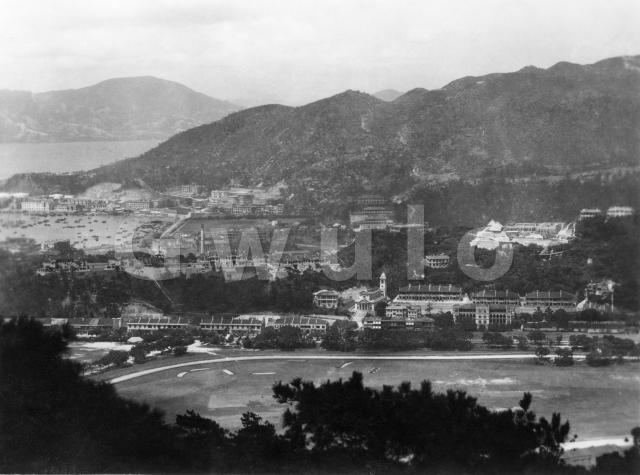
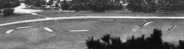
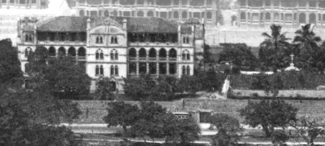
Where: That's easy, with the Happy Valley racecourse clear to see above the trees in the foreground. At this time the centre of the racecourse was shared among several sports clubs, including the golf club. Those light-coloured shapes are the bunkers on the golf course.
When: Fortunately in old Hong Kong photos there is usually some building being either built or demolished, that can help us pin down the date the photo was taken. I can see two large construction sites in this photo, so we shouldn't have too much trouble.
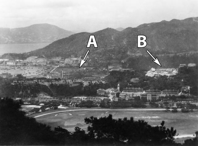
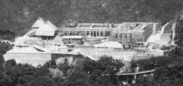
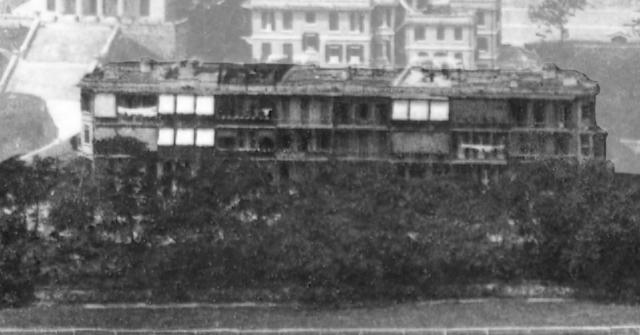
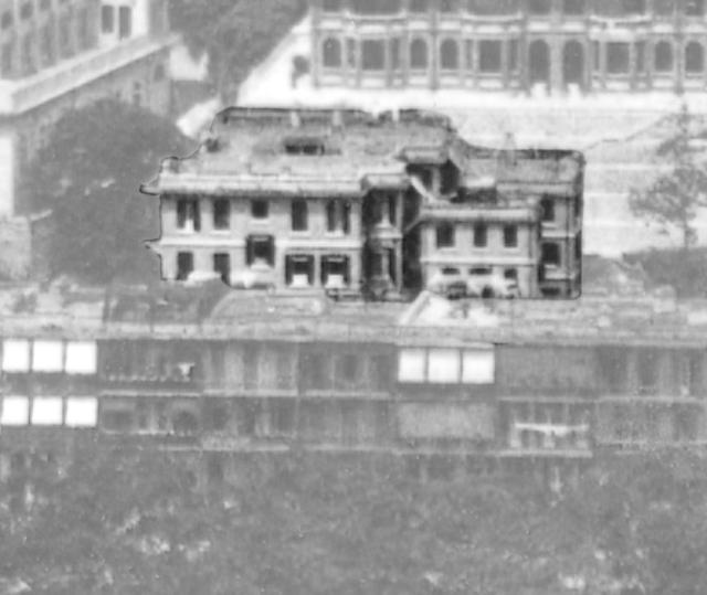
Here's a closer look at site A.
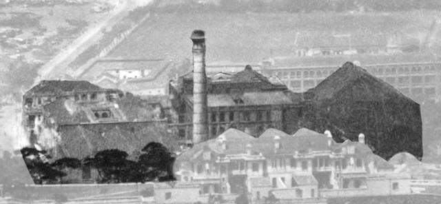
The pitched roof on the right is the roof of a large, temporary shelter, used to protect a building site from the weather.
The chimney in the centre suggests we're looking at an industrial site. The chimney is marked on this 1901 map (see the small square below the word 'MILL').

The map confirms that in 1901 the site was industrial, home to the Cotton Mills of the Hongkong Cotton-Spinning, Weaving, and Dyeing Company, Ltd.
However there had been big changes by the time our photo was taken. The mills weren't a success, and closed down after just over ten years of operation. Coincidentally, the Sisters of St Paul de Chartres had run out of room at their original site on the seafront in Wanchai and were looking for larger premises. They bought the empty Cotton Mills, moving there from Wanchai in 1915, and began converting the site into the St Paul's convent, school, and hospital that we see today.
The sisters didn't only re-use the old mill buildings. When this photo was taken they were adding something of their own to the site: the building taking shape under the temporary shelter was their new Christ the King Chapel.
The Public Works Department's (PWD's) annual reports say that work on the chapel began in 1928, and finished in 1929. The chapel wasn't officially opened until May 1930, but if the building work was completed in 1929 I think the shelter would have been taken down around that time too. That makes me think the photo was taken in 1929, but let's see what site B has to tell us.
It also appears in the PWD's reports, described as 'A large Chinese family mansion', at 6 Broadwood Road. The reports keep us updated on progress:
- 1927: Site formation and retaining walls in progress
- 1928: Nearing completion. (Though perhaps a bit optimistic, as ...)
- 1929: Almost completed.
- 1930: Works completed.
I'll stick with 1929, though I wouldn't argue with a late-1928 date. If you spot any other clues to date the photo, please let us know in the comments below.
Who: Civil servants, each housed at an elevation befitting their rank!
There were several groups of government houses in this area.
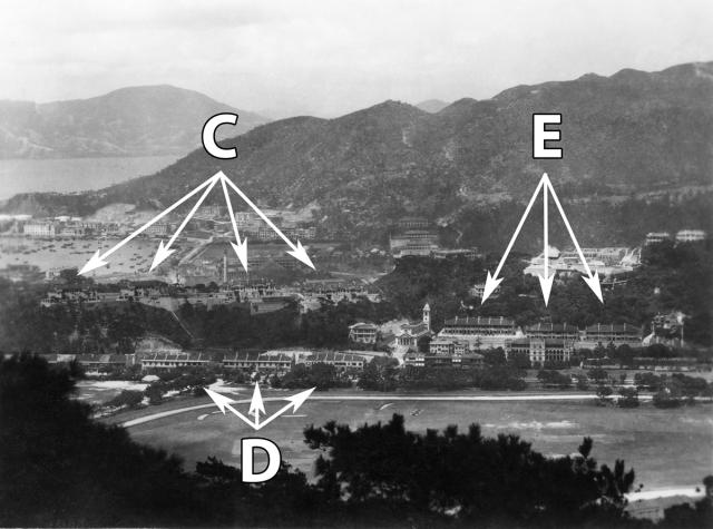
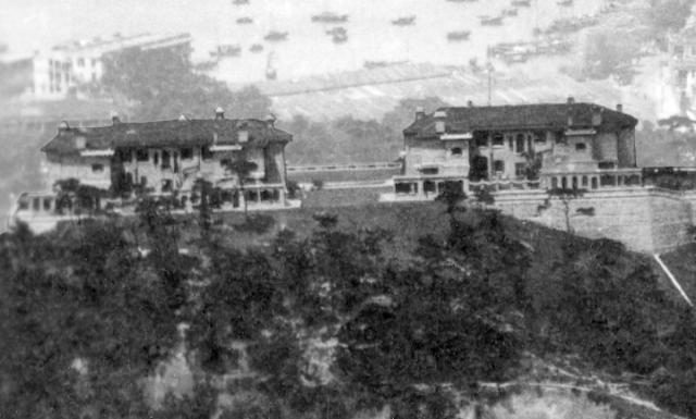
C points to the Quarters for European Officers, standing at the top of Leighton Hill. They were built in two phases, first these two blocks of four houses each on the right (south), finished in 1921.
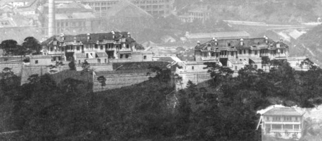
Then another two blocks, but of three houses each, built on the left (north) and finished in 1923. All four blocks were destroyed in the fighting in December 1941.
The stereotype of life in the civil service is a strong sense of your place in the hierarchy, so it's no surprise to find that the buildings D at the bottom of the hill are Quarters for Subordinate Officers. These were also built in phases, with the block of six houses on the right (south) finished in 1916, and the two blocks of six houses to the left (north) finished in 1921.
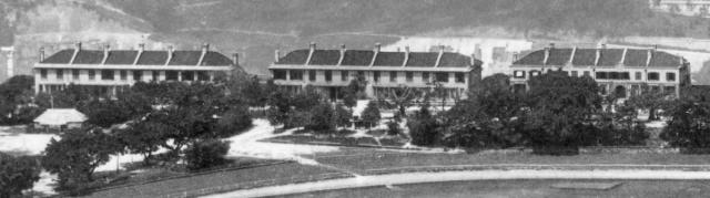
Then how about the residents of buildings E, the Ventris Road Government Quarters? These houses were half way between the levels of buildings D and C, so were they a stepping stone for officers who were heading up the career ladder?!
Once again they were built in phases, first the two blocks on the lower level, then the block on the upper level. All were completed by the end of 1927, making them the newest of the bunch.
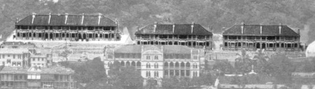
What: Several other buildings are worth a look. We'll start off with a walk along Wong Nai Chung Road. Heading to the right of government quarters on Wong Nai Chung Road, we cross the junction with Broadwood Road and come to this terrace of houses. [Update: identified as Broadwood Terrace.]
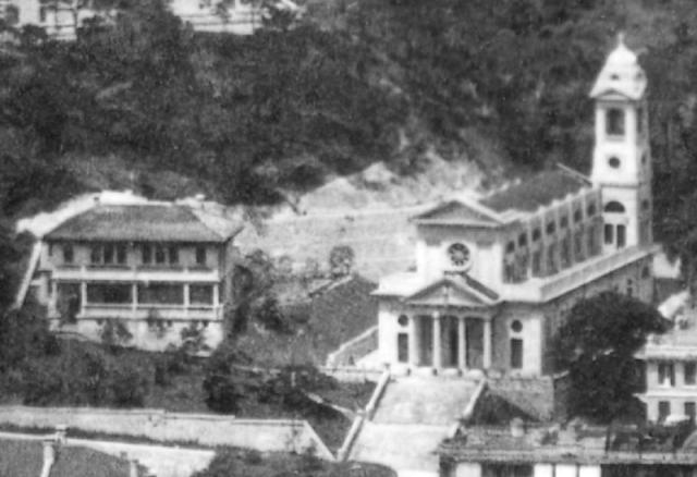
Next to the terrace we see the site of the Sisters' earlier expansion out of Wanchai, Le Calvaire. It opened in 1908 as their orphanage, but now houses the St Paul's Primary Catholic School.
On the right there's a small dome with a cross on top - does anyone know what it was? And I think I can see a vehicle below the right edge of the building, just heading behind the trees. Maybe a bus or a tram?
Now walk back to the junction, turn into Broadwood Road and start walking uphill. On your right side, between the terrace and Ventris Road, you'll pass the three houses 1, 2, and 3 Broadwood Road.
While over on the left of the road are St Margaret's Church and its presbytery.
Continue climbing the hill until you reach the brow, then follow Broadwood Road around to the right, where it curves in front of this house, number 4.
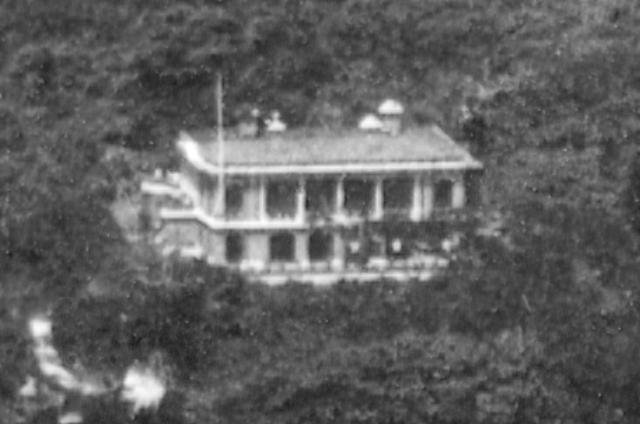
Number 5 is on a large plot of land at the top of the slope.
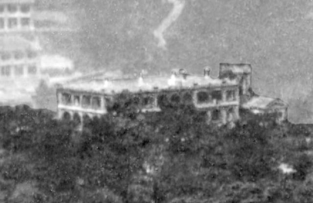
And as we've already seen, number 6 is under construction.
I've linked all the buildings to their pages on Gwulo, so you can click through to see any additional information and photos we have for them. If you can add any memories or other details, please leave a comment on their page. And of course, any extra photos you can add of these buildings are also very welcome (here's how to upload a photo to the site).
Gwulo photo ID: A745
Trivia: This is a small photo (4 x 3" or 10 x 7cm) I bought on eBay earlier this year. In general the smaller the print the less detail there is, so buying a small print on eBay is a bit of a gamble, as I can't check it with my magnifying glass like I would at a postcard fair. Happily, the Gods of Ephemera were on my side, and it turned out well.
Further reading: For an older view of Happy Valley, see Photo 13 in Volume 4 of my books.
Comments
Excellent Photo
Excellent photo purchased.
Judging by the position of the boats in Causeway Bay Typhoon Shelter, I have the impression that the photo below is a companion photo and was taken by the same photographer.
Thank you, every time I pass…
Thank you, every time I pass by "Christ the King Chapel" just wonder what is behind the street naming of "Cotton Path". Now I know! Thanks alot.
re: Excellent Photo
Thanks Moddsey, and well done for spotting the link.
After reading your comment I'd hoped the two photos would combine to make a panorama, but though I agree they were both taken at the same time, unfortunately the photographer took the two photos from different locations (see how the alignment of the old cotton mills' chimney against Causeway Road is different in the two photos).