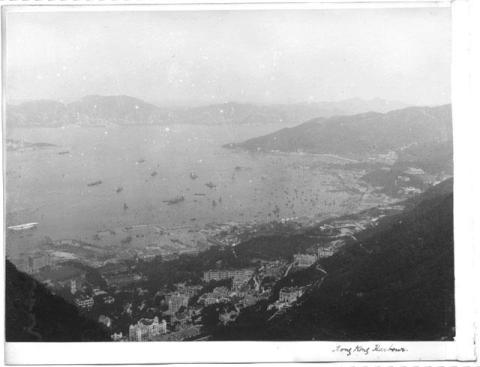
We first looked at this photo a few weeks ago (see the newsletter for 20th August).
That time I concentrated on the area around the Naval Yard Extension project, which helped us date the photo to early 1904.
Today we'll take a closer look at the right of the photo, running from eastern mid-levels, through Wanchai, and ending at Causeway Bay.
|
Gwulo meetup: If you're free on Tuesday, 10th October, please join us for lunch. |
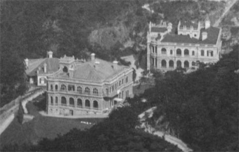
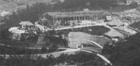
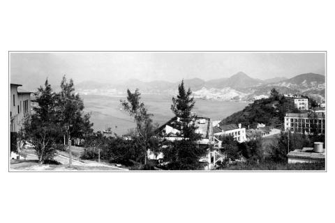
Here are those two houses in the foreground.
I'm not sure what the lower building was. Looking at the 1909 map, it may have been "The Grove". Can anyone confirm?
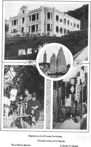
The higher building is a match for the building in the photo below, previously identified as Braeside on the hillside above Macdonnell Road.
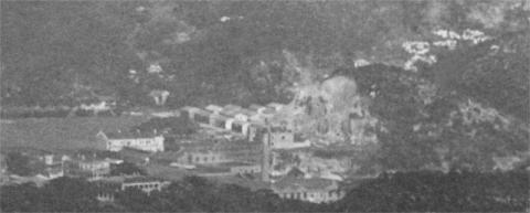
Look up from those two houses, to see a large construction project underway.
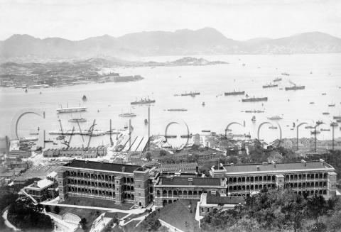
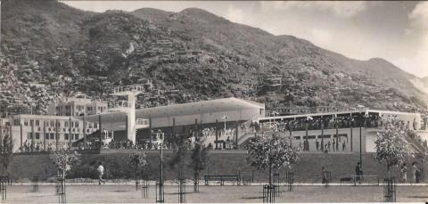
While the Navy were building their dockyard the Army were busy too, building the new British Military Hospital. By 1904 the left wing is furthest advanced, at about one storey high. There was still a lot of work to do though, so the hospital wasn't opened until 1907. Here's how it looked when it was all finished.
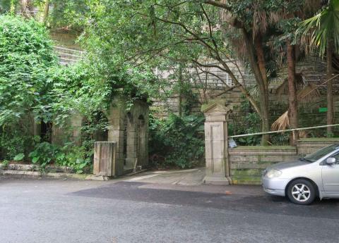
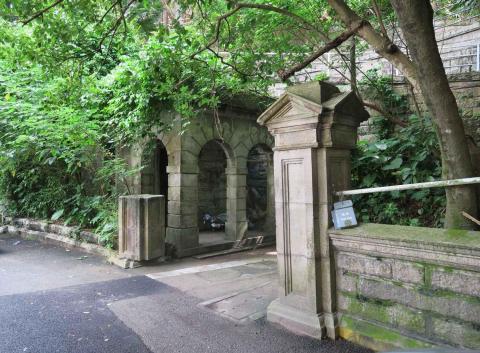
Looking at the older photo again, there are a couple of roads at the bottom of the view. Bowen Road runs across the photo, while Borrett Road leads down and away to the left. Just above the junction of the two roads is the entrance to the Hospital's grounds, marked by two large gateposts.
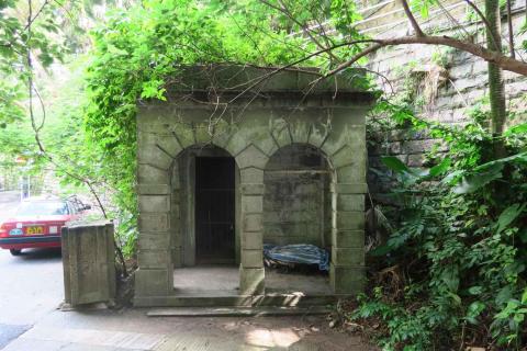
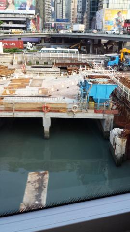
I walked past there on Friday, and took the photos below. You'll see that one and a half of the gateposts are still standing, and that they've acquired a small gatehouse building at some point.
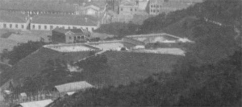
Looking beyond the hospital site, the next spur has three, square-shaped areas.
We can see reflections, showing that they held water. They were the Bowen Road Filter Beds, part of Hong Kong's drinking water supply. Their job was to take water from the aqueduct that ran along Bowen Road, and filter impurities from that water before it carried on downhill to the buildings below.
|
Gwulo book update: I've received the cover layout back from the designer, in two different versions.Which one do you prefer, the red or the blue? |
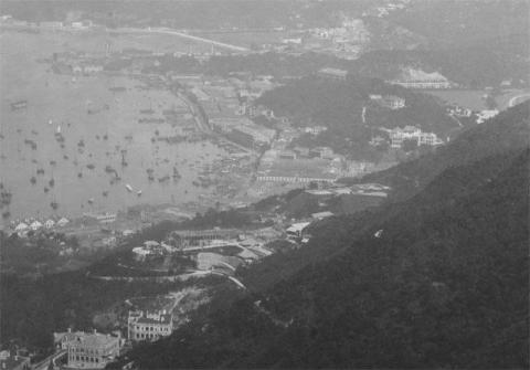
Before heading further into the distance, look left from the hospital to see the Wanchai seafront.
I've added the street numbers of the buildings, eg the four white buildings at the left were numbers 1-4, Praya East, more commonly known as the Blue Buildings. For more information about them and the other buildings along the Praya, I recommend an article from earlier in the year that looks at them in detail: Wanchai's seafront in 1902
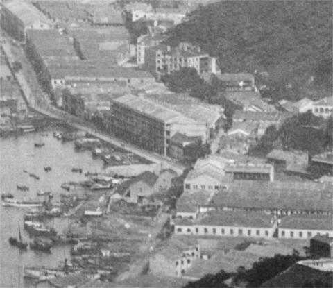
Here's the next section of the seafront.
The road running along the seafront is still Praya East. You can see it runs up from the bottom of the photo, then turns off to the left at a junction. There are a few interesting items around that junction.
Looking towards 7 o'clock from the junction, there are a couple of buildings on the sea side of the road. I believe they belong to Ah King's shipyard.
In the 10 o'clock direction, the Praya turns off to the left, then a bit further along it turns back to the right. Today this is the section of Johnston Road that runs from the junction with Wanchai road to the junction with Hennessy Road.
At 11 o'clock from the junction is a low building behind some trees. That was the Number 2 Police Station, Wanchai's police station for many years.
Finally at 1 o'clock we see Wanchai Road continue into the distance, skirting around the base of a large hill.
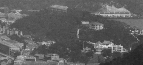
Heres a better view of that hill, Morrison Hill.
Down in the right foreground is another military hospital, the Royal Naval Hospital. Did Hong Kong really need two military hospitals?
There were large numbers of British troops and sailors in Hong Kong at this time. And Hong Kong was an unhealthy place to be, which kept the hospitals busy. But aside from any rational arguments, this was the time when the Navy and Army were still very proud and separate, so it would have been very unlikely to see them sharing a hospital.
Just behind the hospital I can see a couple of high roofs that look like the matshed roofs that were erected over building sites. Perhaps the sight of the new Army hospital under construction encouraged the Navy to make some upgrades to their own hospital buildings.
Above the hospital, about half-way up the slope, is a building that I think must have been built not long before this photo was taken. Looking through the maps at the Hong Kong Historic Maps website, there's no sign of it on a detailed map of the area from 1901, but it is shown on a 1913 map, marked "European House".
The 1901 map does show the buildings at the top of the hill though. They're shown as a terrace of four buildings, with address 1-4, Morrison Hill. The Morrison Education Society had built a school on the hill in the 1840s, but I'm not sure if the building seen in this photo kept any part of the old school building.
On the right of the hlll is the flat land of the recreation ground, with a terrace of houses in the background at the base of Leighton Hill.
We can see over Leighton Hill to get a glimpse of the buildings on the other side.
The chimney in the centre foreground marks the site of the old cotton mills, where St Paul's school and hospital stand today. Above and left of the chimney are a group of buildings built to a standad design. They look to be built on that grid of streets in Tai Hang, behind Tung Lo Wan Road.
Above and left of the chimney is a hillside being quarried away. Has that hill been completely removed or does some of it remain today?
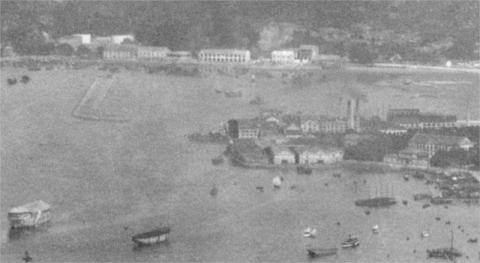
For the last zoom, here's the top-left corner showing the area around Causeway Bay.
The Navy make their last appearance with one of their hulks at bottom left. And is that another, smaller hulk slightly to its right?
The centre of the photo shows East Point, then an industrial area with several chimneys belching smoke. Beyond that is the old Causeway Bay Typhoon Shelter, today's Victoria Park.
|
New on Gwulo this week...
If you can leave a comment with any more information about these, it will be gratefully received. Some of the new photos added this week:
Click to see all recently added photos. |


Comments
The building on the seaward
The building on the seaward side of the Praya near the No 2 Police Station that has been marked as Ah King's Shipyard is actually the new Public Works Department store that replaced Crosby Store near Theatre Lane in Central. The new store was completed in early 1900. Here it is on the 1901 map:
From the 1899 PWD Report:
36. Public Works Extraordinary
(ii.) Public Works Department Store: - The various buildings comprised under this heading are being erected in the eastern section of Wanchai Store-yard. They consist of a large two storey building, a series of low sheds, roofed in and open along the front, and quarters for an overseer. The whole of the works are nearing completion.
23. The Public Works Department Store at Wanchai was completed early in the year, the total cost being; $17,843.96. To it all the stores previously kept at Crosby Store and the rented building on Praya East were removed and then properly arranged and catalogued. The Storekeeper lives in the quarters built on the premises, and the work has proved a great success in every way, except that already more room is required.
The Store lasted until the reclamation of the 1920s, later being relocated to a spot on Lockhart Road and between the Royal Naval Hospital and the remains of Morrison Hill.
Public Works Department Store
Thanks for the correction and extra information. I've made a page for the PWD store at https://gwulo.com/node/39043