Here's the photo I mentioned last week:

It's a large print, so there's lots of detail to see. For an example, look at the red square above, then look at that section enlarged below. It shows a couple of launches tied up at the end of the Commissariat pier.

The photo is showing its age, with lots of dots and blotches. Some time spent with Photoshop helped make things clearer.

It'll take a while to clean the whole photo, so I'll work on it section by section. I've started with the area around the pier.

It shows a large reclamation and construction project was underway. I chose to start on this area hoping that it will help tell us the date the photo was taken.
The construction project was called the Naval Yard Extension, and the extent of the new land is shown on this map from 1905.

It shows how limited the Royal Navy's shore facilities were at the time, just the small area north of Queens Road (today's Queensway) marked "Naval Yard". The reclamation would give the Navy much more land for workshops, stores, etc., and also give them two new water facilities, a dry dock and a tidal basin.
1. Dry Dock / Graving Dock
The dry dock, more properly known as a graving dock, could be drained of water to allow access to the parts of a ship that are normally under water. Up til this time, the Navy had to rely on the privately owned dry docks around Hong Kong if their ships needed repairs. This project would give them their own dry dock at last.

Back to the main photo, and we can see how far along they are with the construction. They've built a temporary wall or "cofferdam" around the site, pumped out all the seawater, excavated the sea bed and started building the base of the dry dock.

2. Tidal Basin
The map shows the tidal basin was a large, sheltered area of water where ships could moor. The photo shows them building the broad barrier across the front of the basin. First they'd built the outer wall on the side facing the harbour, and that looks about complete. Next they're building the inner wall, and we can see a crane on a barge is lowering the next large granite block into place.

When both walls were finished, the middle was filled in to form the barrier. Here's a view of the finished barrier and basin.

3. Camber / Boat Pool
The 1905 map shows a third, smaller water facility on the eastern side of the site. Maps of the completed Dockyard Extension label it as the Camber, and show it it belonged to the Army Service Corps (ASC), not the Navy.

The Camber was the descendant of the Commissariat pier we saw earlier. The Commissariat was the organisation responsible for delivering supplies to the Army, hence the need for a pier to receive deliveries from the ships in the harbour. The reclamation put the pier out of use, so they got the Camber as the replacement. Though the Commissariat name was still used on the 1905 map, the organisation had disappeared in the 1880s, when its role was absorbed into the new ASC.
At some point the ASC moved away from here, as in the 1950s we find the RASC (The "Royal" successors to the ASC) based at Sham Shui Po. The Navy took over the Camber, renamed it to the Boat Pool, and used it as the home for their Hong Kong Flotilla. Here's one of the Flotilla's boats that was based there.

How it has changed
This 1952 map shows the Dockyard at its greatest extent.

It didn't last much longer though, as by the end of the 1950s, the bulk of the land was returned to civilian use. The dry dock was filled in, most of the buildings were demolished, and Harcourt Road road was built across the old dockyard site. The Boat Pool lasted a little bit longer, but in the early 1960s it was filled in too.
The tidal basin was the part that lasted the longest, finally filled in shortly before the 1997 handover. The last British military presence in this area was the Army's Prince of Wales Barracks, built over the old dry dock.
Here's how the area looks today.

The Prince of Wales Barracks has been renamed as the Central Barracks, and now houses soldiers from the Peoples Liberation Army. I wonder how many of the soldiers know that their sports pitches are built over an old dry dock?
The filled-in tidal basin became the site of the new cluster of Central Government Buildings, and the old Camber is home to a couple of electric substations.
The date of the photo
Back to the original photo, and the date it was taken. The annual reports of the Public Works Department (PWD) are a good place to look for information about construction projects. As a military project, the Naval Yard Extension didn't get the detailed coverage we see for PWD projects, but the reports usually include a line or two about its progress. Here are the two whose descriptions best match the scene in the photo.
"16. General Remarks.—[At the Naval Yard Extension] the sea wall and inner-wall or quay forming the pier on the north side of the Basin, a portion of the east wall of the Basin and the Murray Pier Extension and roundhead beyond it were all brought above low-water level, whilst the cofferdam enclosing the site of the graving dock was completed and the water pumped out."
"16. [...] The Naval Yard Extension.
The general reclamation here is approaching completion. The walls of the tidal basin and the sea walls are, in great part, ready for the coping. The dock bottom is nearly completed and the dock walls are well advanced. The reclamation, West of the dock, and the diversion of the Albany Nullah are finished."
The work in the photo isn't as far along as the 1904 report, eg there isn't any sign of the dry dock's walls, which it reported were "well advanced". But the work is further ahead than the 1903 report, with the work on the dock bottom already well underway. I estimate the photo was taken in early 1904 - corrections welcome!
|
New on Gwulo this week...
If you can leave a comment with any more information about these, it will be gratefully received. Some of the new photos added this week: 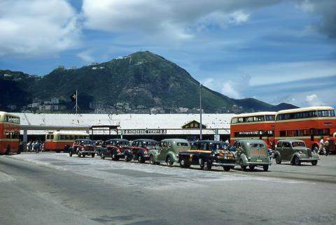

Click to see all recently added photos. |
Comments
1910 Naval Dockyard
The map below shows the division between the Admiralty and War Department.Thus, the Boat Basin came under the War Department.