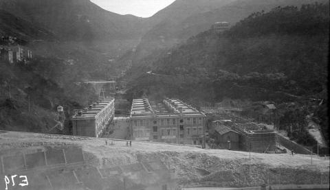
On Warren Swire's fourth visit to Hong Kong, his photos show he'd settled into a predictable routine as far as the places he visited. There was one major change on this visit though. He'd learned a new photographic skill, panning the camera to form panoramic shots like this one, looking up the valley behind the Sugar Refinery:
Taikoo Sugar Refinery
I used the computer to make that panorama from three of his photos. Here's one of the original photos, titled Taikoo Sugar Refinery housing, Hong Kong.
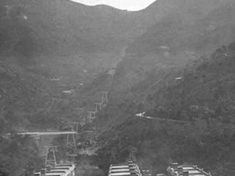
At first glance it just shows a row of houses, but that faint line running up the hillside caught my eye. It shows us the pylons that carried the cable car up to the Sanatorium in the gap at the top of the photo. Here's a closer view:
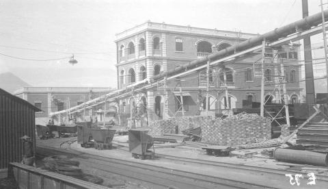
After a few photos of the housing, it was down to business and into the sugar refinery itself. This first photo captures several side-tipping trucks, that could be pushed around the refinery on the rails that were laid throughout the site.
Here the trucks would be used to move the raw materials that were used in sugar refining, but when I've seen these trucks in other Hong Kong photos, they were used to move earth around at construction sites.
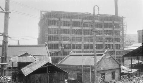
Coincidentally, the refinery site was also a construction site during Swire's visit. We can see large stacks of bricks in the photo above, to the right of the trucks. Other photos show the likely destination for those bricks, a large building under construction, and still surrounded by bamboo scaffolding:
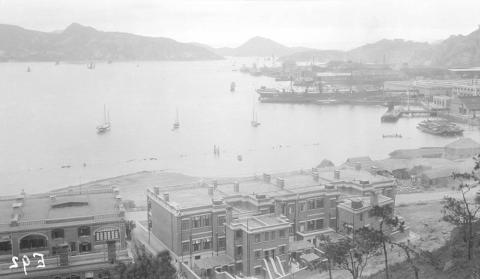
He took several photos from a high vantage point, which makes me think he went to a high floor or even the roof of that new building. Here he's looking out over the Taikoo Dockyard towards Lei Yue Mun pass, the eastern entrance to Hong Kong's harbour:
Then he moves to the other side of the building, and captures the view to the northwest
That photo shows several accommodation buildings for refinery staff in the distance, at the foot of the hill. But I think he was more interested in the shoreline where new land was being reclaimed, as he climbed the hill to take this view of the reclamation from above:
And just to be sure, took a close-up view (panorama, of course!) of the newly reclaimed land:
These were some of Hong Kong's largest construction projects at the time, and were mentioned in the Annual Report for the Public Works Department in 1924. The reclamation was mentioned first: 33,600 square feet of new land, described as "Q.B.M.L. 1, (additions to) Quarry Bay (in progress)". The "Q.B.M.L. 1" referred to the existing piece of land where the refinery stood, and is the short form for "Quarry Bay Marine Lot number 1".
Later in the report it described the building work underway:
At Q.B.M.L. No. 1, Quarry Bay, the building of the undermentioned was in progress
- Godown (in two sections),
- Rebuilding of the main Power House,
- Reinforced C. C. Coal Silo,
- Godown for storage of Raw Sugar.
Given their size, it isn't surprising that Warren took so much effort to document them.
Kimberley Road
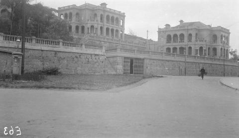
He also paid a return to visit to these houses in Kowloon:
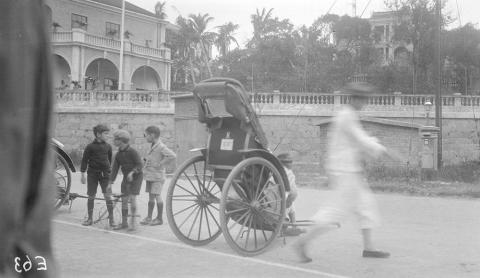
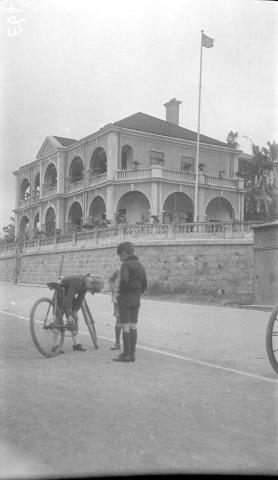
Though they're captioned "Mansions in Holts Wharf", we saw a similar photo in the set he took on his previous visit to Hong Kong, and identified the location as the area near the junction of Austin Avenue and Kimberley Road. The triangle of open land in the photo above can still be seen on modern maps of the area. Further confirmation comes from the second photo, as it shows the Observatory's building at the top of the slope.
Though the photos were't taken at Holt's Wharf, there was a close connection due to the houses' residents – this was where the Holt's Wharf manager lived. I wonder if these were some of his children?
Tai Mo Shan
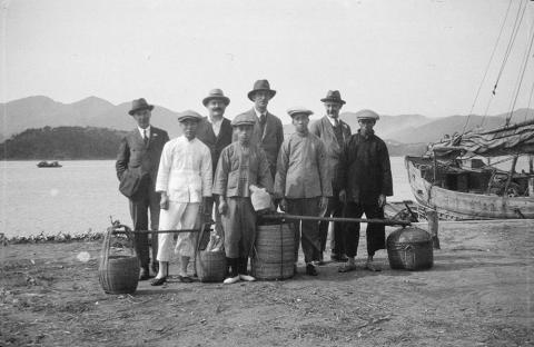
Finally Swire branches out to show us new scenes from a couple of outings to the New Territories. The first one started with a trip by boat to the foot of Tai Mo Shan. They were going walking in the hills, and looking at the baskets they certainly didn't plan to go hungry!
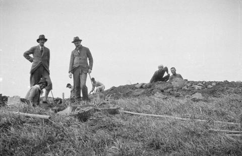
Along the way, they visited what looks like a construction site:
Unfortunately we don't have any record of the outing beyond a note on the negatives, "H K Taimoshan". So we can't tell whether this was some work connected with Swire's business, or just a team of workmen they happened to meet on their walk.
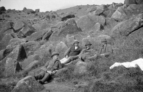
The last of the set shows the walkers resting among a jumble of boulders.
They remind me of the boulders you pass if you walk along section 8 of the Maclehose Trail, between Tai Mo Shan and Lead Mine Pass.
Golf at Fanling
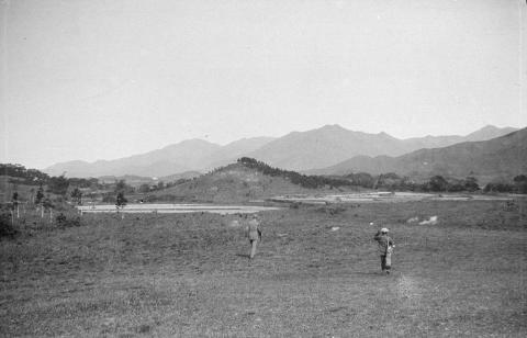
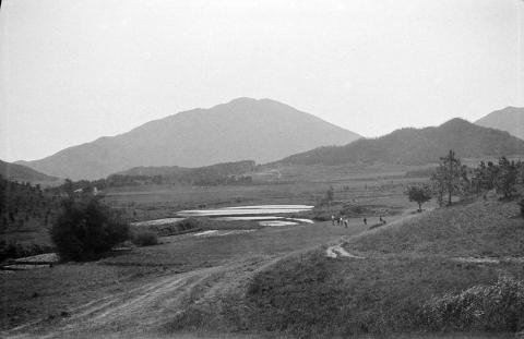
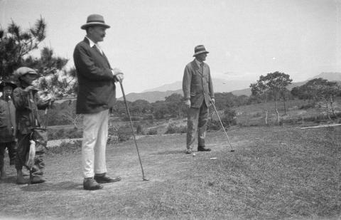
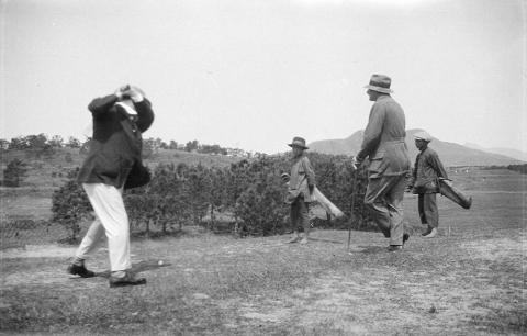
Their other outing was a trip to play golf at the course in Fanling.
These are just a selection of photos from Swire's 1923-4 visit to Hong Kong. You can see photos from his earlier visits here on Gwulo (1906, 1911, 1919, 1928, 1933) and the full collection of his photos online at the Historical Photos of China website.
|
New on Gwulo this week... New posts, pictures & comments:
Readers' questions:
Answers to previous weeks' questions: If you can add any information to the above pages, please go ahead and leave a comment there. |

