Mt Violet Japanese Tunnel [????- ]
- Read more about Mt Violet Japanese Tunnel [????- ]
- 1 comment
- Log in or register to post comments
As the Hiking and Tunnel finding season draws to a close, I went out last weekend for a poke around Mt Violet.
As the Hiking and Tunnel finding season draws to a close, I went out last weekend for a poke around Mt Violet.
In last month's visit to the Braemar Hill AOP, we also took the chance to take a look in the tunnel beneath it.
The tunnel is more complex than the usual 'dig a hole in the hillside'. First they had to make this hole in the AOP's floor:
I went out for a little “Walk-about” this afternoon around Jardine’s Lookout. As I was walking back down towards Parkview I spotted a small trail leading off to the side near the covered Water Reservoir next to the old Anti-Aircraft Battery. The trail went around the side of the hill behind where the BBQ site is for about 40m, along a fairly steep and slippery path. I noticed a big groove cut out of the hill and when I got closer it was clearly a blocked up Japanese tunnel. Where there is one tunnel, there are usually others, so I continued crashing through the undergrowth.
I'd seen this on an earlier hike, but went back on Sunday for another look. It was disappointing in that there was nothing much in the way of a tunnel. Still, it's an unusual layout, in that there is a deep (1.5-2m) square hole, with a short 2m tunnel leading into the hill beside it.
The marker is approximate - if you're walking along the Wilson trail from Kornhill you soon come to a T-junction, andthere's a public toilet there too. The Wilson trail continues right, the Hong Pak Country Trail starts off to the left. Follow the Hong Pak Trail, and a little way along, on the bank up to your right you can see the sharply cut sides of a tunnel entrance.
It's a bit of a scramble up, and the whole entrance is filled with earth.
Nothing very exciting, just a short tunnel that runs straight back into the hillside.
If you're looking on the Countryside Series map, you'll see a small hill marked with '135' height, just to the north of the youth camp. This tunnel is on the south west slope of that hill, just above the footpath that is marked with the solid line (you can also see the path in the satellite view above).
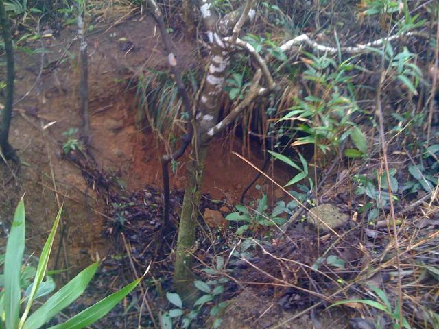
The entrance is where you can see the tree in the middle of this photo:
These are surely the best-known Japanese tunnels in Hong kong. The "Outlying Islands" sheet of the Countryside map series shows the location of one of them, titled 'Cave Kamikaze". That trips off the tongue, but of course it is really a man-made tunnel, not a natural cave.
After tunnel #1, we carried on up the hill looking for more. We found this one near the first peak. I think I have the marker at the right place on the satellite image, but just look for the big rocks in the left of this photo.
Location: 22.265981’N, 114.201143’E