In the last newsletter for 2017 we'll wrap up a photo we've looked at a couple of times before, then flip it over to see if you can help identify an unknown school.
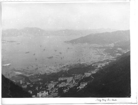
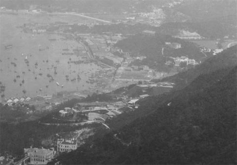
Here's the photo again, a view looking east from the Peak, taken around 1904:
Today I'll start off in the distance.
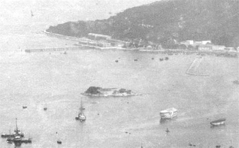
Kellett Island in the centre is an easy landmark to spot.
Looking up at 12 o'clock from the island, we see the shoreline of the area around today's Fortress Hill. Reclamation means the modern shoreline is much further out, but back in 1904 you still saw the original shoreline, which ran roughly along the line of today's Electric Road.
The exception was the reclaimed land at the start of the long pier. Both the pier and the new land belonged to the Dutch Oil Company, a predecessor of today's Shell company.
At 2 o'clock from Kellett island, the hockey stick shape is the wall at the front of the old typhoon shelter, then at 4 o'clock from the island are two hulks - de-masted sailing ships that were moored in harbour. Hulks were typically used for accommodation or storage. Can anyone identify these two?
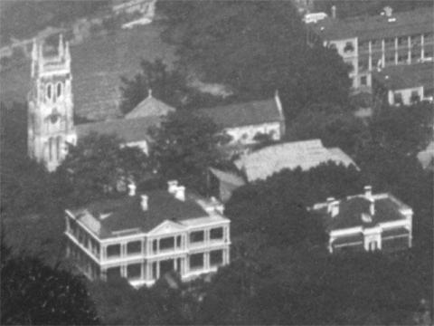
Over at the left edge of the photo, another easy-to-recognise landmark is the tower of St John's Cathedral.
At 2 o'clock from the cathedral we see the edge of the army's Murray Barracks. At 4 o'clock it's the army again, as the light-coloured roof belonged to the Volunteer's headquarters building. At 5 o'clock, the two buildings in the foreground belonged to HSBC, and housed their manager and sub-manager.
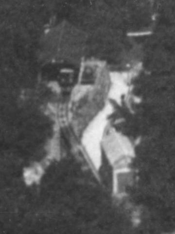
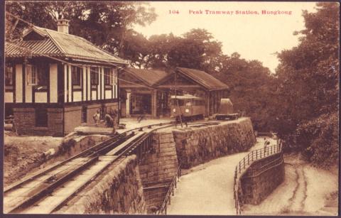
Continuing uphill, we see the lower terminus of the Peak Tram, with a tram at the station.
Follow the tram line from the parked tram, and you'll see a darker section. That marks a bridge, where the tram crosses a bridge over the big nullah that runs past here. My first thought was that the white stripe on this crop showed water rushing down the nullah, but the close-up below shows it was a footpath:
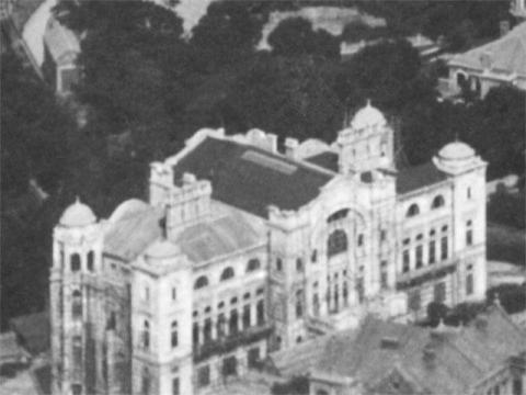
Continuing up the hill again, the grand building in the foreground is Kingsclere.
It is a lighter colour than its neighbours, which makes it stand out. The light colour is often a sign of a new building, as the humid climate means walls quickly get grubby-looking. That, plus the bamboo scaffolding, suggests the building was just being finished off when this photo was taken.
The mystery school
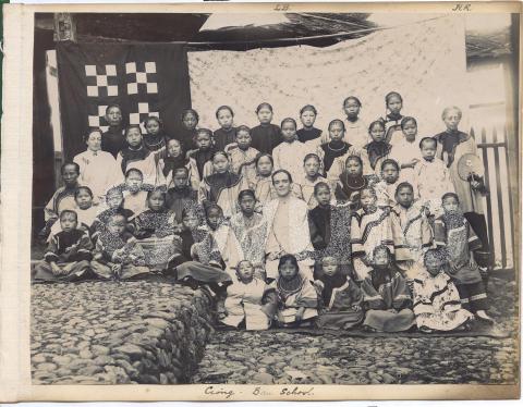
The photo above was bought in an auction. It was originally part of an album, but as is often the case the album had been broken up at some point and the pages sold individually. There's a photo stuck on the other side of the page too:
Here's the title, written in ink at the bottom of the page:
The last word is clearly "School.", but there are several possible interpretations of the other spelling and punctuation:
- Gong Bau School.
- Gorig. Ban School.
- ?
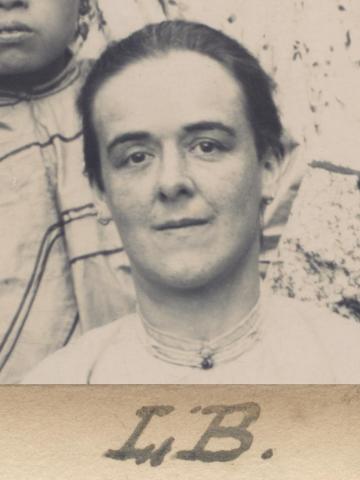
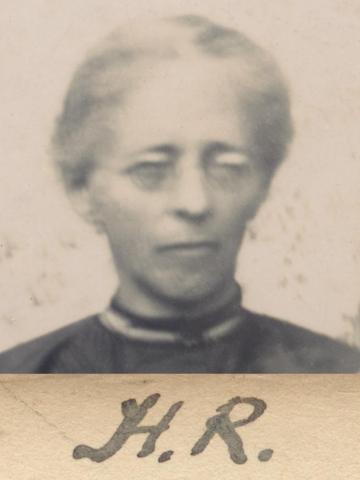
We can see three western women, and a group of Chinese girls & young women. I guess the photo shows the teachers and students at one of the many schools that missionary groups set up in Hong Kong and China.
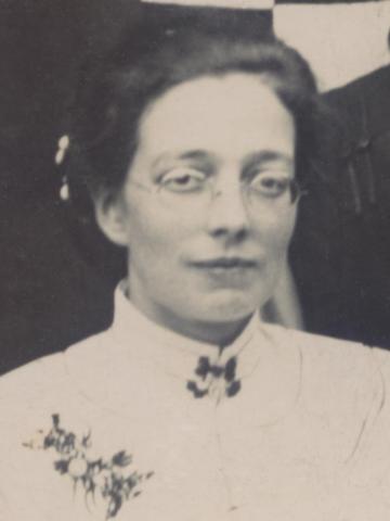
Here are the teachers from left to right. The middle and right teachers have initials written in the margin above their heads.
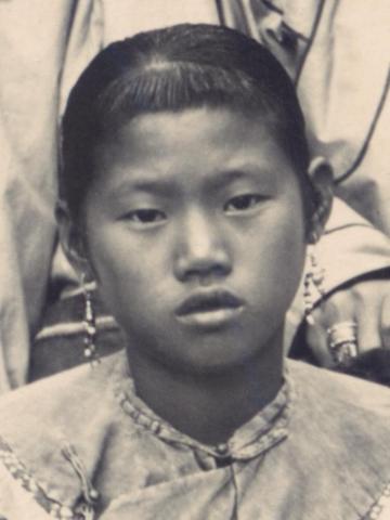
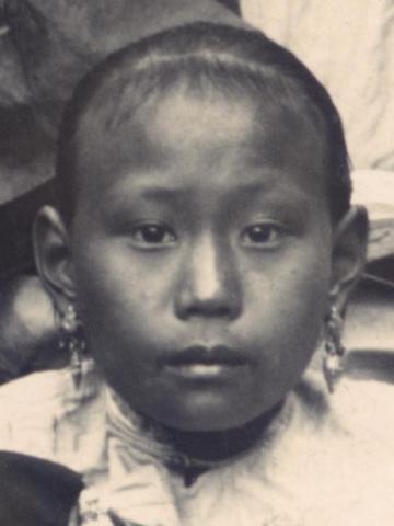
The students look well dressed, and many have their ears pierced and wear earrings. Would that mean this was a paying school, rather than an orphanage school? Here are the three on the left of the centre teacher as we look at the photo:
This photo was likely taken around the same time as the view from the Peak, ie c.1904. (Though they wouldn't have to be exactly the same year, as the Peak photo could have been a stock photo from the photographer's collection.)
Not a lot of clues, but if you have any ideas which school this could be, please let us know in the comments below.
Thank you for reading, and I wish you a happy and healthy 2018.
Regards,
David
Gwulo references: BE002A (school) and BE002B (view east from the Peak)
For more information about the view from the Peak, we've previously looked at the section showing the Navy's land, which suggested the photo was taken in early 1904.
And we also looked at the area around Wanchai and Causeway Bay.
|
Gwulo Book Update: It's been very satisfying to see that people from all around the world are interested in old Hong Kong. Over 40% of orders for the Gwulo book have come from outside Hong Kong, and so far I've mailed copies to Australia, Belgium, Canada, Denmark, Finland, France, Germany, Hong Kong, Ireland, Japan, New Zealand, Norway, Panama, Singapore, South Africa, Switzerland, Taiwan, United Kingdom and the USA! New on Gwulo:
If you can leave a comment with any more information about these, it will be gratefully received.
Some of the new photos added:
Click to see all recently added photos. |



Comments
Ciong Bau School
Thanks to Loretta and Lingo on Facebook, and Axel via email, who've identified the school as the "Ciong Bau" school in Fujian. Loretta also pointed me to page 288 of Frances Slater's book, The Wolfe Sisters, which has more about the school, including a copy of the same photo!
That page identifies the teachers, as Miss Boaz, Miss Bryer, and Miss Rodd.
Ciong Bau School
https://milliganwhitefamilyhistory.ca/2017/03/05/louisa-jane-bryer-missionary-to-china/
https://gwulo.com/node/9138
Ciong Bau ( aka Kiang / Kiong Bau) School, Foochow
The school and the three dear ladies are also listed in the Chronicle & Directories of China, Japan. Corea etc etc.
I found the school and missionaries' names quite easily by searching the full 1905 Directory which may be downloaded online. This is always a good source and starting point when searching for names of foreigners and foreign institutions in China up to the war years.
Ciong Bau location
I'm not sure of the modern name, but A History of the Dublin University Fuh-Kien Mission, 1887-1911 describes Ciong Bau as one of the "neighbouring village stations" near to "Kien-Ning city", which is modern-day Jian'ou. (See Jian'ou in Wikipedia, and on Google maps)