How did Mount Parish get its name? Originally I thought it was from some connection with the Methodist church on the corner of Queen's Rd E and Kennedy Road. But it turned out the church came after the Parish, not the other way around.
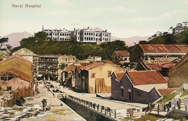
This page has the full story, together with an early sketch of the area. The author, Peter Davis, writes that Hong Kong's first land-based Royal Naval Hospital opened when the navy bought the "Seaman's Hospital which had been first opened in Wan Chai in 1843 [...]. This water-front hospital, which [...] had flourished for many years, was by the 1870s running at a loss. A letter from Vice-Admiral Shadwell, the Commander-in-Chief on the China Station, reveals that William Loney, as chief Medical Officer on the station from October 1872 to January 1875, played a large part in the successful move ashore. [...] The hills on which the hospital - and the later Infectious Diseases Hospital - were built, were given the names Mount Shadwell and Mount Parish respectively (Commodore John E. Parish was the "Naval Officer Commanding" in Hong Kong between 1873 and 1876)."
So, as with the English names of many of Hong Kong's landmarks, 'Parish' was the name of a British man in Hong Kong at that time. As for the Methodist church, that originally acted as a church for the seamen in the area.
Now, what about that comment 'This water-front hospital' above? Yes, in those days the hospital was on a hillside overlooking the sea. Here's the map in 1863, you should just about be able to make out the words 'Hospital Hill' in the middle. At that time it would still have been the Seaman's hospital overlooking the shoreline - the present-day Johnston Road. Queen's Rd East is shown on the map south of the hospital, then south of that lies the grid of roads around Stone Nullah Lane.
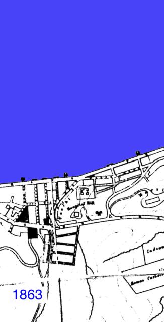
More info about this picture here.
Moving forward to 1889, the hospital is still marked the 'Seaman's Hospital', though it should already have been the Royal Naval Hospital according to the note above. The route of Kennedy Road is there, though this last section of it that joins Queen's Rd E. was originally called Albany Lane.
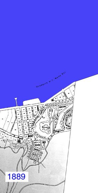
More info about this picture here.
In 1931, more changes. 'Mount Parish' appears at last, and is the site of the Infectious Diseases Hospital. Morrison Hill to the North East was still a hill, though the map says it is 'in course of demolition', as it was used as landfill for the new reclamation up to Gloucester Road, also clearly shown on the map.
The RN Hospital has changed shape from a cross to more of a 'T' shape, so it looks as though three of the four original wings had been extended. (The sketch on Davis's site shows no room for extension - either they had to enlarge the hill or more likely there was a certain amount of artistic licence taken when that sketch was made.)
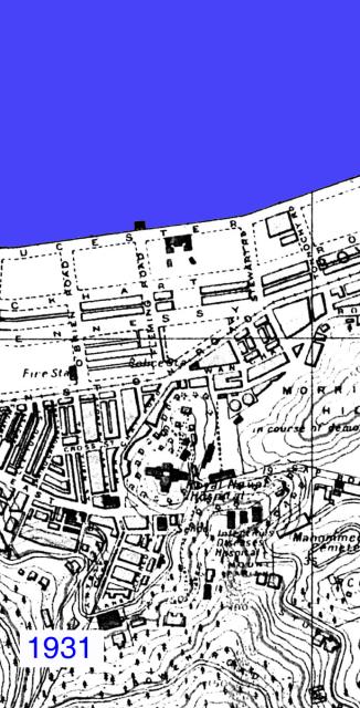
More info about this picture here.
Comments
In the map of 1946 the new reclamation now shows it is heavily built-up. Just to the South West of the RN Hospital you can see the Wanchai market.
More info about this picture here.
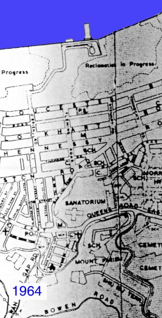
In 1964, yet another round of reclamation is underway. The Infectious Diseases Hospital has been demolished, and Mount Parish is now the site of the Wah Yan College, which opened in 1955 and is still there today. The outline of the RN Hospital is still there - I wonder when it was demolished?
More info about this picture here.
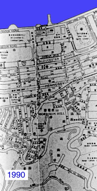
By 1990, everything is pretty much the same as it is today. Kennedy Road has been straightened out, the RN Hospital has been replaced by the Ruttonjee, and the name 'Mount Parish' has dropped off the map.
More info about this picture here.
I took another walk around the area, to see what I'd missed the first time. Walking along Queen's Rd East from the junction with Stubbs Road, there is this granite pillar on bank to your left.
More info about this picture here.
More info about this picture here.
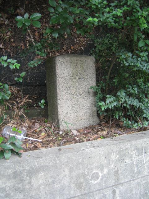
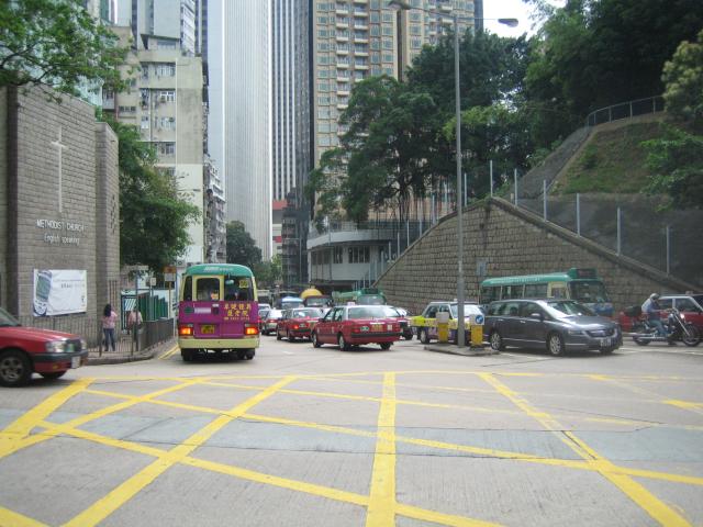
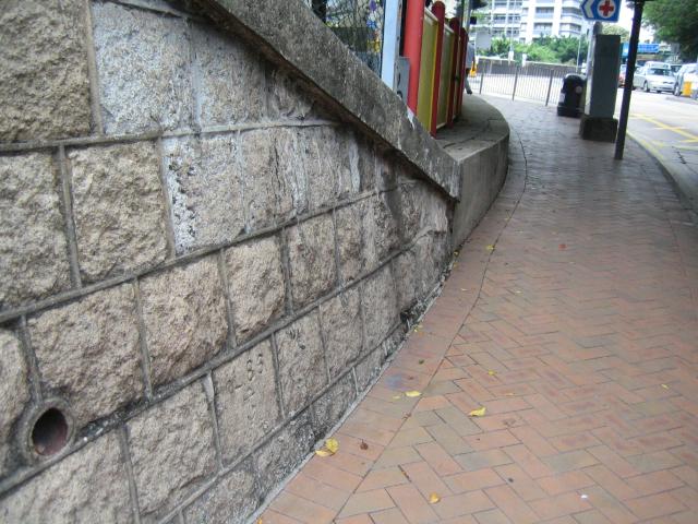
Any idea what it represents? It is inscribed with a '7' on top, an anchor in the middle, and '1905' underneath. Next comes the junction with Kennedy Road, with the Methodist church on the left, Wanchai market dead ahead in the centre, and the hill on the right where the RN Hospital stood.
More info about this picture here.
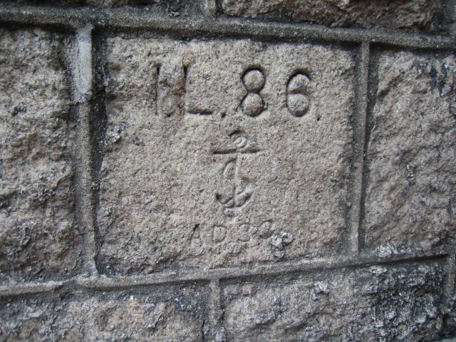
Low down in the retaining wall of that hill is another inscribed stone. This one says 'I L 86', then an anchor, then 'AD 33'. The Wanchai market was built in the early 1930s, so I guess this wall was built at the same time. (Does anyone know what the 'I.L.' stands for? I have seen those initials on other stones around Hong Kong)
More info about this picture here.
More info about this picture here.
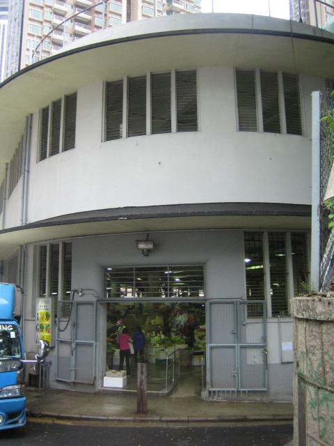
Here is the entrance to the Wanchai Market building, which unfortunately is scheduled for demolition.
More info about this picture here.
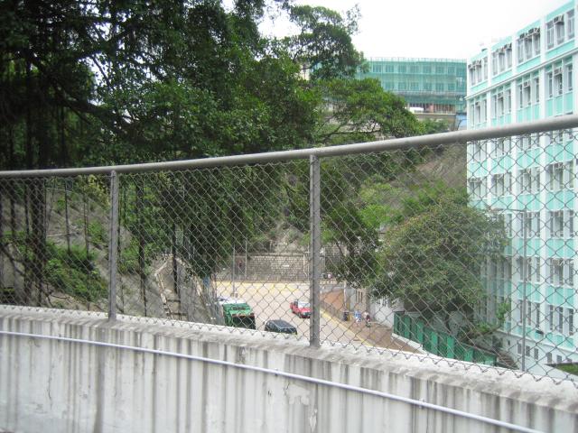
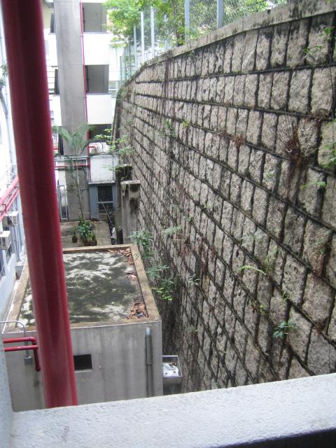
You can still get up on the roof, so here's the view back towards the junction of Kennedy Road and Queen's Rd E, with a view of Wah Yan college behind the trees. I guess this roof is where the British troops we mentioned in the last piece were positioned with their 18-pounder?
More info about this picture here.
It's hard to see why they'd have chosen this place as it seems to have a very limited view. But of course the surrounding buildings were so much lower then, they'd probably have had a view of the whole of Mount Parish, and much of Kennedy Road too.
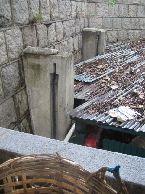
To see just how different it would have been then, take a look at this photo of the area in the late 1930s. Walking down the staircase from the market roof I saw the familiar shape of the doorway to an air-raid tunnel - there must be another network under Hospital hill.
More info about this picture here.
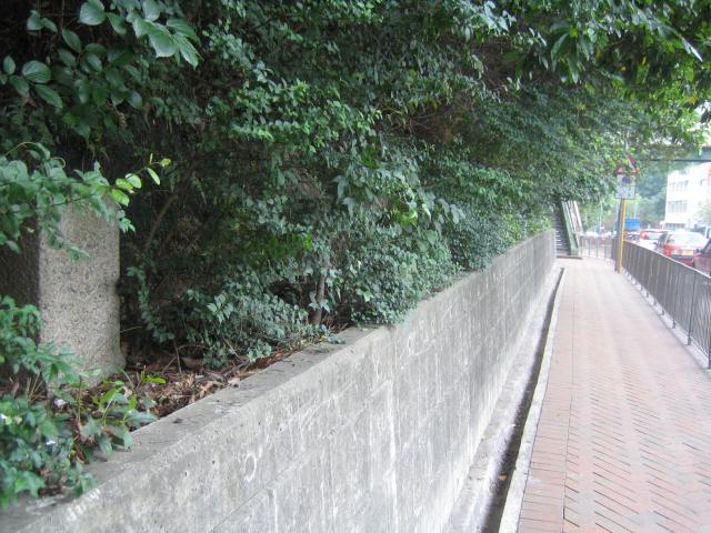
Looking back along the retaining wall and there's another entrance a little further along.
More info about this picture here.
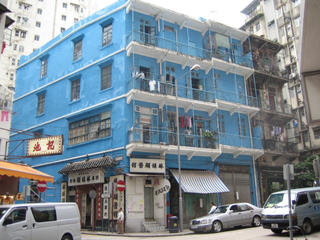
Just across Queens Rd E, opposite the market is Stone Nullah Lane, a road that was visible on the 1863 map. Here on the corner of that Lane and King Sing St is a building that's hard to miss.
More info about this picture here.
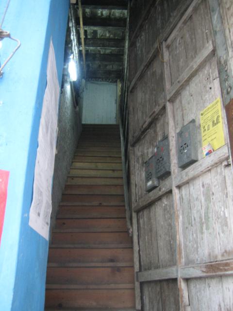
It's a wonder that it has managed to last this long; it would certainly have been here before any of those air raid tunnels were built. There can't be many buildings in Hong Kong that still have wooden stairs?
More info about this picture here.
I wanted to take a look at this road to compare it with this excellent picture of Stone Nullah Lane that reader Moddsey had kindly sent in (thanks also to him for several other pieces of information I've used here).
More info about this picture here.
Comments
The three stories house that can be seen at the end of the nullah is what we now call the Blue House. It has strong links to the martial art Hung Kuen. I've written an article about the history of the Blue House, especially in regards to the martiart practiced there. It can be read online here:
http://naamkyun.com/2012/12/the-blue-house-a-piece-of-hung-kyun-history/
Hope you enjoy and find it usefull.
Hi, I don't think that's the Blue House, although it is a very similar style of building. If you look at the Blue House, it's set parallel to the nullah, whereas the four-storey building in this photo is at an angle.
I believe that the Blue house was built after this photo was taken.
Thanks for the extra information about the Blue House's history, I've added to the main page for the building:
Regards, David
The naval hospital dominates the area, and is in its extended 'T' shape, not the earlier cross shape. The stone-lined nullah that gave the lane its name is also clear to see. The blue building photographed above had not yet been built, though a very similar building stands at the bottom of the lane.
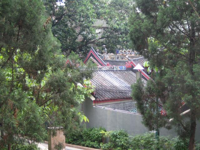
On the right of the picture is the Pak Tai Temple, looking much as it does today. In fact if you go back to the older picture on Davis's site, you'll see the temple's roof also appears there in the bottom right corner. There are many more trees along the lane now, which make it difficult to get exactly the same view. Still, the lines of the temple roof today are clearly the same as in the earlier pictures:
More info about this picture here.
If you have any more information about the area's history, we'd love to hear from you.
References:
- PRO catalogue: http://www.grs.gov.hk/ws/english/es_online_cata.htm
- Maps: The easiest way to look at them is to see the 'Mapping Hong Kong' book in the map section of Central Library. They also have larger scale copies of the individual maps available.
