Maybe the smaller pier to its right was the one for the Kowloon Ferry? That would match the HK Standard's description that "the first ferry pier stood in the middle of Central, by the old Alexandra House."
Peddar's Whaft was straight on from Peddar Street. Things had changed by 1900 if the map is correct. I don't know the actual date of this well known photo, but Dent's (or the Hong Kong Hotel) on the left only has three stories.
As a stamp collector I'm more interested in the site of the (General) Post Office and wonder if you have other more detailed maps, pictures & info showing such. It was of course the precursor of the much larger GPO,"the Grand Old Lady of Pedder Street"that survived until 1977. Thanks.
That pier at "Peddar's Street" was still Pedder's Wharf :-)
Something throwing us off is the "1900" date. This map still has Des Voeux Road as the seafront, and only shows the proposed reclamation. But by 1900 the reclamation was complete.
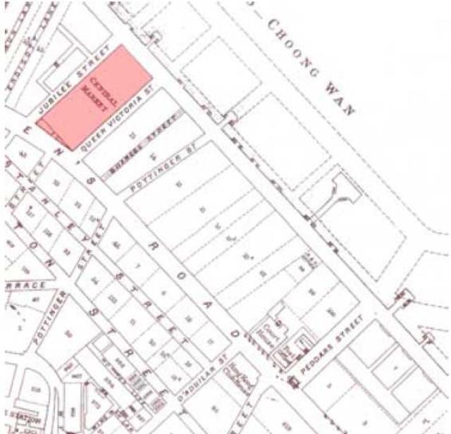
There's a larger copy of this map in Mapping Hong Kong (Plate 3-2), which shows the publication date of 1889.
Comments
Pier at 'Peddars Street'
That pier was Pedder's Wharf.
Maybe the smaller pier to its right was the one for the Kowloon Ferry? That would match the HK Standard's description that "the first ferry pier stood in the middle of Central, by the old Alexandra House."
Peddars Wharf gone by then
Peddar's Whaft was straight on from Peddar Street. Things had changed by 1900 if the map is correct. I don't know the actual date of this well known photo, but Dent's (or the Hong Kong Hotel) on the left only has three stories.
Post Office at the top of Peddars Street/Queen's Rd Central
As a stamp collector I'm more interested in the site of the (General) Post Office and wonder if you have other more detailed maps, pictures & info showing such. It was of course the precursor of the much larger GPO,"the Grand Old Lady of Pedder Street"that survived until 1977. Thanks.
I've added a link to the
I've added a link in the "Places shown in this photo" above.
Date & Pier
That pier at "Peddar's Street" was still Pedder's Wharf :-)
Something throwing us off is the "1900" date. This map still has Des Voeux Road as the seafront, and only shows the proposed reclamation. But by 1900 the reclamation was complete.
There's a larger copy of this map in Mapping Hong Kong (Plate 3-2), which shows the publication date of 1889.
Another red-herring is that despite the 1889 date, this map still shows Peddar's Wharf in it's earlier position. But by 1889 it had already been replaced by the new Peddar's Wharf, built around 1886.
Regards, David
Sure, what date do you want ?
Sure, what date do you want ?
1889 please. I'll assume it's
1889 please. I'll assume it's the same map as shown in Mapping Hong Kong.