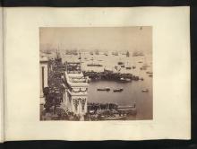

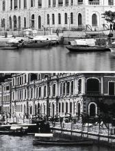
Mo Tat Wan Pier, North [c.2023- ]
- Read more about Mo Tat Wan Pier, North [c.2023- ]
- Log in or register to post comments
I vaguely remember the pier was built and inaugurated back in 2023. Chuen Kee Ferry had been using this pier since.
T
I vaguely remember the pier was built and inaugurated back in 2023. Chuen Kee Ferry had been using this pier since.
T
Amended the title to reflect the river crossing.
Pier in the Lei Yue Mun village. When seafood restaurants opened in this village in the 1960s and 1970s, transport became a major issue. Therefore, a pier was constructed. It first appeared on the 1972 map on New HK Maps labeled jetty.
It is likely no longer used as a pier, it bears the name Lei Yue Mun Viewing Deck No. 2.
Pier in Kennedy Town at the junction of today's Catchick and Cardogan Streets (see 1901 map on Gwulo).
The Public Works Report for 1896 refers:
90. Pier at Kennedytown .- The erection of a suitable pier at Kennedytown in connection with the Slaughter Houses and Depots was commenced in August last under Contract No. 12/.
The pier opened in 1910 at the same time as the adjacent Tai Po (Kau) Railway Station. The pier was a dam built out into the sea with a (wooden?) pier at the end. It had a total length of about 180 m (source)
Time of competion is approximate. Date cited was the approxiate occupation of Phase 1 of South Horizons. However the pier may be operational ahead of it. Unable to confirm as for the time being.
Pier opposite M.L. 234 (today's 28 Connaught Road West). It was one of the earliest piers to be constructed after Central reclamation. It appears first on the 1901 (Gwulo) map.
The 1934 map on hkmaps.hk gives the name: Cheong Wing Kue & Cheong Wing Po (EXORS) Wharf. On the 1945.3 map the name Yueng Tai Hing Wharf is used.
At the end of the 1940s, the pier was considerably shortened (to about one third compared to the original length). The 1954 map gives the name Tai Hing Wharf with the addition Public Pier No. 8.
The location of the pier is taken from map 1985.2 at https://www.hkmaps.hk/viewer.html
The first reclamation started around 1850. One of the first areas to be reclaimed was in front of Government properties (Post Office, Supreme Court) because many owners of lots at the old waterfront refused to allow reclamation. On the new reclaimed land (ML 100) a house was built: https://gwulo.com/node/5247.
Pier near the Tin Hau Temple at Tai Miu Wan (Joss House Bay) [????- ]. Opened in early 1983 (an aerial photo from 1982-10-15 shows the pier under construction)
Serviced Saturdays and Sundays on the Sai Wan Ho < > Tung Lung Chau service.