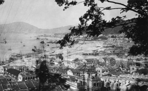
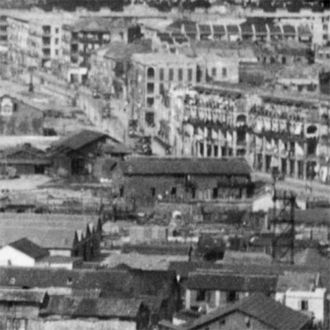
Where: We're looking out over Wanchai, with Kellett Island and North Point in the distance:
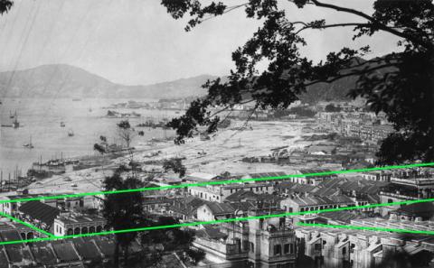
The main roads in the photo are the two parallel lines shown here:
The top line is the old seafront, the Praya East that gave its name to the reclamation. It's called Johnston Road today. The line below it and one block inland marks the route of Queen's Road East.
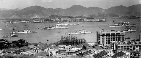
I haven't pinned down the exact location yet of the photographer yet, though the two other streets I've marked are clues. On the left is a short road running between the Praya and Queen's Road East. On the right side of that short road is a terrace with a dark-coloured pitched roof. It looks like the one at the right of this 1933 photo:
Possibly Li Chit Street?
The other clue is the neat terrace running up the slope in the bottom-right corner. That looks more like Wing Fung Street ... but that doesn't fit with the Li Chit Street idea !
Hopefully you can recognise a building in the photo and let us know its location.
When: The reclamation began on 1st November 1921 and finished on 31st May 1929, so the photo must have been taken somewhere between those dates. We can get a closer look at progress from the annual reports of the Public Works Department (PWD) [1]. From 1924 on they report the number of acres of land reclaimed:
| Year | Acres reclaimed | % reclaimed |
| 1924 | 36 | 40% |
| 1925 | 44 | 49% |
| 1926 | 58.5 | 65% |
| 1927 | 75 | 83% |
| 1928 | 87 | 97% |
| 1929 | 90 | 100% |
By the time this photo was taken the bulk of the reclamation was already done, though down on the left / west there is still land to be reclaimed. I guess the reclamation in this photo is between 83-97% complete, and so the photo was taken sometime during 1928.
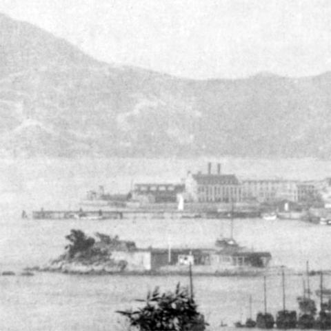
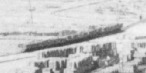
What: We can see lines running across the reclamation. These were temporary railway lines, used to bring the rock and soil from the excavation sites so they could be dumped in the sea and so reclaim the land. Here's a close-up of a line of trucks over to the right of the photo:
The railway was ordered at the very beginning of the project, as shown in the PWD report for 1921:
The Contractors placed orders for four Locomotives, one mile of track (155 lbs. rails), two miles of track (30 lbs. rails), one mile of track (12 lbs. rails), fifty Decauville Wagons and wheels, axles, and axle boxes for one hundred 3 1/4 cubic yard side-tipping wagons.
Decauville [2] was a French manufacturer who developed a narrow-gauge system of track and rolling stock. Their track could easily be moved around, so it worked well on a project like this.
If you follow the lines of the tracks you can see two main routes. One set runs along the seafront til it reaches the top of the reclamation next to the Bowrington Canal. The other heads inland towards the old Praya at top-right. These were the two routes to Morrison Hill, the main excavation site for the reclamation.
The route along the side of Bowrington Canal is one I've heard of before. It is described in the 1922 PWD report:
During July, the transport line via Bowrington Canal was completed and the transport of earth filling by locomotives and side-tipping trucks commenced; good progress was made with this, a total of 410,000 cubic yards having been deposited on the Reclamation by the end of the year.
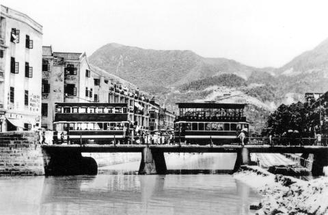
You can see the tracks running alongside the Bowrington Canal on the right of this photo:
But the 1922 PWD report also introduces an earlier set of tracks I hadn't heard of before:
[...] the laying of transport lines on Heard Street was completed and the deposition—by hand wagons—of earth filling from Morrison Hill commenced in April.
The next year's report shows the Heard Street route was upgraded from hand wagons to locomotives:
[...] in addition to the transport line via Bowrington Canal, a track was laid on Heard Street, and the transport of filling material by locomotives and side-tipping wagons via the latter route was commenced in March.
I've never seen a photo of the tracks or trains running along Heard Street. If anyone has copies, I'd love to see them.
Is that one of the locomotives out where a track runs along the new sea wall? Unfortunately it's behind some branches, so not very clear to see, but see what you think:
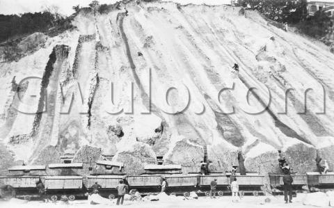
Though we don't have any good views of the locomotives, we do have a good close-up of the wagons, which also shows how Morrison Hill was excavated:
Apart from the railways, another item of interest is about half way up the main photo, and over to the right:
Among the jumble of huts on the new land, there is a neater area. Look for a tower on the right, facing a single storey building on the left that has pitched roofs. This building has previously been identified as the temporary fire station [3], with its tower for drill and for drying hoses.
Who: Sir Paul Chater - another surprise!
I knew he was instrumental in getting the big reclamation project off Central underway in the 1890s, but didn't know he was also behind this reclamation. He's mentioned in the government's final report on the Praya East Reclamation Scheme [4]:
The Praya East Reclamation Scheme was under consideration as far back as 1897 and at that time the Director of Public Works, Mr. Ormsby, C.M.G., sounded a note of warning to the promotors of the scheme with regard to the large amount of rock that might be found in Morrison Hill and pointed out that such development on the Island would be a very heavy tax upon the then inadequate water supply.
Due to the untiring efforts of Sir Paul Chater, Kt., C.M.G., the scheme ultimately received the sanction of Government in 1921 and resulted in the resumption of Morrison Hill and the passing of the Praya East Reclamation Ordinance No. 17 of 1921. After which the work was put in hand and carried to completion in 1930 by the Public Works Department on behalf of the participants—the Government being one of the interested parties.
[...]
Sadly Sir Paul Chater died in 1926, before the reclamation was completed.
|
Also on Gwulo.com this week:
|
References:
Comments
Wanchai Streets
In the original photo on the extreme left in a side street is a dark coloured nine-slatted roofed building. When compared to other buildings in front and at the rear, the dark colored roofed building can be seen below from 1934 on Anton Street next to the Sailors' Home and Mission to Seamen. I guess the photographer was somewhere up Monmouth Path.
The dark-coloured roof in
The dark-coloured roof in both photos looks like a match, but the next building over on the Landale Street side is different. In the 1934 photo it's also a building with a pitched roof, but in the 1928 photo it's a lower building without the pitched roof. Not sure if the site was re-developed between the photos, or the dark-coloured roof is on a different road. Looking at the 1933 photo there were buildings in this style along several of the roads between QRE and the Praya:
Re: dark-coloured roof
Noted the comments. In your 1928 photo, in front of the dark coloured roof building is a light coloured building. At the rear is a building with arches. I think the light coloured building looks the same and is visible in both photos whereas the outline of the roof of the building at the rear is visible in the 1934 photo.
Here is the side view of the dark-coloured building at street level with the building at the rear on Anton Street.
Exact location
Found this on flickr (uploaded there January 2015). Maybe it helps with identification of streets and houses.
Wanchai 1924
Another one from Flickr. On this image it says "..taken from Kennedy Road".
Photo location
I've done a bit more digging. The 1924 photo from Klaus gives a good view of a very similar area. It shows the wooden markers in the sea that will be the limit of the reclamation, and the first signs of the reclamation in the distance.
To find out where they're located I switched to look for views from the sea. The outlines of the facades facing the Praya are clear enough in the views above to match them with a photo looking from the opposite direction.
I found a good match in the second edition of Once Upon A Time Hong Kong, pages 90 & 91 that identifies the streets. From left to right we have Landale, Li Chit, Gresson, and Lun Fat Streets:
The building on the north-west corner of the Gresson Street / Praya junction (mostly hidden behind a tree in the 1928 photo) is the Seamen's Institute:
Regards, David
Re: Terraced houses by the right
Hi David,
Now that the four streets had been identified, by referring to a present day map, I believe the terraced building by the right were likely on the slopes along Saint Francis Street instead. This being, Wing Fung Street (mentioned previously) was (and still is) a bit beyond Landale Street towards the west.
Thanks & Best Regards,
T
Good work
Good work on the identification.
1928 reclamation
Thanks Moddsey, and yes, Saint Francis Street is a likely location for that terrace. It's funny how few photos we have of this stretch of coastline, when compared with the number that show HSBC and the buildings in Central!
Regards, David
1929 Wanchai (Praya East) Reclamation
A better perspective of buildings from the harbour of the Wanchai waterfront. The Sailors and Soldiers Home (2nd Generation) has been constructed on the eastern site of the former Blue Buildings The western portion, served as the Naval Canteen with the Sailors and Soldiers Home (1st Generation) at the corner of Arsenal Street. The Seamen's Institute would be in the centre of the photo.
Above the rowing boat in the
Above the rowing boat in the foreground there's a diagonal line running up the hillside (best to zoom in to see it). That's the terrace mentioned above, and with a grand-looking building at the top end of it.
Regards, David
1928 Praya East Reclamation