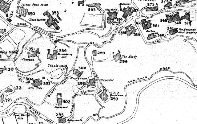
The first map of The Peak on which I have seen KNOCKLAYD clearly marked is a Road Map of the Peak District of 1954 digitally available at HKmaps.hk (other than the 'mention' on the 1924 map). This is a snippet of that map clearly showing the location of KNOCKLAYD (House No. 300) and its location on the south side of Bluff Path above Clavadel.
Comments
KNOCKLAYD clearly shown on 1954 Map of The Peak (hkmaps.hk)
The first map of The Peak on which I have seen KNOCKLAYD clearly marked is a Road Map of the Peak District of 1954 digitally available at HKmaps.hk (other than the 'mention' on the 1924 map). This is a snippet of that map clearly showing the location of KNOCKLAYD (House No. 300) and its location on the south side of Bluff Path above Clavadel.