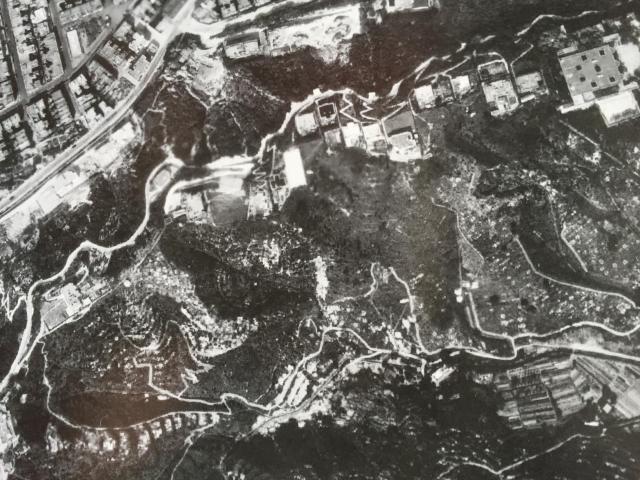
This post-war 1949 aerial photo of the top of Broadwood Road is courtesy of the Lands Office. The area where The Towers is located is actually a bit of a blur. I can contextualise it in relation to the steep zigzag road leading up to the house beyond the space that was The Towers's lawn - perhaps that was no. 18. No. 21, the single house just below The Towers is also visible. The area that may interest you, Aldi, is more distinct. I think eurasian_david's hypothesis that the number 24 is unlucky in Cantonese is interesting, but the address of 24 Broadwood Road clearly still existed when Harvey Decker lived there.
Date picture taken
1949
Shows place(s)
Shows street(s)

Comments
Fabulous
Fabulous clear view stripped of vegetation in the war, Jill. That's great. Thank you.
I don't suppose we have a view of the Broadwood Road - Tai Hang Road junction?
Broadwood Road - Tai Hang Rd junction
I don't think this c. 2013 photo is going to help you. See https://gwulo.com/media/44940
Maybe other contributors have earlier pictures.
Numbered version
Hi Jill
I've taken the liberty of putting numbers to your aerial photo from #8 to #22/23. Just wondering would you be happy for me to show it for discussion and correction if necessary? Looking at your 1970 map I may have a couple wrong.
Aerial photo of Broadwood Road
Aldi, it’s not my image, so not my prerogative to advise what can be done with it, but thank you for asking.