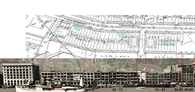
Similar to the houses between the General Post Office and the Central Fire Station, there are more houses between the Central Fire Station and the Harbour Office that appear on many photos, simply because they were at the waterfront for some 60 years.
To get an impression about the buildings here is a map together with a photo (cropped from Hong Kong from the Harbour.jpg) from around 1930.
The map is from 1960, on HKMS 2.0 there is also one from 1922. There is only a slight difference (houses near Sincere Department Store) to the one from 1922, but the advantage of the younger one is the fact that numbers of houses are given which really helps a lot. The photo ends at Wing Wo Street, the following houses to the west are covered on another map/photo combination.
The photo is annotated and the individual houses were grouped together. The grouping of houses used for the creation of places is somewhat arbitrarily but not completely at random. The grouped houses (places) are linked to the map.
These groups of houses have individual places on Gwulo.
