Current condition
Demolished / No longer exists
Position of marker is approximate.
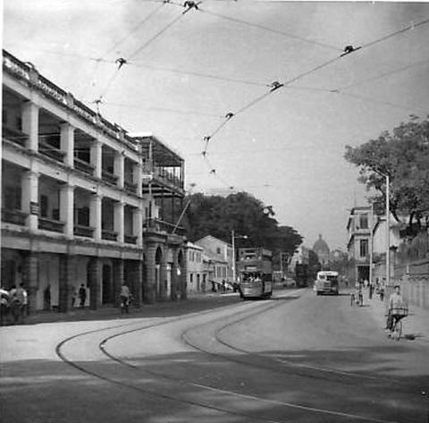
It was a three-storey building that ran parallel to Queen's Road, today's Queensway. It is shown at the left of this photo:
Location can be seen on the old map of the Barracks available at the Survey & Mapping Office, their ref: HG7.


Comments
Victoria Barracks Block names
The HKPRO has a good selection of old photos of the barracks including blocks A to E (all demolished to make way for Pacific Place et al).
http://www.grs.gov.hk/PRO/srch/english/search_fields.jsp?p1=victoria+ba…
I'm curious as to the naming though. I thought that blocks A through to E sat in a line going up the hill from queensway with A being the lowest and E the highest. Were the blocks renamed at any point? Here is a picture of E block courtesy of HKPRO:
http://www.grs.gov.hk/PRO/srch/english/imgdisplay.jsp?RecordKey=1000013…
re: Victoria Barracks Block names
Hi Phil,
It is confusing - I haven't worked out a good way to make it clear yet.
The problem is that the name "Victoria Barracks" is commonly used to mean two different things:
Then to confuse things more, the same Block letters were re-used across the site, at least in c.1924 which is the date of the map I'm using. So if I told you "deliver this to A block", there were four different A blocks across the site. It must have caused no end of confusion.
The title for this page is using the second definition of Victoria Barracks, and it refers to one of three E blocks around the site!
A more formal name for option 2 above is "Military Cantonment of Victoria". I don't think it's as easy to recognise, but switching to that would help avoid the confusion about Victoria Barracks.
Does anyone have any strong objections to "Military Cantonment of Victoria", or any other ideas how to work around this?
Regards, David