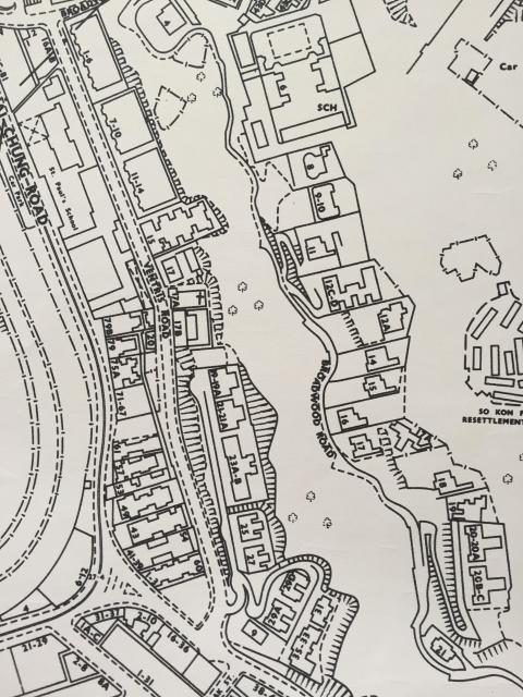
The image shows a portion of a revised Crown Lands & Survey Office map dated 1970 and shows the surviving Broadwood Road houses nos. 6-21. The date of the original isn't given, but no. 20 Broadwood Road which was knocked down in 1953 has been replaced by three blocks of flats, 20A, 20B and 20C, so we can assume that it was post-1953. No. 13 which belonged to John Olson jnr. until the early 1930s is here designated as no. 12A. I deduce that as 12A has a good line of sight to The Towers (no. 20), not possible from the larger house numbered 12C-12D. No. 7, mentioned earlier as having been hit by a rock fall, no longer exists here. Perhaps 4 Broadwood Road is also shown at the bottom. I could upload a fuller image of the map if needed. I'm tagging this image with the nos. 13 and 20 Broadwood Road for positional reference, even though they do not appear here. Others may wish to tag extra buildings. Please feel free.

Comments
Missing connections
Thanks for this Jill. Very useful.
We can't add connections for the following numbers as there are no pages for them: 9, 10,11, 15-18.
Do you have an image of the map where Broadwood Road and Tai Hang Road meet?