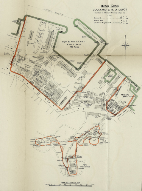
Thanks for sharing this set of maps. I haven't been able to find it elsewhere online. May I have the source of this set of images (along with the map of Mount Shadwell) for citation purposes? Thanks.
My estimate for the date would be after 1908 (opening of the Victoria Recreation Club). Probably not too much later, it looks as if the map shows the situation after completing the new dockyard.
Comments
Image source for further research and citation purposes
Thanks for sharing this set of maps. I haven't been able to find it elsewhere online. May I have the source of this set of images (along with the map of Mount Shadwell) for citation purposes? Thanks.
You may buy online from The National archives
https://images.nationalarchives.gov.uk/assetbank-nationalarchives/actio…
My estimate for the date…
My estimate for the date would be after 1908 (opening of the Victoria Recreation Club). Probably not too much later, it looks as if the map shows the situation after completing the new dockyard.