Source: This image came from Flickr, see https://flickr.com/photo.gne?id=4299339867
Date picture taken
1900s
Shows place(s)
Source: This image came from Flickr, see https://flickr.com/photo.gne?id=4299339867
Comments
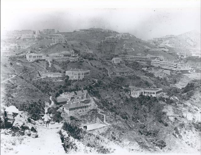
Mount Gough
In the top right corner of the photo is the triangular peak of Mount Gough. Coming left down its ridge line the first building is "Brockhurst", then "Bicton/Burrington" (just one building) and "Red Hill". Additionally, immediately below "Brockhurst" as we look at it is "Kirkendoa".
As "Kirkendoa" was built in 1897-8, followed closely by "Red Hill" completed by 1898 and "Bicton/Burrington" by 1899, the photo must have been taken in 1898 or later.
The 1909 Peak map (https://gwulo.com/atom/14774) shows two additional homes had been built on the Mount Gough ridge line by 1909, namely the house called "Mount Gough" (https://gwulo.com/node/7760) and "The Ridge" (https://gwulo.com/node/5741). Later photos taken from a similar angle to this one show both buildings clearly - so they would have been visable had they been constructed by the time this pic was taken. As they are not visable, the photo must have been taken before 1909.
It's date range should therefore be from 1898 to 1909.
Date updated to 1900
Date updated to 1900