Several of Mike Cussans' recently posted photos [1] were taken looking along Argyle Street, so I'll continue the theme with this week's photo.
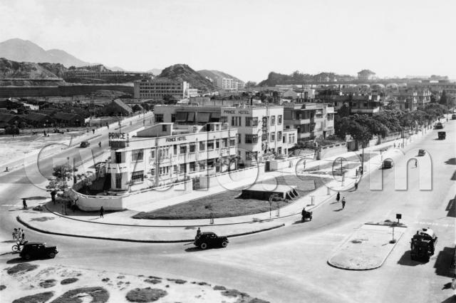
Where: We're at the junction of a couple of major roads in Kowloon. Prince Edward Road runs along the right edge of the photo, while Argyle Street is the road on the left behind the buildings.
When: This comes from a set of photos all taken around 1950. If you can see any clues that give a more accurate date, please let us know in the comments below.
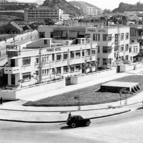
What: The main landmark is the Prince Hotel, on the junction of the two roads:
We've had a couple of comments about this hotel on earlier posts:
- "many Russian from Shanghai after 1949 lived there"
- "It later became the Sek Wai Sin Restaurant in Kowloon City in the 1970s."
Does anyone else remember this hotel?
In the middle of the patch of grass in front of the hotel is a concrete platform. Any ideas what it used to be?
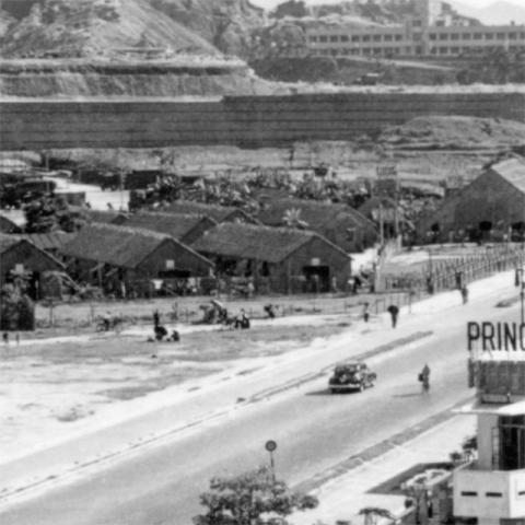
Across Argyle Street from the hotel is what looks like a camp of low huts:
There's one larger building to the right of the huts, and at the back there look to be several trucks parked.
My first guess that it was the site of the Ma Tau Chung camp [2], but that was further along the road. Does anyone know what the camp in this photo was used for?
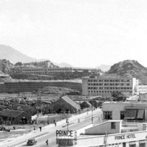
Beyond the camp are a couple of more substantial buildings:
The long, low building furthest away is the King George Vth secondary school, raised on a low plateau.
Between the camp and the school is a four-storey building, next to Argyle Street. Does anyone know what it was?
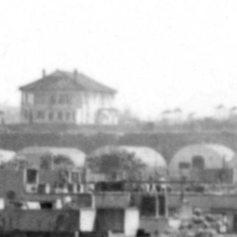
Crossing back over Argyle Street, on the land between that street and Prince Edward Road there's another camp, indicated by this line of Nissen huts:
They mark the site of the Argyle Street Barracks. In the 1950s they were barracks for the British Army, but at other times the site had been used to house Chinese soldiers, British prisoners-of-war, and finally Vietnamese refugees.
Just behind and above the Nissen huts are a couple of larger buildings on the sky line. Does anyone recognise them? I wondered if they were also part of the Argyle Street Camp?
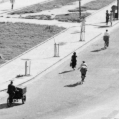
Who: People on the move, with cycles out-numbering motor vehicles. There are a couple of bicycles in this group, and also a delivery tricycle:
As you can see from the questions above, I'm not very familiar with this part of Hong Kong. I'll be interested to hear any stories you have of the area.
Regards, David
References:
Reference: A225B
Comments
St. Teresa's Hospital
Just next to the nissan huts in the barracks should be an incarnation of St. Teresa's Hospital, probably in the right of the photo. Does anyone know the story of the hospital? I was in there a couple of times (much later than when the photo was taken), but didn't find out about its history - guess I was busy making sure I didn't become history!
breskvar
King George V School
I was interested to see KGV in the background of the photo - it looks as though there is a ramp leading down from the front of the building to what is now their (grass) pitch? Not sure how long that may have lasted?
I do recall playing on the hillside to the right (north) of the school buildings, when my father was playing cricket at the school.
Many years earlier, my uncle injured himself up there when he was a boy (he was at KGV in 1952), by sliding down a slope on his bottom with a roll of 'caps' in his back pocket! He blew off the back of his trousers!
This hillside was later quarried away to make room for the Police HQ buildings and another school, I think.
St Teresa's and other buildings
Breskvar, there's a photo of first St Teresa's Hospital building at http://www.sth.org.hk/montage.asp?lang_code=en, which shows a four-storey building with balconies. I think it's visible in the main photo above, just to the right of the line of Nissen huts.
Thanks to Richard Wong & Thomas for identifying the buildings on the skyline as Kowloon Hospital.
Richard also identifies the new building on Argyle Street as the Kowloon City Police Station, and goes on to date the photo to 1950-53:
The photo may be taken between 1950 to 1953. New Kowloon City Police Station was opened on 16 Nov 1950. The Argyle camp was used as La Salle College from 1947-1957. In the late 1970s, it was used to house Vietnamese boat people awaiting resettlement in third countries. The camp closed in the late 1980s. In 1956, an illegal squatter area of 40 huts housing 200 residents was built up in the private farmlands around Kowloon City Police Station. While Tang King Po School was opened in 1953, which is just behind the police station and in front of KGV but not seen in the photo. While the Civil Aid Service Kowloon Training Centre, adjacent to Kowloon City Police Station, was opened on 1955.
Finally, Henry Ching explains the low structure in front of the hotel:
The concrete platform in the middle of the patch of grass in front of the hotel was a water tank constructed of bricks with a concrete roof. These tanks were built all over the urban area and could still be seen late into the 1950s. I think they were intended to supplement the water supply in case of fire.
Thanks for everyone's help, much appreciated!
Regards, David
Argyle St Photo
Following up the picture of pedestrians - Argyle St in the 1950s had slip roads running parallel with the main road all the way to the Waterloo Rd Junction. You can see that in the pedestrian clip. At some point these were merged with the main thoroughfare.
Slip Rd(?) at KGV
I believe the road is Tin Kwong Rd. KGV did not have a slip rd down to the sports field, to my knowledge. I used to walk to KJS from the Kowloon City Police Station along now Sheung Kin St, through the KGV main gate and across the school lawns to the small back gate leading to the path which went down two flights to Perth St. Later I walked to KGV by the same route and played football on the sports field.
I believe the road seen as a slip road was between the sports field and the now cricket pitch. It was lined with shrubs and small trees, as was Sheung Kin St. In my time the hill was being taken away - there was a granite quarry about 3 hundred yards along Tin Kwong Rd with daily blasting and gangs breaking up stones by hand into graded piles, the smallest chips and the larger as hard core. The women wore pieces of rubber tubing on their fingers to protect them from hammer blows.
The earth was dug away by a tracked bucket excavator. Other memories-
- there was an old cemetary there and the digging exposed the coffin wood and burial goods. We used to have potatoe roasts over fires made with coffin wood.
- The Police destroyed tons of seized illegal fireworks routinely on the flatted space. We would rake through the remains after school and collect whole fireworks for our own use.
- the Police dogs used to find opium were trained there by hiding small round china "cups" containing opium. Even now I can bring into my mind the smell of opium. (In the morning addicts from the Old Kowloon Village would walk down Argyle St to reach Nathan Rd for begging and in the evening they would stagger back. |Once seen you would not forget an emaciated jaundiced addict).
- Tin Kwong Rd was the route we took to reach the Watsons Drink factory, one of a group sited together on the way to the old docks and ship breaking yard. The factories had reception areas where tour groups would try out the drinks before and after tours of the factories. The staff welcomed us and we binged on the cold drinks!
Sorry, too much detail, but the memories are happy and strong.
Stephen
(St Theresa's) Hospital
I believe it was on the corner of Lomond Rd and Prince Edward Rd. I spent the night in there with a friend when he had his appendix out, in 1955/56. There is a historic monument/temple (?) in Lomand Rd which I think was on the boundary of the Hospital site.
Lomond Rd by the way was closed off at monthly intervals for the Kowloon Police Station Riot Squad to drill. They would march out of the Station in riot formation and turn into Lomand Rd, carrying out the drills all the way to Prince Edward Rd. Later I did the same rills in the British Army, in the late 196os - unchanged.
Stephen Roberts
Thanks Stephen, don't worry
Thanks Stephen, don't worry we can't have too much detail!
Regards, David
Tin Kwong Road and KGV School
That ramp looks too close to the school buildings for it to be part of Tin Kwong Road? It is hard to tell from that photo though.The field looks as though there is a truck parked on it?
The Argyle Street police station
The walkway between the patch of grass and the front of the hotel was the Boundary Street extension line - the hotel was in the southern side so meant to be permenantly belongs to the British Empire !
Just wonder if anyone can tell whether the disappeared Campbell Road was still in front of the police station high block as seen in this picture.
Recent pictures of this police station was uploaded here -
http://www.flickr.com/photos/91722684@N05/8564634744/in/photostream
1950 Argyle street & Prince Edward road
Hello David
I think the high ground in the rear of the photo (with the mansion on top would be Kadoorie avenue / Braga circuit( Waterloo roadR running left to right bisecting Argyle & Prince Edward
High ground with mansion on top
Hi Gary,
Looking at the map, I think Braga circuit would be a lot further away in the distance. Moddsey and Thomas think it's Kowloon Hospital, which makes sense to me too - see what you think:
http://gwulo.com/node/15144
Regards, David
Argyle Street/Prince Edward Road
Trying to work out where the photographer was. Probably on a rooftop to get this perspective, but don't recall many high enough buildings around there in the 1950's, except La Salle College (then the 33rd General Military Hospital) but that's too far away along Boundary Street or perhaps he was on a long-gone hillside.
H
Re: Location of Photographer
I would surmise the photographer would be on one of the buildings fronting today's Prince Edward Road West opposite the Kowloon City roundabout as seen here
Location of Photographer
Thanks, M. Plain to see where he was from the uncropped photo.
H.
Kowloon City Police Station and Kai Tak
Been reading the followiing interesting snippets of information of the Kowloon City Police Station with reference to Kai Tak Aerodrome in 1951 as viewed here
a) The height of the Station was limited to 4 storeys due to Kai Tak height restrictions on buildings.
b) The Station's roof had four sets of lights for navigational guidance.
c) It would appear to have been a rather noisy place to work in as 'four-engined planes over Argyle Street would pull up with a roar only 15 ft above the Station's roof or a flight of jets in formation first would break off and come in to land on Runway 07 in single file'.
Here's a good aerial view of
Here's a good aerial view of the area:
Runway crossing
In this image even when zooming in, the main road seems to completely disappear near the back of Kowloon City properties when it should be crossing the runway extension as seen here
https://gwulo.com/atom/11501
Where did it go?
OldTimer
IDJ, thanks for this interesting point. The road was still there but the colour in the photo is deceiving. The straight line is the edge of the nullah. The photo could have been taken during or shortly after the extension when they built the ground over the nullah. The little dirt road that crosses the runway could be a temporary route for traffic/pedestrians. Were they paving the road making its appearance blending in with the nullah? Regards, Peter
Re: Photo
The road across the runway is still there. On the photo, the remnants of a watermark is still visible over the crossing which makes it look as if the crossing had disappeared.
Brickwork water tanks
Hi There,
There is still one such brickwork water tanks just outside CACHe at Third Street. It is smaller than the one shown above, but similarly built. Considering when the old Chan Yuk Hospital was built next door and this is the annex, this should be old enough.
T
re: Brickwork water tanks
Thanks T - I've walked past that several times but never paid any attention, so I'm glad you spotted it.
Regards, David