High Island Reservoir [1979- ]
- Read more about High Island Reservoir [1979- ]
- Log in or register to post comments
The WSD website says:

The WSD website says:
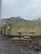
Current documents talk about this as the "Elliot Pumping Station".
The 1926 report about the landslip called it the "No. 3 Pumping Station".
There are some notes about it on the Wikipedia Page for Choi Sai Woo Park.
I'm not sure of the date it changed from reservoir to park. In the book Mapping Hong Kong, the 1964 map (plate 3-6) shows it as "Braemar Reservoir", but the 1990 map (plate 3-7) shows it as "Choi Sai Woo Park", so sometime between those two dates.
Air Defences
It has also to be mentioned that the Colony’s air defences were practically nil. In the now-remote pre-war years effective air defence appeared to be impracticable, because the limited land area of Hong Kong affords little space for airfields. The lessons of the war, however, may suggest methods of overcoming that difficulty. Neighbouring small islands could be flattened and converted into “airstrips.”
When the Tai Tam Upper reservoir is full, water overflows here into the small Tai Tam Byewash reservoir immediately below it.
In early Hong Kong, you got your water from wells or streams. The first attempt to provide a more reliable source was the Pokfulam Reservoir, and its associated conduit. The conduit carried water round the island from the reservoir, following the hillside above Pokfulam Road, and ending near the junction of Albany Road and Robinson Road.
There are still plenty of signs of this old water system. Pokfulam reservoir is the most obvious, clear to anyone looking south from the Peak:
Hi there,
This would be difficult to mark as the Pokfulam Conduit runs along approximately the 150 contour line on maps. Some sections of it are visible from Pokfulam Road and some of the side roadsm, for some other section you may walk atop of it. Some had been under developed sites like Queen Mary Hospital.
I had an impression that the conduit, which is still in use today, had been graded.
Here's the AAB's Historic Building Appraisal. Unfortunately I didn't read it until after the visit, or I'd have looked for the loopholes and air raid shelter.
From WSD website:
Construction work commenced in 1957 and was completed in 1963. The reservoir intercepts and gathers the gully water flowing from the neighbouring mountain ridges on its three sides. With a storage capacity of 24 million cubic metres, it was once the largest reservoir in Hong Kong during the 1960's.