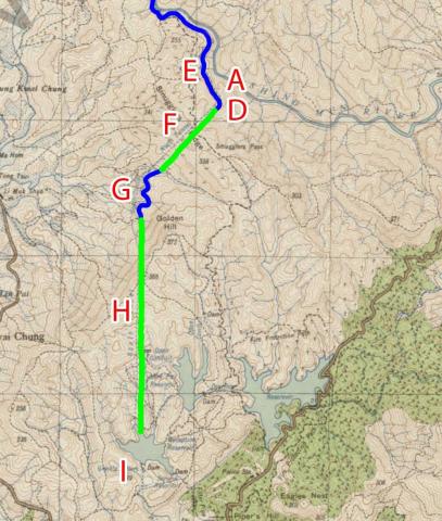
This tunnel was part of the first section (phase) of the Shing Mun Valley Scheme. It is marked (H) on the map below, connecting the South Conduit (G) to the Reception Reservoir (I).
Water first flowed through the tunnel on 24 Dec 1926. The tunnel is described in item 164.g of that year's PWD Annual Report:
South Tunnel.—This Tunnel was ‘holed’ on 4th July or about 19 months after driving was commenced, at a point 2,300 ft. from the South end and 2,350 ft. from the North end.
The rock throughout was of excellent quality and no lining has been required. It is possible however that atmospheric influence on the rock way in the future have a softening effect and that a certain amount of lining may be found necessary.
The Tunnel is of the same sectional area as the North Tunnel and has an average gradient of 1 in 2,800. The invert has been graded smooth with a minimum of 3" cement concrete.


Comments
Southern portal
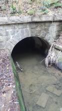
Here's the portal where the water flows out from the southern end of the tunnel. Note the completion year, 1926, engraved in the keystone.
The water flows from the tunnel along this channel towards the Kowloon Reception Reservoir.
Near the end of the channel is a footbridge, where the 'round-the-reservoir' path crosses over the water.
This is the end of the channel, just before the water flows into the reception reservoir. Though there wasn't any flow of water today - you can see the water level was lower than the lip of the outflow.
I was surprised to see how much silt gathered here. I thought that as the water flows mostly through tunnels, it would be silt-free.