60 years ago, Ms. Lorraine J. Ford visited Hong Kong. She signed up for a sight-seeing tour, and captured these scenes on Kodachrome slides.
The view from above
I guess the tour started as most do, with a visit to the Peak. We don't know if she took any photos there, but she did take several scenes as the tour bus drove along Stubbs Road to Happy Valley.
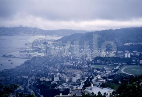
The first of her slides I have shows the view looking out across Wanchai and Causeway Bay.
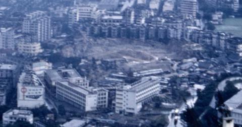
One of the areas I'm always drawn to is Morrison Hill. It was first excavated in the 1920s to provide material for the Wanchai Reclamation, but it seemed to take forever to get rid of the whole thing. Here in 1960 they're so close to finishing the job, but there are still two rocky remnants at the left and right of this close-up.
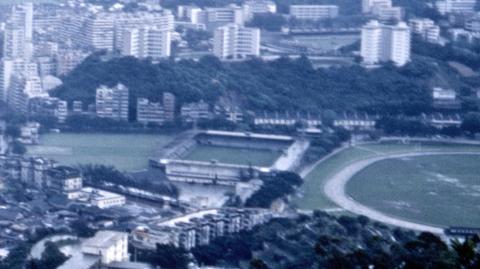
Over to the right, Leighton Hill was home to several blocks of government quarters, which looked out over the old layout of the Football Club and the racecourse.
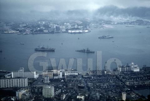
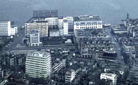
The next scene is a view of Wanchai and the harbour, looking towards Tsim Sha Tsui.
The block bounded by Arsenal & Fenwick Streets appears in many old photos. It housed the China Fleet Club and the Missions to Seamen buildings, so it is a popular scene in sailors' albums.
Down in the bottom-right corner there's a very wet-looking Southorn Playground.
Fortunately Lorraine jotted down notes on each of the slides, showing where it was taken, and that they were taken in May 1960. It's another wet May day in Hong Kong as I write this, 60 years later.
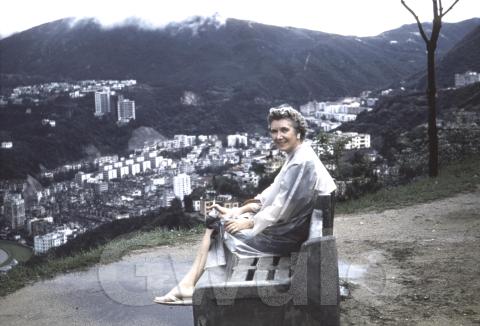
Her next photo shows the buildings in Happy Valley, with another glimpse of the racecourse at bottom left.
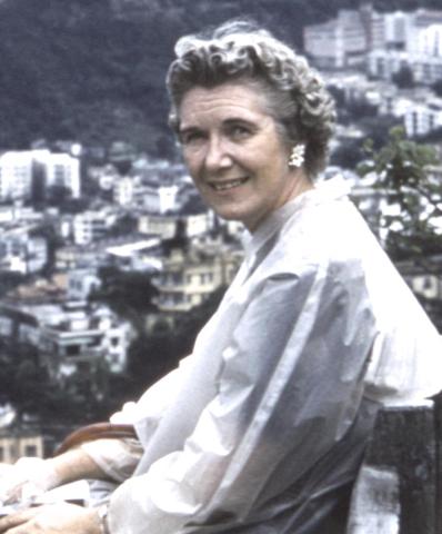
But she didn't write the lady's name on the slide. Why would she, it's not as though you'll forget your own name! Say hello to Lorraine...
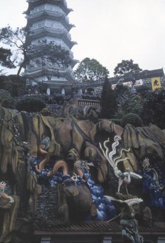
Before they left the north side of the island, the tour called in to another must-see for a Hong Kong visitor, the Tiger Balm Gardens.
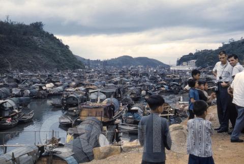
Then it was back on to the minibus and over to the south side of the island. Here they've stepped out again to take a look at the sampans in Staunton Creek. If you've got Volume 3 of the Gwulo Books it's worth turning to photo 5, the 1920s view of Staunton Creek, to see it before it got this jam-packed.
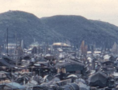
In the distance is Aberdeen Harbour, with Ap Lei Chau rising up in the background. The yellow smudge in the centre of the close-up below is likely the roof of the Sea Palace, one of Aberdeen's floating restaurants.
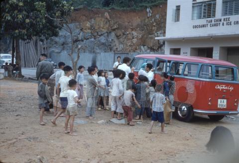
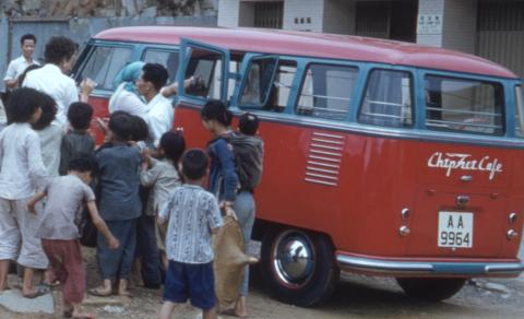
The next photo probably shows the tour bus that carried Lorraine and the rest of the group from place to place. Volkswagen minibuses seemed to have had the monopoly for this type of work.
The building in the background, the factory for Yan Chim Kee Cocoanut Candy & Ice Cream, confirms the van was parked in Wong Chuk Hang, a short walk away from Staunton Creek.
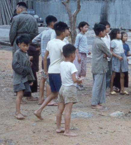
Each stop on the tour attracted a group of curious children, many of them barefoot.
I wonder who organised the tour? The name on the van reads something like "Chiphei Cafe", but it isn't a name I recognise.
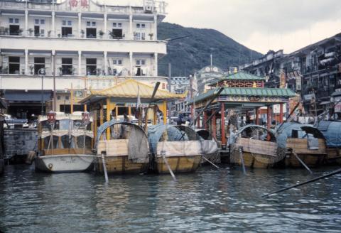
A change of transport for the next photo. It was taken from a boat on Aberdeen Harbour, probably an oar-powered sampan like those shown tied up at the water's edge. There's a yellow roof again, showing where to catch the boats for the Sea Palace restaurant. We can't be sure that's where our group were heading, but I guess the tour included lunch on one of Aberdeen's floating restaurants.
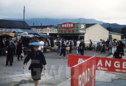
The last three slides were all taken in the New Territories, though it's not clear if they were taken on the same day as the earlier slides, or later in the vacation. After a hearty lunch, would the tourists head back to their hotels for a nap, or feel fortified and ready for new adventure?
Here's the first of the New Territories slides. Does anyone recognise these buildings?
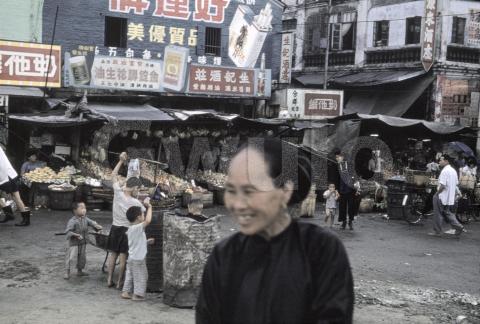
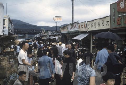
I didn't recognise the second slide either, but there will be a couple of clues in a moment. Note the adjacent green and white storefronts in the centre of the scene.
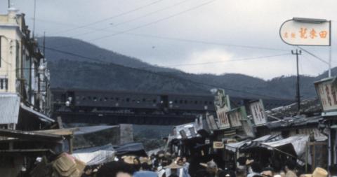
They also appear at the right of the last photo, showing both photos were taken in the same town.
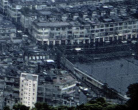
That dark line in the background is a train passing by. Here's a closer look.
There aren't many sections of the old railway line that were raised on pillars like this. I guess it's where the railway line crosses the river at Tai Po.
I hope you've enjoyed seeing Lorraine's slides. You can click on any photo to visit its page, then click on the "Zoom" tab to see a copy you can zoom in to take a closer look. You can also click the links in the text above to see pages on Gwulo with more information.
Lorraine bought some boxes of commercially produced slides as well. We'll take a look at them in a future newsletter.
Thank you
Many thanks to Sandy Devine, who is the reason we can see these slides. She contacted me by email:
I have old slides of post war Hong Kong taken by or purchased by my aunt, Lorraine J. Ford. I am looking for a person or organization who would be interested in having them. They are possibly of historic value and I would prefer not to throw them away.
Of course I wrote straight back! Sandy very kindly mailed me her Aunt's slides to add to my collection, and to share with readers. Thank you Sandy.
Comments
Pak Shing Street
I think the last image is Pak Shing Street in Taipo market.
Railway Bridge @ TaiPo Market
Yes that view of the railway bridge at Tai Po Market was from the end of the market. I had walked under the bridge many time to get to our country place in the hills beyond.
The final slide
By coincidence, a couple of weeks ago I posted on Hong Kong in the 1960s Facebook page a photograph I had taken around January 1966 in Tai Po Market. It was identified as Pak Shing Street, and was from a similar position. The only difference was that we were not tourists.