Temporary Remark: Problems that occurred during the update of this post, will be fixed soon
The extent of the 1850/60's Praya Reclamation is shown in https://gwulo.com/node/40695.
There it says:
During the early years of the Colonization of Hong Kong Island, the north shore was very narrow. The north coast included today’s Queen’s Road Central, which ran along the coast with piers and single-storey godowns lined along the waterfront. Since there was insufficient land along the coast for further development to meet the increasing population on Hong Kong Island, reclamation was carried out from the west of Kennedy Town to the east of Wanchai.
The planning for reclamation along the north coast by Governor George Bonham started in the early 1850s. In 1859, reclamation along the coast of Sheung Wan was completed and Queen’s Road (Queen’s Road Central today) and Bonham Strand were formed.
It’s interesting to see what this new coastline looks like and which houses were built there. On Gwulo, a number of images have been uploaded that show the new praya.
The general outline of this 1850/60's Praya Reclamation is shown in the map below:
The outline can be seen in this 1874 photo by Lai Afong.

This photo gives a good overview, but the details are hard to see. So let’s have a closer look at the other photos.
We start from west to east. Here is a detail of the 1866 map on Gwulo that illustrates the coastline in the following two photos. The map starts on the left with Hill or Whitty Street, and ends on the right with Central Street (although just outside the map).

ERROR: FilterGwulo.php missed D7 image macro
Going east, the next map starts at about Sutherland Street and finishes with the start of Wing Lok Street.
Further east is the next map, starting from Pedders Wharf and ending behind City Hall (first generation).
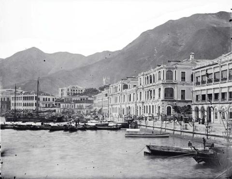
This photo shows the praya looking east.
ERROR: FilterGwulo.php missed D7 image macro
ERROR: FilterGwulo.php missed D7 image macro
")
ERROR: FilterGwulo.php missed D7 image macro

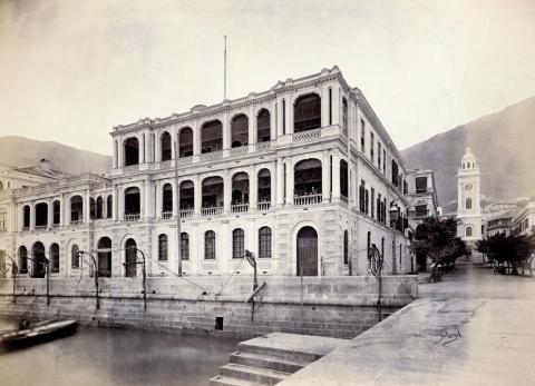
And finally, a photo showing Dent & Co/Melchers Building on Pedder Street.
ERROR: FilterGwulo.php missed D7 image macro
Sure more photos exist showing the praya (after the 1850/60's Praya Reclamation and before the 1890s Central Reclamation) as well as its buildings. Any additions are welcome.
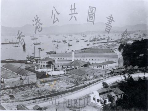
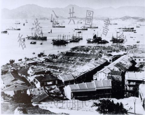
This panorama gives a good
This panorama gives a good view of the praya not long before the next round of reclamation began: