Uploaded from Historical Photographs of China at the University of Bristol.
Originally hosted by the National Archives UK.
Don't know the exact location.
Date picture taken
19 Jul 1926
Gallery
Shows place(s)
Shows event(s)

Comments
Re: Location
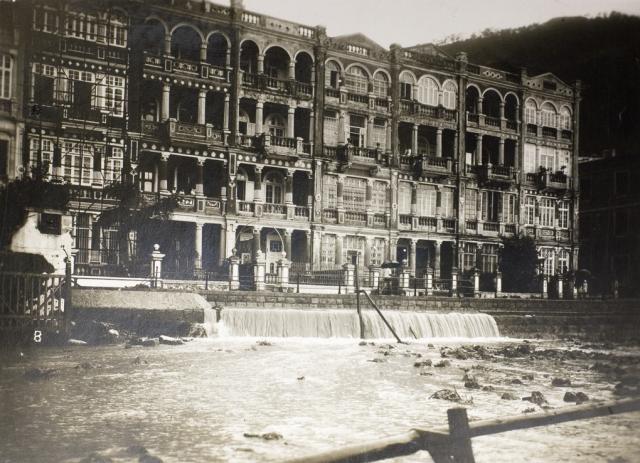
As seen here, the long row of buildings stood on Wong Nai Chung Road (Wongneichong) at the southern end of Happy Valley Racecourse between Sing Woo Road and Village Road, alongside today's Happy Valley Tram Terminus. To the west of these buildings was a smaller building which can be seen here. This group of buildings was known as Man Chung Terrace, 1-29 Wong Nai Chung Road (see 1938 Street Map here )
The 1922.1 Hong Kong map at: https://www.hkmaps.hk/viewer.html show these buildings faced the tram tracks and just beyond the road was the Wong Nai Chung Nullah which later met up with the Bowrington Nullah at the northern end of Happy Valley.
The photo was liken taken from Happy Valley Racecourse looking south and across the nullah towards Wong Nai Chung Road.
Re: Man Chung Terrace
Moddsey, thank you for finding the exact location. I think these houses were built after the demolition of Wong Nai Chung village, or at least the lower part of it. You already made some contributions to this place (e.g. here), so I propose that you create a place for theses houses.