Skip to main content
Menu
Menu
Home
Free newsletter
Shop
Explore
Add new...
What's new
FAQs
About
Gwulo menu for header
Show — Gwulo menu for header
Hide — Gwulo menu for header
Home
What's new
Gwulo
Old Hong Kong
Photos tagged:
rainstorm
Primary tabs
View
Books
Events
Organisations
Pages
People
Photos
Places (map)
Places (list)
Streets (map)
Timelines
Year
Title
1889
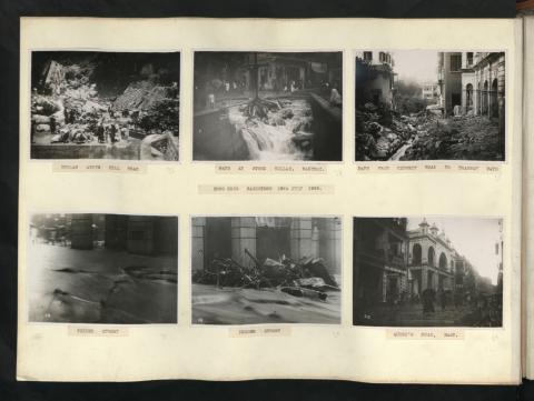
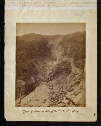
Effects of Storm on side of the Peak, Hong Kong [No. 1]
1889
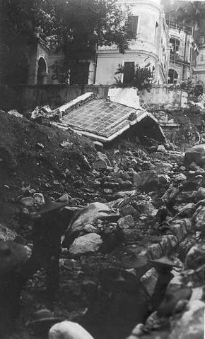
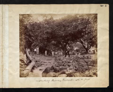
Neighbourhood of Murray Barracks after the flood [No. 3]
1889
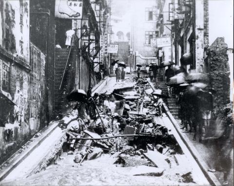
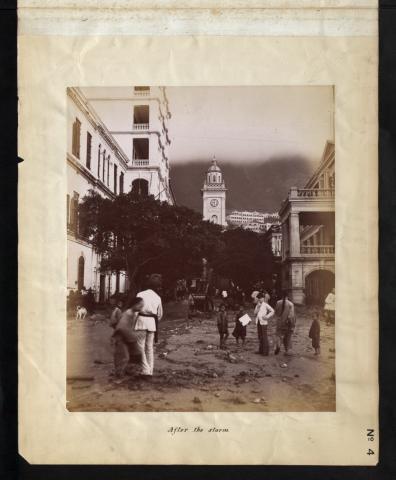
After the storm (Pedder Street) [No. 4]
1889
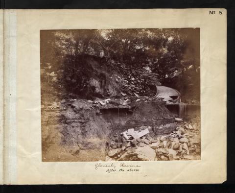
Glenealy Ravine, After the storm [No. 5]
1889
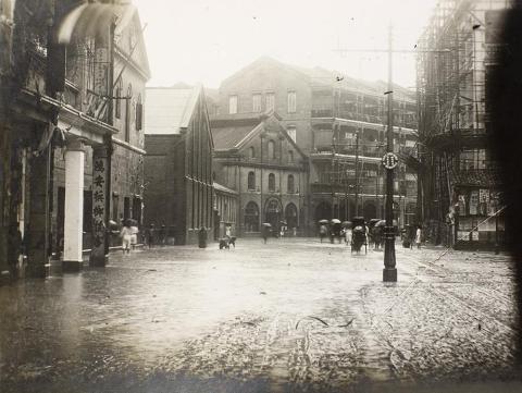
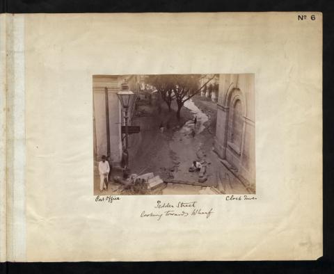
Pedder street, Looking towards Wharf. [No. 6]
1889
After the storm (Wyndham Street) [No. 7]
1889
Glenealy Ravine, Before the storm [No. 5A]
1926
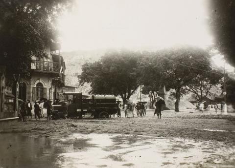
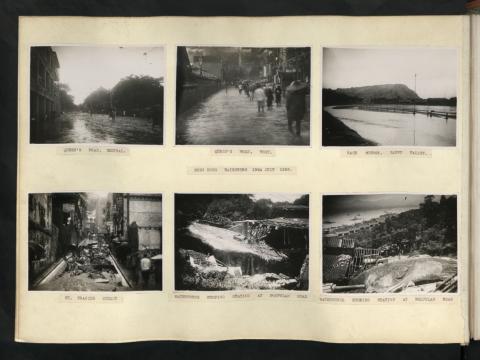
1926 St. Francis Street, Wan Chai = 聖佛蘭士街
1926
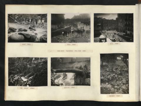
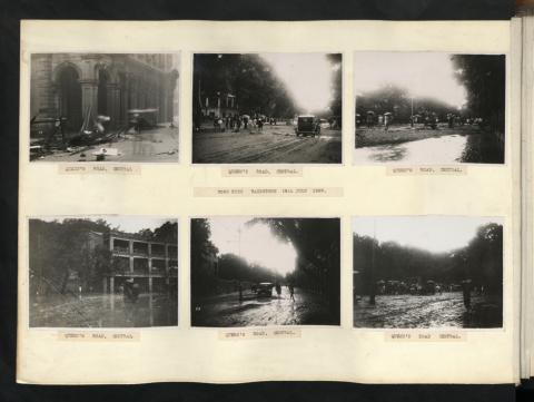
Flooding caused by the 19th July 1926 rainstorm, Des Voeux Road, Hong Kong
1926
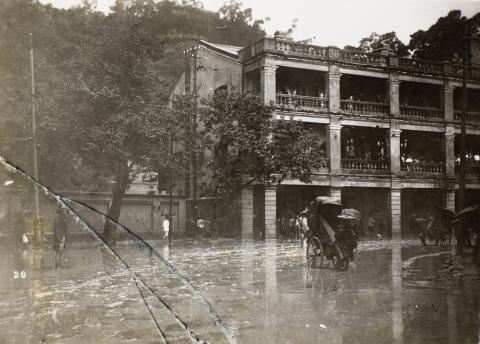
Flooding caused by the 19th July 1926 rainstorm, Queen’s Road, Central, Hong Kong
1926
Flooding caused by the 19th July 1926 rainstorm, Wong Nai Chung nullah (黃泥涌峽), Hong Kong
1926
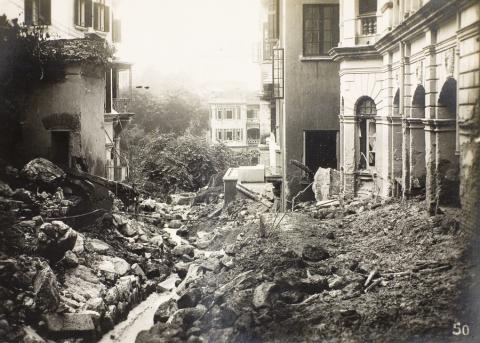
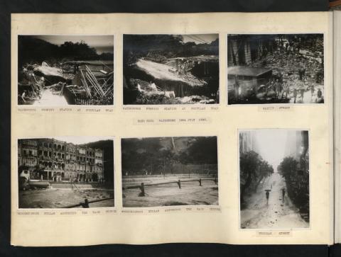
Damage caused by the 19th July 1926 rainstorm, Morrison Hill Road
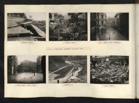
1926
HONG KONG RAINSTORM 19TH JULY 1926. / PATH FROM KENNEDY ROAD TO TRAMWAY PATH
1926
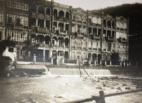
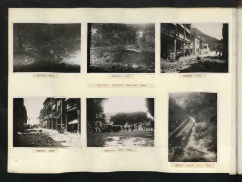
Damage caused by the 19th July 1926 rainstorm, at Calder Path, Hong Kong
1926
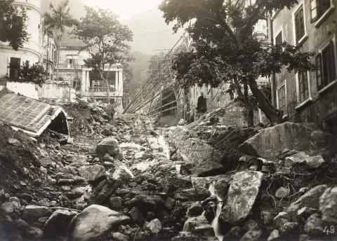
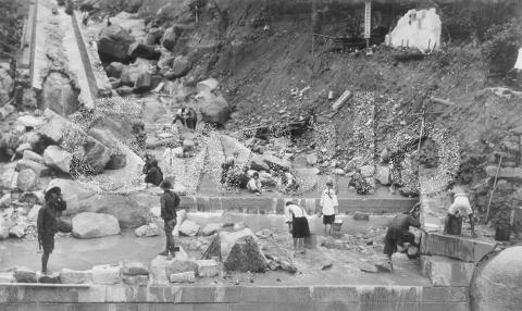
Damage caused by the 19th July 1926 rainstorm, at the nullah above Hill Road, Hong Kong
1926
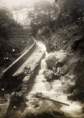
"1926 - Nullah swept away"
1926
1926 18 -19th July Rainstorm
1926
1926 July 18th -19th Rainstorm 02
1926
1926 July 18th -19th Rainstorm 03
1926
1926 July 18th -19th Rainstorm 04
1926
1926 July 18th -19th Rainstorm 05
1926
1926 July 18th -19th Rainstorm 06
1926
1926 July 18th -19th Rainstorm 07
1926
1926 Damage Caused by the 19th July 1926 Rainstorm, at Calder Path
1966
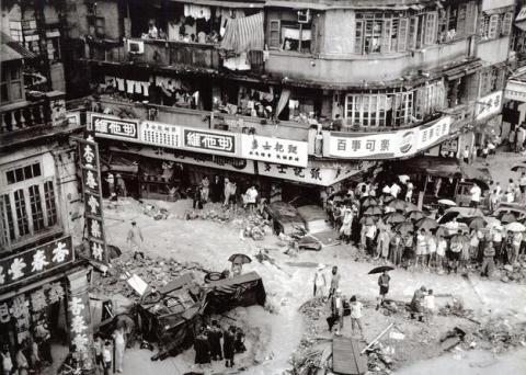
Stone Nullah Lane 1966_June_12_floods
1966
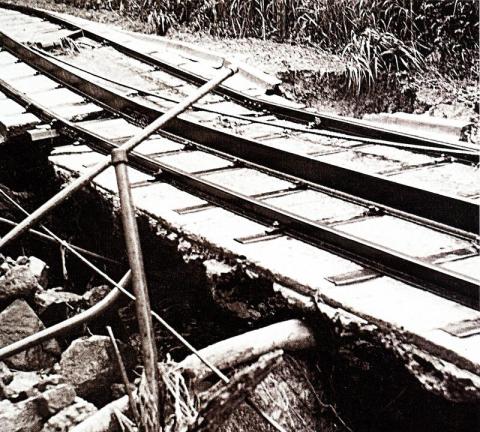
Peak Tram Bridge after June_12_floods
![After the storm (Wyndham Street) [No. 7]](/sites/default/files/styles/large/public/2022-07/7838584244_bc1aba4b4e_o.jpg?itok=uGnCxtDm)
![Glenealy Ravine, Before the storm [No. 5A]](/sites/default/files/styles/large/public/2022-07/7838585532_09421822d9_o.jpg?itok=b1XLwJ1v)