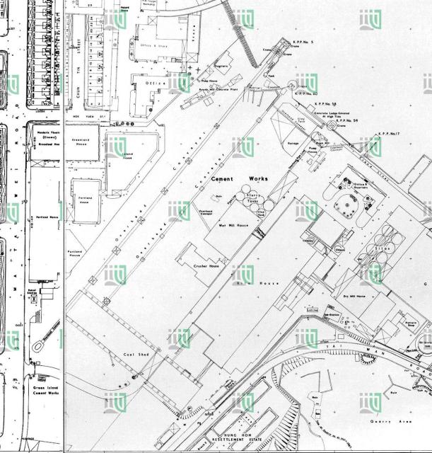
This is a merger of the maps 180 -SW-13 and 179-SE-16.They are from 1690, updated 1969.
On this map, two overhead ropeways are shown. Not clear if they were both active for some time, or only shown on this map.
Date picture taken
1969
Gallery
Shows place(s)
