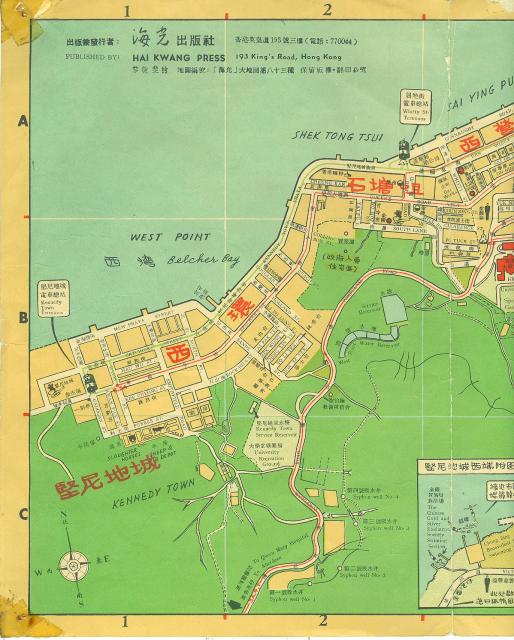
Andrew Suddaby Tue, 01/05/2021 - 22:48 prevnextoldernewer My intention is to load the map running along the Northern shore of the island in eight files starting at the West end. Date picture taken 1 Nov 1957 Author(s) Andrew Suddaby Gallery Suddaby, Andrew (1957-58) Shows place(s) Slaughter Houses, Kennedy Town [1895-????] West Point filter beds / Elliot filter beds [????-????] Kennedy Town Tram Terminus [????- ] Whitty Street Tram Terminus (1st Location) [????-1989] Belcher Bay [????- ] Log in or register to post comments Comments Re: Pokfulam Conduit Hi There, This map also showed part of the Pokfulam Conduit together with some of the syphons. They are slight at the right of the filter beds, higher up the slopes. T Log in or register to post comments
Re: Pokfulam Conduit Hi There, This map also showed part of the Pokfulam Conduit together with some of the syphons. They are slight at the right of the filter beds, higher up the slopes. T Log in or register to post comments
Comments
Re: Pokfulam Conduit
Hi There,
This map also showed part of the Pokfulam Conduit together with some of the syphons. They are slight at the right of the filter beds, higher up the slopes.
T