Current condition
In use
Date completed
The old single-track tunnel is no longer used by the railway, though it is still used to route a pipeline under the hills to Kowloon.
If you zoom in on the satellite map above, you can see the disused cutting that leads to the old portal. It's a short distance east of the current tunnel portal.
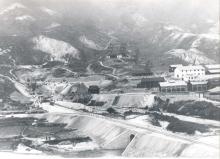
Thanks to Peter Crush for this photo of the portal taken during its construction: http://i1103.photobucket.com/albums/g468/chinarail1/Beacon-Hill-Tunnel-ShaTin-FER-Nov1909.jpg
You can trace the route of the old tunnel on the government's mapping website: http://www2.map.gov.hk/gih3/view/index.jsp (It isn't shown by default - click the "Detailed Map" button, and zoom in to levels 6 or 7 to show it.)

Comments
North portal
Hi David - actually I think the photo from Panoramio shows the south portal in Kowloon Tong. (By the way, thanks for the instructions on the geomap, now found it marked). Cheers, Phil
edit: the excellent keroseneian has some snaps of the tunnel/portals on his FLICKR stream.
http://www.flickr.com/photos/39684656@N06/4334639974/
He/she is definitely one of the more informative people on that site, some great snaps.
re: North Portal
Thanks Phil, I've moved it over to the South Portal.
closing date
The old Lion rock tunnel was closed on 26 April 1981, the same date the new tunnel was opened.
https://en.wikipedia.org/wiki/Beacon_Hill_Tunnel_(Hong_Kong)