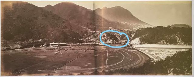
I have a bit difficulties to identify the place I have circled on the photograph. To the right this is Morrison Hill. But to the left, it looks like a small valley.
That must have been Queens Road East I presume. Any clarifications are very much appreciated. Thank you very much
Date picture taken
unknown
Comments
Circle
Try this place https://gwulo.com/node/8322
Thank you Klaus
Thank you Klaus
The Gap
See: https://gwulo.com/node/6952
Thank you David
Thank you David
Daniel, can you please post a
Daniel, can you please post a high def copy of the same photo without your blue squiggles? Thanks!
That little spur within the blue circle was where the future Muslim Cemetery was located - Inland Lot No.288 deeded on 15th July 1870 by Major General Henry Wase Whitfield on behalf of the Colony of Hong Kong, with boundaries adjusted in 1938, but still invested in the Crown. Of interest to me to see the natural state before it was a cemetery.
Race Course 1864
Hi David,
I just have sent the photograph again without the blue circle
Have a good day