Current condition
Demolished / No longer exists
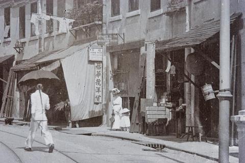
The recreation ground was on a flat piece of land south of King's Road. The sign in the centre of this photo shows the entrance to the recreation ground:
The location of the ground is shown on the map "1952" at http://www.hkmaps.hk/mapviewer.html, however that is a nautical chart, so though the coast is accurately drawn for 1952, many of the features on land are out of date.
The recreation ground was likely closed by the early 1920s, when housing for the workers at the Sugar Refinery was built on this site, see: https://gwulo.com/node/44633
Later place(s) at this location


Comments
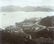
Nice view of the Area c1910
Nice view of the Area c1910 including the Recreation Ground: