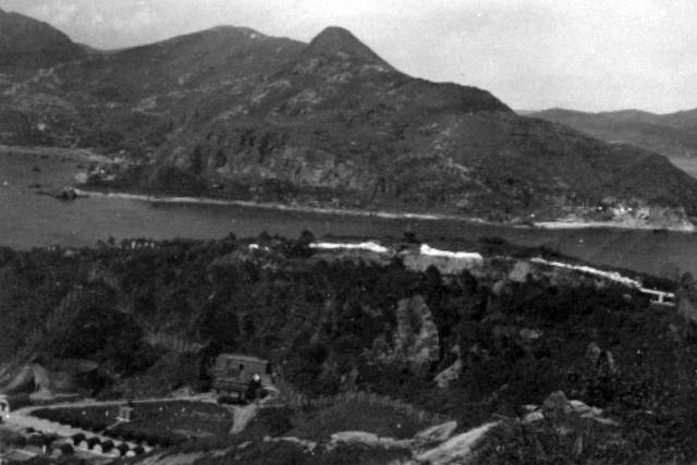
The Lyemun Redoubt battery is visible. I have never previously seen photographs of the buildings in the gap, where the Island Eastern Corridor Road now runs. There are Nissen huts and other buildings, including a very large circular structure. This appears to be roofless and appears to have a door at the lower left side. Is it the remains of some sort of Victorian defensive 'fort'? There is also a very solid looking building built into the hillside below the Redoubt. The whole area is surrounded by a high chain link fence that climbs up the steep slope to the old battery. Does anyone know anything about this group of buildings? Is it the Shau Kei Wan A Kung Ngam Ordnance Depot, which has a pin on the map? (Andrew S)
Date picture taken
1 Jun 1952
Gallery
Shows place(s)
Comments
The large circular structure
The large circular structure is likely the gunpowder factory:
https://www.lcsd.gov.hk/CE/Museum/Coastal/en_US/web/mcd/exhibition/historicaltrailexh/historicaltrail12.html
Lei Yue Mun Quarry
Think that the Lei Yue Mun Quarry started operation already. It should be across the water indicated by the brighter colour compared to the surrounding area.