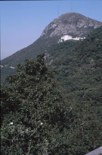
Klaus Wed, 03/20/2019 - 23:42 prevnextoldernewer Taken from Peak Road left of the Peak Cafe. Is the white building Haystack? Date picture taken 1 Oct 1986 Tags Victoria Peak Author(s) Petra Gallery 1980s Hong Kong Shows place(s) South Craig [1955- ] Most south-easterly of the hills ontop of Mount Austin [????- ] Log in or register to post comments Comments South Craig Hi Klaus, The building in your photo is the one numbered "3", i.e. No 3 Mt Austin Road, near the top left corner of this 1960's Peak map. Peak Map, by fivestar You previously assisted to identify it as South Craig (https://gwulo.com/node/8672). Mt Austin Rd Playground 1966, by m20wc51 Log in or register to post comments
South Craig Hi Klaus, The building in your photo is the one numbered "3", i.e. No 3 Mt Austin Road, near the top left corner of this 1960's Peak map. Peak Map, by fivestar You previously assisted to identify it as South Craig (https://gwulo.com/node/8672). Mt Austin Rd Playground 1966, by m20wc51 Log in or register to post comments
Comments
South Craig
Hi Klaus,
The building in your photo is the one numbered "3", i.e. No 3 Mt Austin Road, near the top left corner of this 1960's Peak map.
You previously assisted to identify it as South Craig (https://gwulo.com/node/8672).