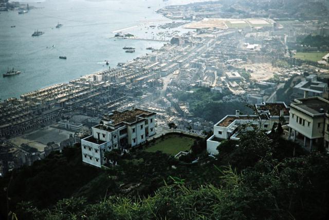
Among other interesting features, Southorn Playground is visible on the left hand side.
Morrison Hill is almost vanished, and reclamation for Victoria Park has been finished.
Can anyone identify the houses in the foreground?
Source: This image came from Flickr, see https://flickr.com/photo.gne?id=40335267380
Date picture taken
1957
Gallery
Shows place(s)
Comments
perhaps #20 Peak Road
There are two empty terraces between Nos 8-12 (Oasis) and 16 Peak Road that might be the ones seen here. The map has it marked as #20.
I believe it's 20 and 16 Peak Road
There are a couple of similar pictures on this site taken by someone called John Glascock in 1957 https://www.fototime.com/memberalbum/8821CB2D02914135A0435AA0E006FEEE/A…
I saw a picture on Facebook showing those buildings, taken from Interocean Court (which i can't post because I can't credit the original author).
Foreground Buildings
According to the extended version of the mid-1950's map at https://gwulo.com/media/14175, the buildings in the foreground are;
No.537 The Peak, at the right edge of the photo.
No.538 The Peak, lower and partly hidden by 537. Has a distinctive long, thin, wing with an angle in it.
No.539 The Peak, the lowest of the three buildings, in full view, which later became No.20 Peak Road.