A couple of weeks ago we traced the history of the Admiralty area, and saw how the land between Kennedy Road and Queensway used to be the British army’s Victoria Barracks. This time we’ll take a walk through what used to be the barracks, to see what’s there today. There are also a few questions along the way, that I hope you can help me with.
We’ll start from the same place as last time, at the junction of Queen’s Road East, Hennessy Road, and Queensway. If you look across Queen’s Rd E. to the hillside, you’ll see the entrances to the old Arsenal Street network of Air Raid Precaution (ARP) tunnels.
Q1. Why is information about these tunnels kept secret?
The tunnels themselves certainly aren’t secret – tens of thousands of people pass them every day on this busy junction. But if you look at government documents about the old ARP tunnels, you’ll find that information about this network is not available, and any references to it in other documents have been blanked out. The only other tunnel network I’ve seen treated this way is the one under Government house.
As we’ve learned, that network can still be accessed from Government house, so it’s to be expected that the details are not public. Since the hill above the Arsenal Street network is still owned by the military, could the secrecy be for the same reason? That the tunnels could be accessed from the buildings on the hills above? Or is it enough that they run under military land, so anything in that area is naturally kept secret?
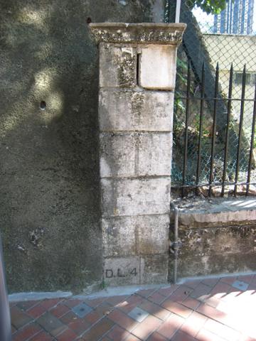
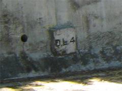
While you ponder our first question, let's cross the road and turn right to walk towards Queensway. Just after the last tunnel portal, you’ll see this pillar.
Q2. What does the “D.L.4” mean at the base of the pillar?
It looks like one of the Lot Markers we’ve seen elsewhere, but I’m not sure what a “D” type of Lot is. The Land Registry’s trusty “What’s that Lot?” page [6] doesn’t give any answers for DL, so no help there. Maybe D for Defense?
Walk on a little further, and then follow the road round to the left. Until the late 1970’s this was one of the entrances to British Army's Victoria Barracks, and would have been off limits to the public. The low building on the left was the guardhouse, as shown in this 1977 photo.
/8-11-75.jpg)
Victoria Barracks. Guardroom east gate, 1977. [1]
It looks basically the same today, though it is now used by the Salvation Army.
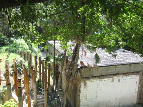
Follow the road round and up to the left to walk up Justice Drive. Even in the 1990’s the blocky building down on the left was still a NAAFI store for the British military personnel. Surprisingly if you look at the Centamap website today, it is still shown as a NAAFI store! Is there some long-forgotten contingent of British storekeepers, still waiting patiently and wondering where their customers have gone?

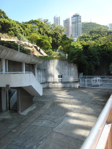
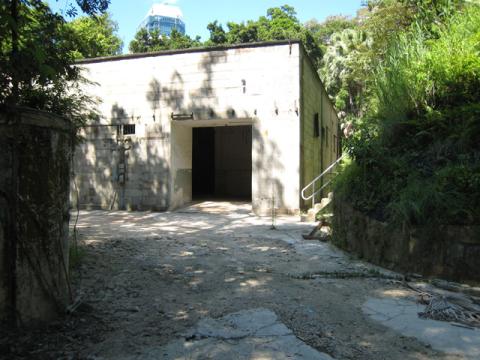
Here's the view today.
The end of the NAAFI building is on the left, then if you look in the centre of the photo you can see a doorway in the white wall. There is a wire gate across it, and appears to be a tunnel leading off behind it.
Q3. Does anyone know what the tunnel was for?
There’s no record of an air-raid tunnel in that area, so I’d be interested to know more about it.
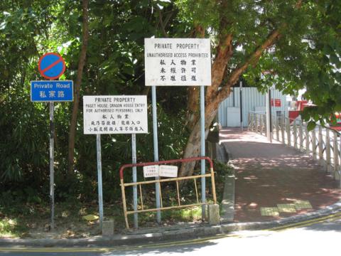
Walk a little further up the hill, and you’ll see a road leads off to the left.
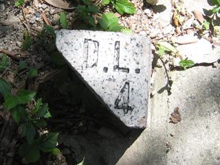
Along the edge of the road you’ll see these little stone markers, again with that DL4 marking.
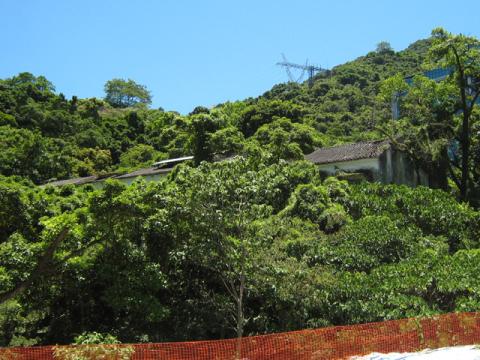
The road leads up to Paget House and Dragon House, which stand on the hill above the Arsenal Street tunnels. This area used to be known as ‘Queen’s Lines’, but the new name is ‘Ching Yi To Barracks’. It is classified as a closed area [2] for use of the PLA’s Hong Kong garrison, ie keep out!
A few steps up the hill is another road on the left, this one curving down and around to the Naafi building shown earlier. And in case you are in any doubt about which piece of land you are looking at, the retaining wall of the road has yet more DL4 marker stones all along it.
A little further up the hill and you come to the British Consulate, with the main road swinging round to the right. On this corner you’d be standing next to the highest of the original Victoria Barracks Buildings. Originally there were five barracks buildings, running from here down the hill to Queensway.
Here’s how they looked in the nineteenth century:

Victoria Barracks, Central District, Hong Kong Island, c.1870-75.
The five blocks for housing troops, known as Victoria Barracks, were completed between 1868 and 1870 (four are visible in the photograph). Well constructed on high ground, overlooking the Royal Naval Dockyard and the harbour, these barracks were a great improvement on the earlier ones-the Murray and the Wellington Barracks. Two lower blocks and part of the 4th block, on the right, were still there in 1979 when the Army had relinquished the area to be taken over by the Hong Kong Government. It has since been converted into a public park. [3]

Victoria Harbour viewed from the east. Victoria Barracks buildings in the foreground with the Naval Yard Beyond, c.a. 1880. [1]
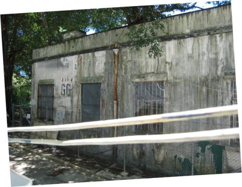
We’ll keep walking up the hill, along the pedestrian-only road. On the left, opposite the consulate is GG block. It is another of the old barracks buildings, but I guess one that is much newer than the buildings from the 1860s shown in the old photo above. There is a construction fence around it at the moment, but if you peep over the top you’ll see:
Here's how it looked in the 1970s:
/8-11-25.jpg)
Victoria Barracks (GG) (south) S.I.B. (Special Investigation Branch) Offices from road leading to P.W.D. area, 1977. [1]
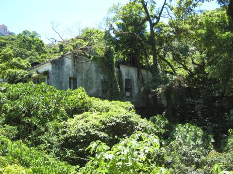
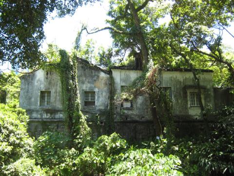
Walk a little further up the hill and you’ll come to an overgrown but solid looking set of buildings. The 1880 map of the military cantonment marks this as a magazine.
That last photo is taken from the far side of the buildings, on Kennedy Road. You can see there is some sort of construction work underway, but fortunately the ‘Former Explosives Magazine’ is classified as a Grade 1 historic building [4]. A note on the gates indicate that the work is related to the Asia Society, and one of their press releases gives this explanation [5]:
On February 10, 2006, Asia Society Hong Kong officially launched the development of a permanent, multi-purpose publicly accessible center to promote education and a deeper understanding of Asia and international affairs. Designed by the acclaimed New York based firm, Tod Williams Billie Tsien and Associates, the facility will transform an important historic but little known site—the former Explosives Magazine—in the heart of Hong Kong Island. This state-of-the-art facility, with exhibition space, a theatre, lecture halls, offices and other amenities, is scheduled for completion in 2008. The projected building and operating costs for this new center are $52 million. The Asia Society Hong Kong Center was established in 1990.
Have you heard of the Asia Society before? I hadn’t, but given that the figure quoted above is USD52million, they’re obviously not short of cash!
Here’s how the magazine area looked in 1977:
/8-11-22.jpg)
Victoria Barracks (FF) (east) P.W.D. Yard. Looking west " Offices Far Rear " workshops on right, 1977. [1]
/8-11-23.jpg)
Victoria Barracks (FF) (east) looking south. P.W.D. Yards, Stores. Note old " Ammunition Train " lines, 1977. [1]
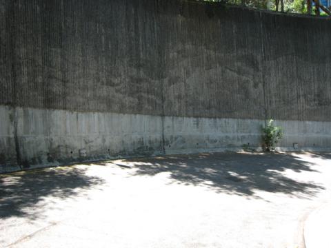
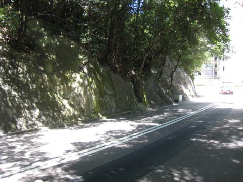
Keep walking up the hill, climb the steps to to Kennedy Road, and we come to our last little mystery. If you turn right heading west along Kennedy Road, you’ll see this nondescript hillside (see map).
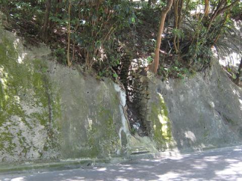
Keep walking and look out for a small cut in the hillside.
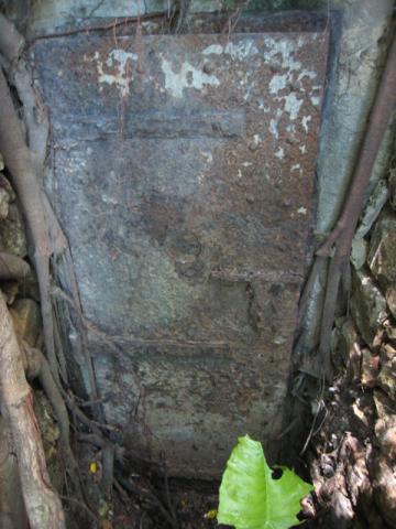
If you cross the road for a closer look, you'll see this sturdy, but very rusty iron door.
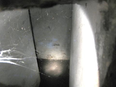
The door is just slightly ajar. It doesn’t open further, but there’s just enough of a gap to poke the camera lens inside:
Q4. So what is it?
It has whitewashed walls, and from the shadow we can see that the short entrance passage turns left around a corner. Does it lead much further, or just to a small room? It doesn’t look like an air raid tunnel entrance, and anyway the narrow passage to the doorway means it wasn’t designed for large numbers of people to go in and out. So was it built by the military, or one of the utilities like water or electricity? Any ideas?
That's the end of today's walk, but you have several options of where to walk next. The easiest is to simply retrace your steps and walk back down to Queensway. Or if you keep walking along Kennedy Road you'll come to Hong Kong park. The park also covers part of the old barracks area, and has several old barracks buildings remaining. You can walk down through the park to Central or Pacific Place. Finally if you're still feeling energetic, you could turn around and walk eastwards along Kennedy Road, and take a look at some of the historic remains around Mount Parish and Hospital Hill.
As always, if you have answers to the questions above, or you have any other information or memories to share about this area, please do leave a comment.
Regards, David
References:
- The Public Records Office (PRO) have a good selection of photos of “Victoria barracks” from the 1970s and earlier.
- 'Closed Areas', see para 32 of this government paper.
- Image from the Hong Kong Public Library online search.
- Listed buildings in Hong Kong
- Asia Society press release about redevelopment of Magazine site.
- To look up the different types of Lot (Inland Lot, Marine Lot, etc) used in Hong Kong, visit the government's IRIS website, click 'English', 'Search Land Register', then click the 'Find Lot Type' button.

Comments
Victoria Barracks H K
Hello. What an interesting site for anyone who has lived in Victoria Barracks. I was there 1950/51 with my father who was Bandmaster, Wiltshire Regiment. We lived in one of the WO quarters that I recall was just inside the Barracks close to what I believe was East Gate. Recent research indicates that Rawlinson House was created from a pair of WO Married Quarters. My question is whether these quarters are the same. Our quarter was definitely on the right hand side at some height from the road. There was a small drainage ditch to the front (I remember crawling through the tunnel) and a much larger one to the right of the house. As both my parents are no longer around, I am having to rely on memory although I believe a few photos may turn up. I know there a good number of photos around HK but not many of the house. Certainly Rawlinson House has a first floor ledge that I remember shuffling around one night when my parents were out at the Fleet Club. Any feedback, photos etc would be most welcome.
WO Quarters in Victoria Barracks
Hello Alan, thanks for writing in. Looking at a map of the barracks from the 1920s, there are two buildings that might be relevant:
1&2 looks like it was roughly where Rawlinson House is today, so it might be the one you found mentioned in your research.
3&4 was further up the hill, close to the boundary with Kennedy Road. From the satellite view it looks as though it is still there today. Both are in the South-west corner of the Barracks.
I'm not sure if they were still used as WO Quarters in the 1950s though - they don't seem to fit your memory of being to the East. Anyway, here's the satellite view, A is Rawlinson House, B is the building I think is the '3&4' mentioned above.
[gmap markers=letters::22.277484010296323,114.16092038154602 + 22.276277750362567,114.16158556938171 |align=Center |zoom=16 |center=22.27664715821808,114.1633129119873 |width=450px |height=350px |control=Small |type=Satellite]
You might also want to browse through these photographs to see if they bring back any memories.
Please keep us updated as you find more.
Regards, David
WO Quarters Victoria Barracks
Many thanks for your reply David. I am not sure why I mentioned East Gate. What I recall was driving (my father had a small Crossley car) away from the harbour on a road that led to the Peak train terminus. I think just before the terminus, we would have turned left along a narrow road with a guard house/manned gate at the end. Our Quarter was then on the right a bit higher than the road. Opposite the house was a small layby where my father always parked the car. The thing that puts Rawlinson House slightly in doubt is that at the back of the Quarter I think was a significant rock face. There may have been some tunnels close by. My sister has a better memory than me and she has just returned from Greece for Xmas so I will be quizzing her shortly. I have also spoken to my brother who is currently looking after the family photos. If any thing regarding the Quarter turns up, I will pass on the images. I know there are plenty of images of our stay including a number of Band appearances in various parks.
How would I access the early map you refer to. This may help me to recall the road layout.
Regards, Alan.
re: WO Quarters Victoria Barracks
Hello Alan, the map is from the Survey & Mapping Office, but unfortunately they don't have any online, and a quick search on the web didn't turn up anything helpful either. Fingers crossed that your sister's memories will help nail it down.
Regards, David
PS 'Yes please' to any photos of Hong Kong from that time you can share!
Iron Door
Today I managed to get into the iron door, now that the slope works were finished.
The door is surprisingly easy to open for something that old and rusty.
What got me is that the door has three massive sliding bolts on the inside, along with a large circular peer hole in the middle. This door was not designed to be opened from the outside, so what was this room really for?
Could there have been another passageway inside that is now blocked off? I took some photos but not sure how to post them here.
re: Iron Door
DZ, Here are some instructions on how to post photos:
Interesting point about the bolts on the inside.
Regards, David
peep hole? OK got the
OK got the pictures up!
re: peep hole?
It certainly looks like a peep hole, and they are some pretty chunky bolts. I suppose it could just have been a standard door of the time, seems strange though.
I'm still hoping we'll hear from someone who worked in this room, and can give us a clear explanation.
Photos of Victoria Barracks
Victoria Barracks and inside the underground bunker:
http://picasaweb.google.com/Colin.Aitchison7/VictoriaBarracksHongKongIn…
It all looks a lot different
It all looks very different to when I lived there in 1982! I've been using your site to show my friends the places I lived in the 80s - I also lived in Osborn Barracks, moving in 1983.
re: It all looks a lot different
Yes, leave a Hong Kong for just a couple of years and things will have changed!
If you can share any photos of the places you stayed, we'd love to see them,
Regards, David