Skip to main content
Menu
Menu
Home
Free newsletter
Shop
Explore
Add new...
What's new
FAQs
About
Gwulo menu for header
Show — Gwulo menu for header
Hide — Gwulo menu for header
Home
What's new
Gwulo
Old Hong Kong
Cart Flyout
Photos tagged:
map
Primary tabs
View
Books
Events
Organisations
Pages
People
Photos
(active tab)
Places (map)
Places (list)
Streets (map)
Timelines
Items per page
25
100
- All -
Year
Title
Sort descending
1954
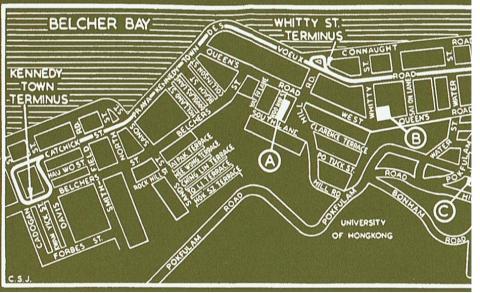
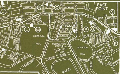
1954 HK Tramlines - Kennedy Town to Sai Ying Pun
1954
1954 HK Tramlines - Quarry Bay to Sai Wan Ho
1954
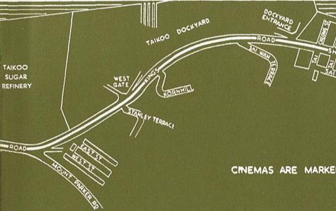
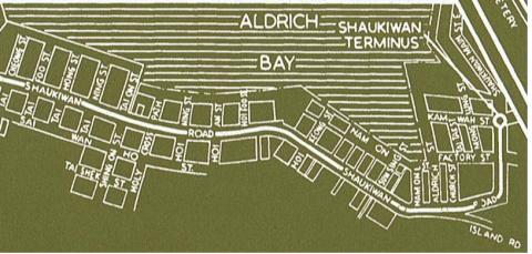
1954 HK Tramlines - Sai Wan Ho to Shaukiwan
1954
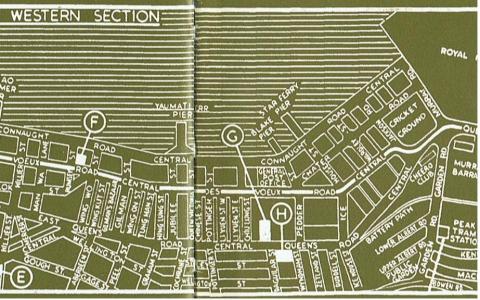
1954 HK Tramlines - Sheung Wan to Central
1954
1954 HK Tramlines - Wanchai to Causeway Bay
1955
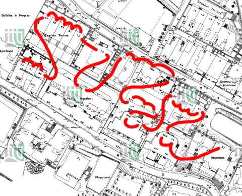
1955 1-600 map of Wyndham Street
1955
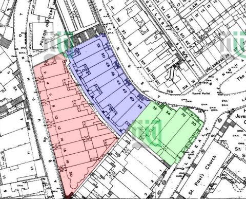
1955 1-600 Robinson Road 196-SW-9
1955
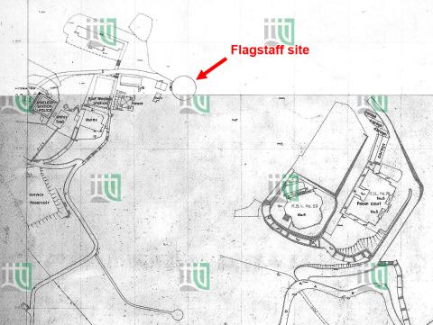
1955 Area around the old flagstaff site
1955
1955 The Peak
1957
1957 Map #1
1957
1957 Map #2A
1957
1957 Map #2B
1957
1957 Map #3
1957
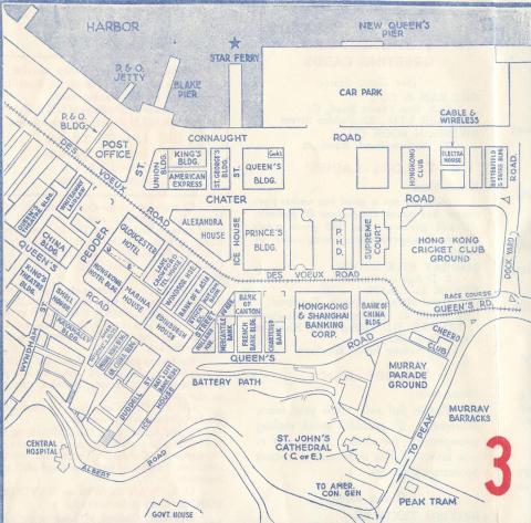
1957 Map of Central
1957
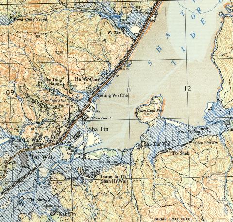
1957 Map of Shatin area
1957
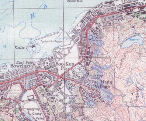
1957 map of Tai Hang
1957
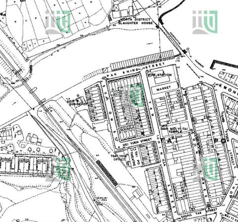
1957 Map of Tai Po Market
1957
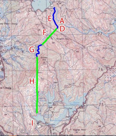
1957 map of the Shing Mun / Golden Hill area
1957
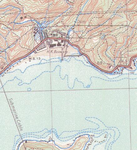
1957 Sham Tseng map
1957
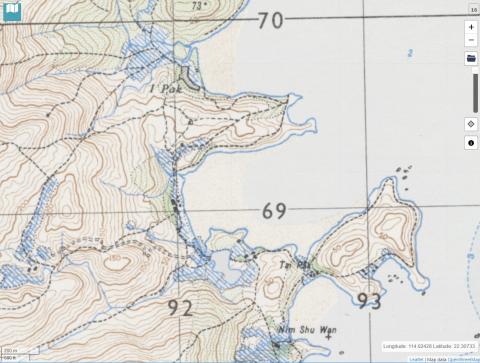
1957 Yi Pak and Tai Pak, Lantau
1957
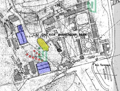
1957-1-1-200-Lai-Chi-Kok-161-SE-B-(Ed-1957).jpg
1958
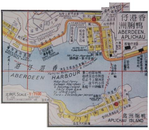
1958 map of Aberdeen
1958
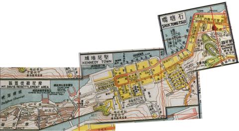
1958 Map of Kennedy Town Area
1958
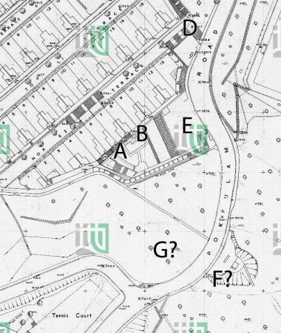
1958 Map of Pokfulam / Pokfield Roads junction
1958
1958 Yau Tong Bay [Kwun Tong Tsai Wan] layout plan
Pagination
First page
« First
Previous page
‹‹
…
Page
5
Page
6
Current page
7
Page
8
Page
9
…
Next page
››
Last page
Last »
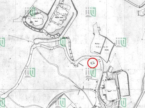
![1958 Yau Tong Bay [Kwun Tong Tsai Wan] layout plan](/sites/default/files/styles/large/public/2023-02/2447358387_77e9fe49a4_o.jpg?itok=H7IKNT2Q)