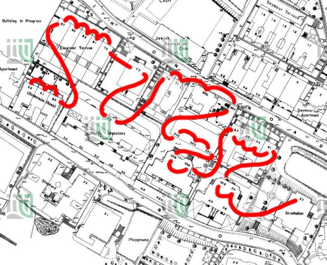
1:600 map of mid-levels in 1955 from HKMS, their ref: 196-SW-9
I've added a red line to show the confusing road numbering for the south side of Robinson Road. The red line traces the imaginary route of a postman walking from 57 Robinson Road at the right, to 93 Robinson Road at the left.
Date picture taken
1955
Gallery
Shows place(s)
