Skip to main content
Menu
Menu
Home
Free newsletter
Shop
Explore
Add new...
What's new
FAQs
About
Gwulo menu for header
Show — Gwulo menu for header
Hide — Gwulo menu for header
Home
What's new
Gwulo
Old Hong Kong
Cart Flyout
Photos tagged:
map
Primary tabs
View
Books
Events
Organisations
Pages
People
Photos
(active tab)
Places (map)
Places (list)
Streets (map)
Timelines
Items per page
25
100
- All -
Year
Title
Sort descending
2015
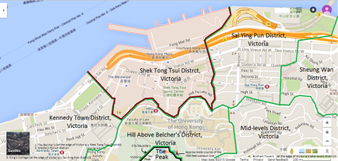
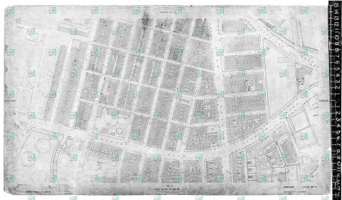
Map of Shek Tong Tsui District, Victoria, Hong Kong
2015
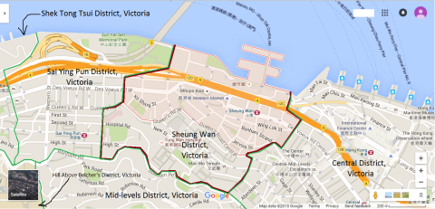
Map of Sheung Wan District, Victoria, Hong Kong
1942
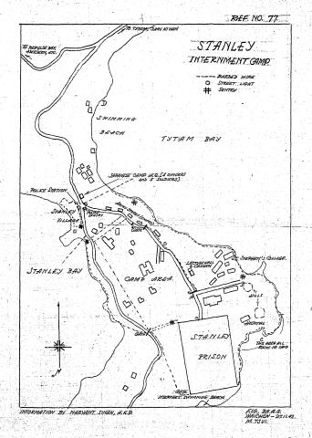
Map of Stanley Civilian Internment Camp
1893
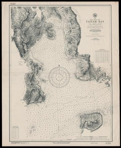
Map of Tai Tam Bay
c.1928
Map of the junction of Nathan and Jordan Roads [1927-1930?]
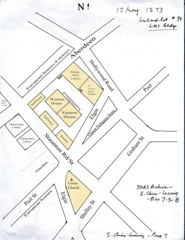
1873
Map of the LMS compound
2020
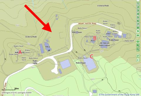
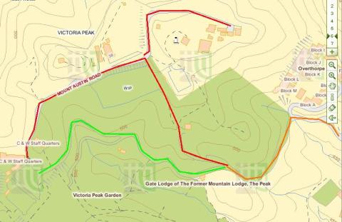
Map of The Peak
1896
Map of TST in 1896
1920s
Map of TST in 1920
1951
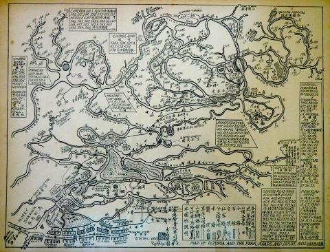
Map of Ultopia & The Peak 15 Dec 1951.JPG
2011
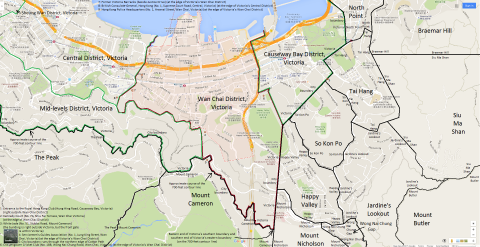
Map of Victoria Peak
2015
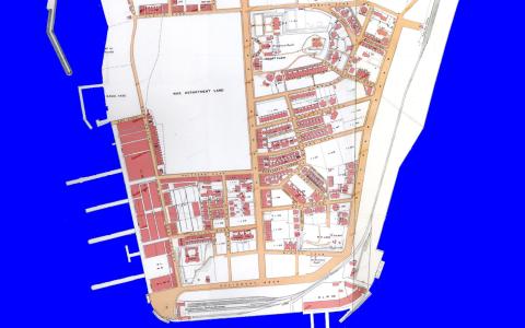
Map of Wan Chai District, Victoria, Hong Kong
1963
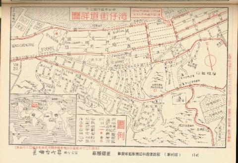
Map of Wan Chai in 1963 (Chinese Version)
2020s
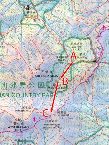
Map of Wong Chuk Shan boulder trackway
1896
Map of Yau Ma Tei in 1896
1920s
Map of Yau Ma Tei in 1920
1968
Map showing Southern end of Anderson Road, circa late 1960s
1889
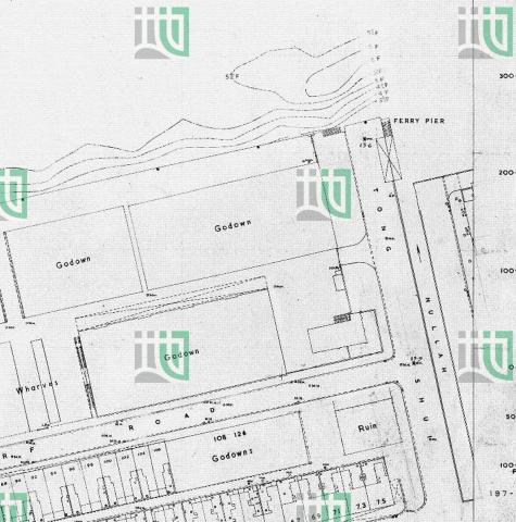
Map showing Star Ferry Pier
1938
Map used by Osler Thomas, BAAG
1957
Map Wanchai Road 1957
1956
Map West Point Pier (Tong Shui Road) 1956
1939
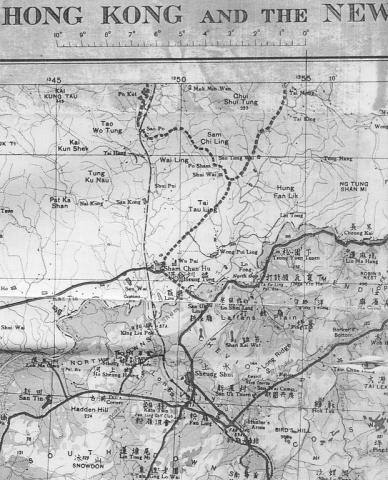
Map-North West New Territories-1939
2014
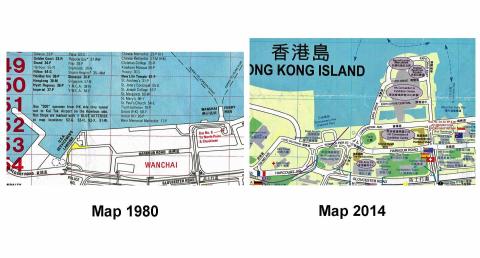
Maps Fenwick Pier 1980_2014
1902
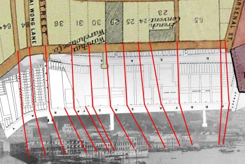
Maps of Wanchai seafront, 1897 & 1903
1850s
Mid 1800s Wanchai Map
Pagination
First page
« First
Previous page
‹‹
…
Page
14
Page
15
Current page
16
Page
17
Page
18
…
Next page
››
Last page
Last »