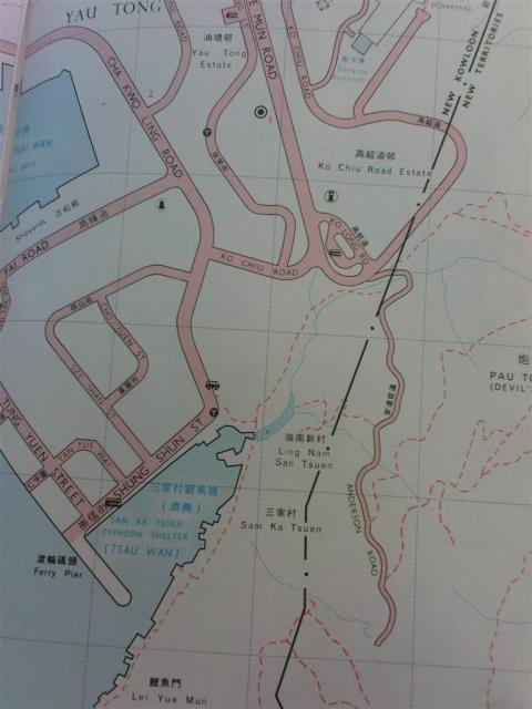
Map showing Southern end of Anderson Road, circa late 1960s. Part of this road has since been incorporated into Wilson Trail Sec. 3 and Ko Chiu Road leading to TKO Chinese Permanent Cemetary.
Haven't seen much info about this here or online elsewhere so I figured I should post it up in case someone wants to look into it.
Originally posted on online forum post dated January 2009 (https://www.hkitalk.net/HKiTalk2/forum.php?mod=viewthread&tid=357993&goto=lastpost). Post also contains more photos but have been blurred by photo host possibly due to file expiry. Credit to original post owner Azuma.
[gmap markers=small red::22.292876476490992,114.24113369645215 |zoom=16 |center=22.29302351905642,114.24077964486212 |width=100% |height=350px |control=Small |type=Map]