Japanese tunnels below Jardine's Lookout [????- ]
Thanks to craig for introducing this one:
Thanks to craig for introducing this one:
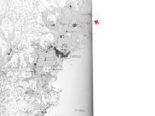
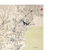
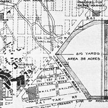
I was surprised at how far the old RAF Kai Tak hangar was from what I thought of as the airport area. So here is a sequence of maps and aerial photographs over the last 100 years or so, showing how the area has changed.
(The red arrow on each photo points to the hangar's location.)
1902 [1]
More info about the airport's history here.
Click the Photos tab above for lots of photos of Kai Tak through the years.
This hangar was mentioned in the 'Japanese pillbox at Diamond Hill' place, but deserves its own entry. It is clear to see on the satellite photo above.
Here are the notes so far:
A recent copy of HK magazine had an article 'Tearing up the town' about historical areas that may be redeveloped and disappear. Their description of Tai Hom Village, Diamond Hill says:
The above map for this place isn't accurate, as I'm not sure exactly where it is. [Update Jun 2008: The location is accurate now, confirmed by this map from the HKHAA.] This week's HK magazine has an article 'Tearing up the town' about historical areas that may be redeveloped and disappear. Their description of Tai Hom Village, Diamond Hill says: